Elevation: 8,579 ft
Prominence: 39
This ridge is not in the book. Published November 2020
Chicken Ridge is another of the many named ridges in this area of the Caribou Range. It is a minor north-to-south ridge that lies between Big Elk Mountain and Elk Creek. Its toe is at the convergence of Bear Creek Road/FSR-058 and West Fork Road/FSR-863. USGS Poker Peak
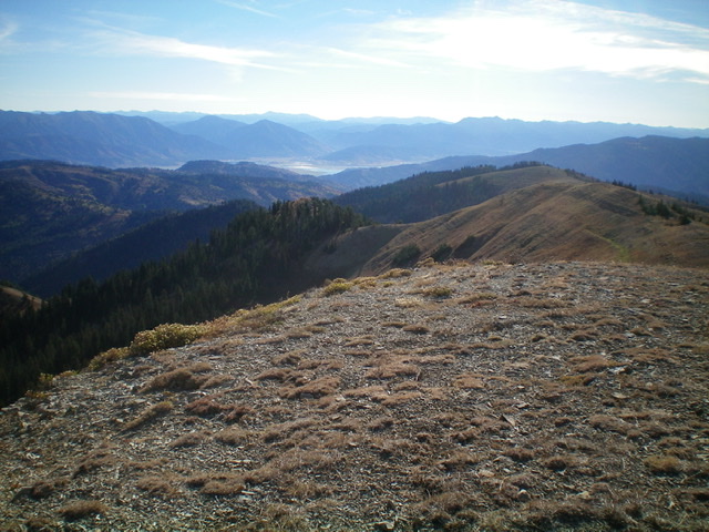
Chicken Ridge as viewed from the summit of Peak 9285. It is the first ridge in the photo that is beyond the broken rock of the summit. The ridge is heading sharply left and becomes forested pretty quickly. Livingston Douglas Photo
Access
Same as for Peak 9285. This is the second leg of a two-peak journey that begins on West Fork Road/FSR-863.
Southwest Ridge, Class 2
The Climb
From the minor 8,540-foot connecting saddle with Peak 9285, scramble a short distance up easy scree and scrub to reach the small hump that is the high point of Chicken Ridge. The summit has no cairn.
Northwest Face, Class 2
The Descent
From the summit, return southwest to the 8,540-foot saddle and descend northwest then north down a steep, forested gully that leads into the main gully alongside Chicken Ridge. Descend the dry main gully a short distance until you get past the thick aspens on the left/west side of the gully. Climb west out of the gully and begin a northward traverse across the east face of the northeast ridge of Peak 9285. Contour through field grass and sagebrush/brush to reach an aspen-clogged gully.
Bash through the aspens to reach open terrain on the other side. Continue to contour northward to cross the rounded ridge crest. Staying above the impending forest, contour northwest to reach a dry gully that has open terrain all the way down to the now-visible road (FSR-863). Descend through somewhat thick brush and sagebrush to reach the [blessed] road. Follow the road right/east (briefly) then north down to your parked vehicle.
Additional Resources
Regions: Caribou Range->SOUTHERN IDAHO
Mountain Range: Caribou Range
Longitude: -111.24539 Latitude: 43.21929