Elevation: 7,162 ft
Prominence: 822
This peak is not in the book. For a winter ascent of this peak, use the three trip reports linked below. Published November 2022
Chimney Benchmark is a big mountain that separates Chimney Creek from Cow Creek in the Soldier Mountains. It has some old 2-track roads that will get you close to the summit area. The summit is located on private land which has public access under the Idaho Fish and Game Department’s Accession Yes Program. Check the department’s website to ensure that this summit is still open to the public. USGS Deer Mountain
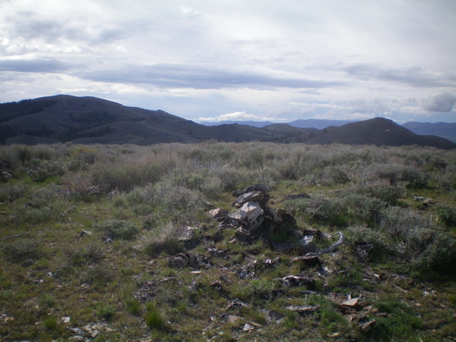
Chimney Benchmark (left) and Peak 6700 (right) in the distance as viewed from the summit of Peak 6641. Livingston Douglas Photo
Access
Same as for Peak 6700. This is the second leg of a 3-peak adventure that includes Peak 6700, Chimney Benchmark, and Peak 6641.
West Face, Class 2
The Climb
From unsigned road junction at a 6,580-foot saddle, hike briefly up an unofficial (and unmapped) 2-track that heads north along the base of the west face of Chimney Benchmark. Once past a patch of thick aspens, leave the 2-track and bushwhack briefly east to reach the open terrain of the west face. The face is thick sagebrush initially but thins out higher up. After reaching a ridge hump, continue east up a ridge (of sorts) to reach the left/north end of the high summit ridge and the high point. The summit of Chimney Benchmark has a USGS benchmark and a bunch of triangulation wood on the ground. There is no summit cairn. From the summit, return to the 6,580-foot saddle and follow jeep roads southwest then west then northwest down to the Salix Creek drainage. This concludes the second leg of today’s 3-peak journey. Peak 6641 is up next.
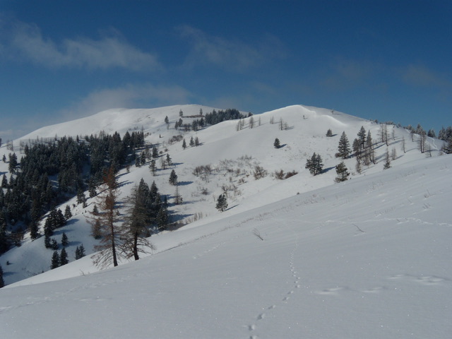
The upper slopes during a winter ascent. John Platt Photo
Additional Resources
Regions: Soldier Mountains->WESTERN IDAHO
Mountain Range: Soldier Mountains
Longitude: -115.07029 Latitude: 43.38769