Elevation: 7,471 ft
Prominence: 331
This peak is not in the book. Published June 2022
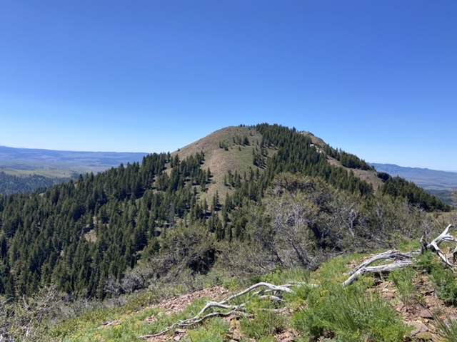
China Butte is located south of the main Silver City Range crest in the Owyhee Mountains. Although your hike to this summit will start at a higher elevation than the peak’s summit, it is a worthwhile goal. USGS Cinnabar Mountain
China Butte as viewed from the north
Access
Access the peak from the Silver City Road [(A)(2) on Page 346]. After crossing New York Summit, the road begins its descent down to Jordan Creek and Silver City. The Slaughterhouse Gulch road leaves this road 0.5 miles below the pass. Turn left and follow the road southeast past the slopes of War Eagle Mountain. The road then climbs up to the ridge top south of War Eagle Mountain. It then follows the ridge south for just under a mile to a junction. Go right at this junction, staying on the ridge that leads to Peak 8021. The road drops steeply into a saddle just north of the peak. Park here. Dry conditions and a high-clearance 4WD vehicle are recommended (see the map below). In June 2022, the road past the north side of Peak 8021 was blocked by snow drifts and two large downed trees. Nevertheless, the blocked road is easy to walk.
North Ridge, Class 2
Follow the road across the west slopes of Peak 8021 to the broad saddle on that peak’s south side. From this point, you have two options (Routes 1 and 2). I followed the Route 1 to the summit and returned via Route 2. This loop route covers 6.1 miles with 1,250 feet of elevation gain.
Route 1 follows the main road south from the broad saddle to the point where it turns east. Leave the road at this point and descend down to the ridgeline that leads south to China Butte. You will eventually reach a 2-track road (option two). Follow this downhill until it turns east and descends off the ridge. Leave the road at this point and follow the ridgeline south. You can either stay on top of the ridge (the best option) or traverse below the cliffs on the east side of the ridge on an infrequent game track. Once you reach the base of China Butte, an obvious steep meadow leads directly to the summit.
Route 2 follows the deteriorating 4WD road (driving not recommended) that leaves the broad saddle on the south side of Peak 8021. This road (mentioned in the Route 1 description above) descends into Mammoth Creek. At roughly 7,200 feet, the road swings southwest and eventually joins the first option route. Follow that route to China Butte.
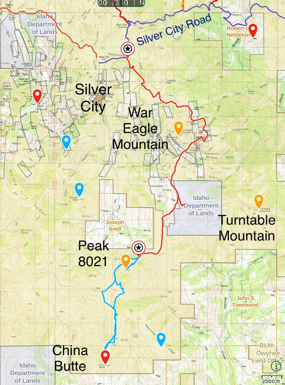
Access route from the Silver City Road (dark blue) to the north side of Peak 8021 (red). Hiking routes for Peak 8021 and China Butte (light blue).
Additional Resources
Regions: Owyhee Mountains->Silver City Range->SOUTHERN IDAHO
Mountain Range: Owyhee Mountains
Year Climbed: 2022
Longitude: -116.73069 Latitude: 42.94709