Elevation: 6,716 ft
Prominence: 566
This peak is not in the book. Published January 2023
China Cap is the smaller/lower of two pyramidal humps that are located just below the south end of Blackfoot Reservoir. Its big brother is called China Hat (7,166 feet). Well, I guess that fits. Both China Cap and China Hat require crossing private property, so please obtain permission from the landowner(s) before attempting a climb of either peak. Both peaks can be easily accessed from China Cap Road or close to it. But they each require a difficult, steep bushwhack in dense terrain. USGS China Hat
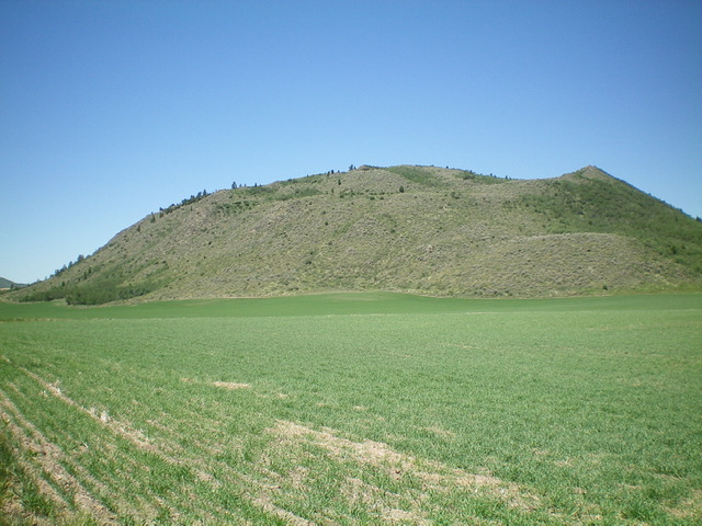
China Cap as viewed from the southeast. Livingston Douglas Photo
Access
From ID-34 at the southeast corner of Blackfoot Reservoir, drive west on [signed] China Cap Road for 1.4 miles to a signed junction with Dike Road. Turn right/north onto Dike Road and park along Dike Road just north of the road junction (6,130 feet).
South Face, Class 2
The Climb
From the road junction, walk north on Dike Road for 0.1 miles to a sharp left/west bend in the road. The south face of China Cap is dead ahead, but it’s ain’t pretty (see photo). Bushwhack directly up the steep, loose, brushy slope to reach the ridge crest. The ridge crest is even worse because it includes thick brush, aspens, and a few rocky outcrops—a truly miserable combination. Bash your way left-ish/northwest to reach the summit ridge. Bushwhack a short distance northeast to the summit high point. The summit has a cairn amongst the thick brush. The summit offers a nice view of nearby Blackfoot Reservoir to the north and of China Hat to the south.
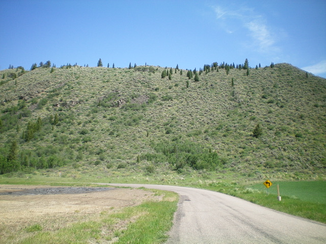
The steep, brushy south face of China Cap as viewed from Dike Road. This was my ascent (and descent) route. Livingston Douglas Photo
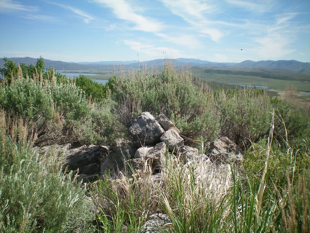
The cairn atop the brushy summit of China Cap. Livingston Douglas Photo
Additional Resources
Regions: Aspen Range->Peale Mountains->SOUTHERN IDAHO
Mountain Range: Peale Mountains
Longitude: -111.5934 Latitude: 42.8218