Elevation: 6,419 ft
Prominence: 144

This peak is not in the book. Published November 2020
Cinder Butte is located along the Dubois-Kilgore Road, just above its junction with Red Road. It is a fun, albeit brushy, scramble from the road via its south face. Wear long pants for this one. This hike is entirely on public land (State of Idaho land). It is a 20-minute round-trip scramble. USGS Idmon

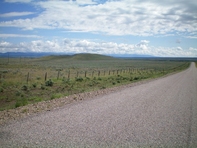
Cinder Butte (the gentle hump in center) as viewed from the southwest along the Dubois-Kilgore Road. Livingston Douglas Photo
Access
From Exit 167/Dubois on I-15, drive east on Main Street to the east end of Dubois, ID and a signed junction with the Dubois-Kilgore Road (signed for Kilgore and Yellowstone). Go left/north onto the Dubois-Kilgore Road and reset your odometer. At 18.7 miles, reach a [signed] double junction with Red Road/Fort Henry History Byway on the right/east side of the Dubois-Kilgore Road. Park at the second of the two junctions (6,260 feet).
South Face, Class 2
The Climb
From the road junction, cross to the west side of the Dubois-Kilgore Road, cross a stiff cattle fence, and bushwhack north-northwest up to the south summit through thick sagebrush. Cross a flat saddle area and continue north to the north/true summit of Cinder Butte. The summit area is open with lava gravel/rock as its base. There was no summit cairn so I built one.
East Gully, Class 2
The Descent
For a more pleasurable descent, return to the saddle south of the summit and descend a dry gully east to reach the Dubois-Kilgore Road. The brush and sage on this route is much easier than on the ascent route. Follow a fence row along the road to reach a cattle gate where you can more easily cross the stiff, high cattle fence and get back on the road. Follow the road a short distance back to the road junction and your parked vehicle.
Additional Resources