Elevation: 7,492 ft
Prominence: 272
This peak is not in the book. Published December 2020
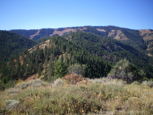
Congress Knob is located northwest of the Palisades Dam and separates Dry Gulch from Yeaman Creek. It is merely a point on a mostly-forested ridge that extends northeast from Red Benchmark (8,952 feet). It is probably most easily climbed via the Russell Creek Trail/FST-266 and the [mostly-open] southwest ridge. USGS Red Ridge
The summit of Congress Knob. Livingston Douglas Photo
Map Errors
If climbing Congress Knob from the east side, the map errors will frustrate you to no end. Both the USGS topo map and the Caribou-Targhee National Forest Map fail to show the Dry Gulch/Yeaman Creek Trail (FST-036). This is particularly amazing given that FST-036 is well-signed at a trailhead just off FSR-277. I believe that this trail connects to the upper section of the Yeaman Creek Trail (FST-265) at Yeaman Creek. The Yeaman Creek Trail/FST-265 has an unsigned trailhead next to the Little Lemhi BSA Camp but the trail is gone, which is probably why there is no trail sign there anymore. Perhaps it re-emerges higher up Yeaman Creek where the Dry Gulch/Yeaman Creek Trail (FST-036) connects to it.
The USGS topo map does NOT show the paved road (that becomes FSR-277) that crosses the Snake River on a good bridge near the Riverside Park Campground (just below the Palisades Dam). It fails to show the bridge as well. Please be advised that the Palisades Dam Road is closed and has been closed for years. Both the USGS topo map and the National Forest map show the dam road as if it is still open but it’s not.
Access
From the junction of US-26 and ID-31 in Swan Valley, drive about 10 miles southeast on US-26 to a signed turnoff for “Camp Little Lemhi/Riverside Park” just north of Palisades Reservoir Dam. Turn right/south off US-26 and reset your odometer. Follow the paved road south briefly then right/west as it skirts the Riverside Park Campground and crosses the Snake River on a good bridge.
At 2.1 miles, reach a signed junction with Bear Creek Road/FSR-076 (left turn). Go straight here on FSR-277 and drive toward the Little Lemhi BSA Camp. At 2.2 miles (only 0.1 miles after the junction), turn left/west onto an unsigned spur road and dispersed camping area. You will quickly see the signed trailhead for FST-036/Dry Gulch-Yeaman Creek Trail. Incredibly, this trail is not shown on any maps, despite the signage and the existence of the trail.
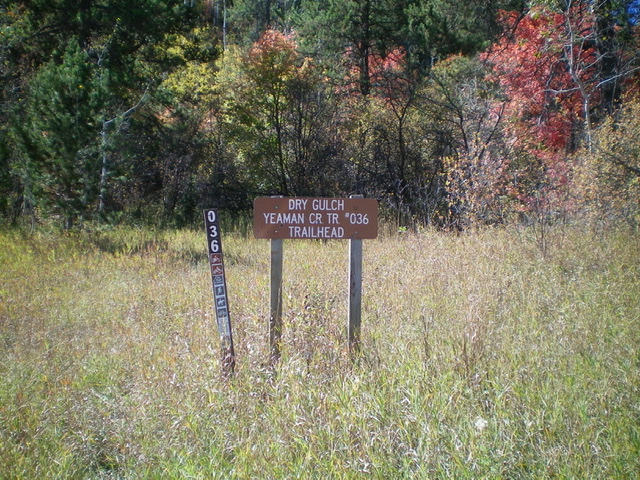
The trail sign at the Dry Gulch/Yeaman Creek trailhead. Livingston Douglas Photo
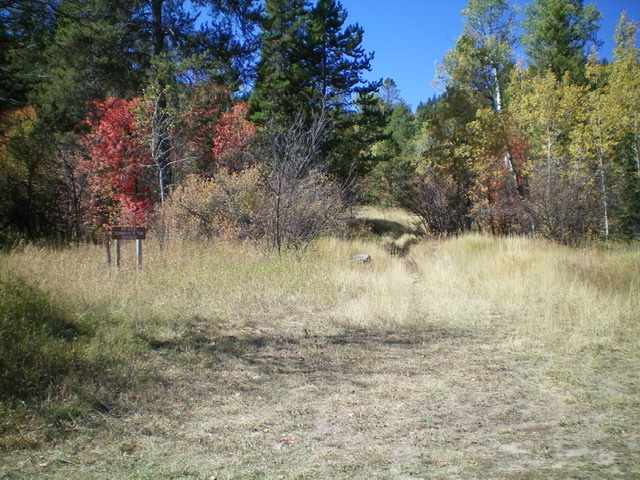
Looking up the start of FSR-036 from the trailhead parking area. Livingston Douglas Photo
Northeast Ridge/Northeast Face, Class 2
The Climb
From the signed trailhead, hike up FST-036 and quickly reach an unsigned junction with an old 2-track that heads left/south. Ignore the 2-track road for now (we will use it on the descent) and go straight to remain on FST-036. When the trail crosses the northeast ridge of Congress Knob (about 0.7 miles up from the trailhead), leave the trail to bushwhack up the ridge. The trail begins its descent to Yeaman Creek from here.
The forest bushwhack up the northeast ridge is simply BRUTAL. It is a pine forest with aspens mixed in and lots of brush. For a good chunk of the initial ascent up the “ridge,” it is so ill-defined that it is more of a face climb. Just keep bashing your way up through the wicked forest and you will find the better-defined ridge higher up. Reach a flat ridge section (a minor ridge hump at 7040+) and find a very good game/use trail that goes up the right/west side of the ridge and gets you close to the top.
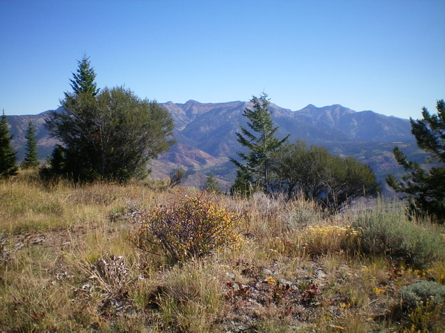
Leave this trail when you near the summit and bushwhack to the top. You will be surprised to find how open the summit of Congress Knob is. The USGS topo map fails to show this. There is no summit cairn but the summit offers magnificent views in several directions. The view of Palisades Reservoir is particularly striking.
Looking southwest from the summit of Congress Knob. Livingston Douglas Photo
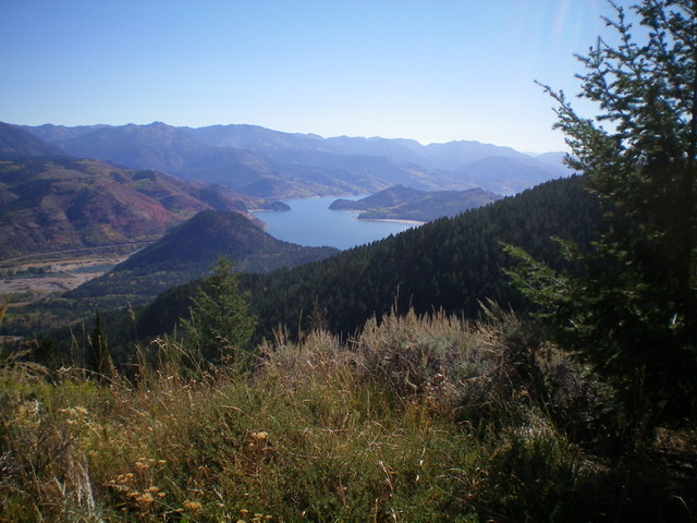
The magnificent view of Palisades Reservoir from the summit of Congress Knob. Notice the Snake River and the bridge crossing below the Palisades Dam at the far left of the photo. Livingston Douglas Photo
East Ridge, Class 2
The Descent
Given the difficulty of the bushwhacking on the northeast ridge, I vowed not to descend that route. I decided to try the east ridge. From the summit, descend the use trail on the left/west side of the northeast ridge back to the minor ridge hump (7040+). From that hump, bushwhack east down the right/south edge of a ridge that has Dry Gulch on its right/south side. At times, this bushwhack is punishing as it goes through thick forest, brush, and blowdown. At other times, the bushwhack isn’t too bad.
At about 6,000 feet, find a use trail that is coming up from the north. Perhaps this trail will lead back to the trailhead area. Yes, it does. The use trail soon bends northeast and reaches a shoulder. The trail turns into an old 2-track jeep road and leads down to FST-036 just above the trailhead parking area. Yes, this is the 2-track jeep road that you encountered early in the hike up FST-036 when undertaking the northeast ridge route. Follow FST-036 a short distance east to return to the trailhead.
Additional Resources
Regions: Caribou Range->SOUTHERN IDAHO
Mountain Range: Caribou Range
Longitude: -111.25879 Latitude: 43.34269