Elevation: 10,303 ft
Prominence: 1,523
Climbing and access information for this peak is on Page 327 of the book. The book contains information for ascending the peak’s West Ridge. Livingston Douglas has provided (see below) updated access information and a new route up the peak’s West Shoulder and South Ridge. Livingston points out that “For warm weather climbers like me, you might find my alternative route of interest. It is a shorter, easier route than the standard West Ridge Route discussed in the book.”
Copper Mountain is located on the Beaverhead Range’s Southwest Divide. USGS Copper Mountain
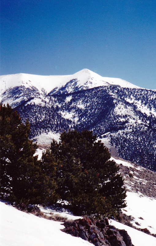
Copper Mountain as viewed from Skull Peak/Peak 7830. Rick Baugher Photo
West Shoulder/South Ridge, Class 2 by Livingston Douglas
Access
Long Canyon Road [(B)(11) on Page 330] as modified and detailed here. Long Canyon Road (FSR-176) is located on the east side of ID-28 in the Lemhi Valley. Specifically, the road is located:
• 8.8 miles north of the INEEL north boundary
• Just north of Mile Marker 42
• 1.8 miles south of the north entrance to the Birch Creek Campground
Long Canyon Road is signed with a small street sign as you would find in any town or city. It’s easy to miss it, so look for it. When you turn east onto Long Canyon Road, set your odometer to 0.0. Long Canyon Road is a very smooth gravel road for the first 2 miles or so. At 2.1 miles, there is a prominent mine located up and to the right of the road, on a hillside. If you respect your vehicle, you might choose to pull off the road and park here, as I did. The road forks at 2.3 miles and becomes rougher and much steeper. There is no formal parking area or trailhead. The elevation here is approximately 6,480 feet.
The Climb
There are multiple jeep/mining roads (mostly unmarked) that you will encounter on this hike, so it is helpful to have the USGS Copper Mountain quadrangle with you as a reference. From the parking spot at 2.1 miles, walk northeast up the canyon for about 0.2 mile to a signed road junction. Go left/north to stay on Long Canyon Road/FSR-176. The key is to make sure that you continue to follow the road that goes up the center of Long Canyon. Don’t get diverted off on a spur road that either goes to an old mine or up an alternate drainage. I must caution you that this is a steep road, climbing over 1,100 feet in the first 1.7 miles. I hope you’ve been doing your cardio training.
At 1.2 miles, there is a road sign indicating that you are on FSR-176/FST-184. Apparently, the forest service couldn’t make up their mind whether it is a road or a trail at this point. At 1.7 miles, there is a sign indicating that you are traveling on FST-184, which is open to ATVs and motorcycles (no jeeps or SUVs). Although this is a “trail”, it’s still a good road to hike or ride on. The road crests at the crossing of a ridge/shoulder at 8,300 feet and makes a sharp right turn. Copper Mountain is the massive hulk to the northeast and the summit is still 2,000 feet above your current position.
The standard West Ridge Route (discussed in the book) is still a mile away, and the road drops 100’ to cross a prominent drainage en route to the pass that separates Long Canyon from Skull Canyon. You have a great look at both the narrow pass (which is the launch point for the West Ridge Route) as well as the very choppy West Ridge. The West Ridge has a rough section about halfway up that sure didn’t look like Class 2 to me.
I had planned to climb the standard West Ridge Route, but I was rather disturbed by what I saw. So I checked the map (I told you to bring one!) and found that the shoulder that the road crosses here is actually a good alternative ascent route for Copper Mountain. This route is shorter and easier than the standard West Ridge Route. Best of all, it starts out as an old two-track road. Hike northeast then east up the shoulder to reach Point 9414, passing a water trough en route. Apparently, the cattle like this area, so it must not be too rugged. Though the two-track road flames out fairly quickly, a game trail helps make things continue to go smoothly higher up. From Point 9414, descend northeast to a gentle saddle that has another water trough for the thirsty cattle. From the saddle, scramble northeast up a steep, wide ridge of loose scree, using a good game trail that switchbacks up through this mess. At just above the 10,000-foot level, the slope eases considerably and you reach an open grassy field. This is the lengthy, sloped summit plateau.
Enjoy the easy stroll up the short grass for almost half a mile to reach the shale outcrops/shelves that must be climbed or otherwise circumvented to reach the rocky top of Copper Mountain. The summit has a large cairn, triangulation posts and wiring, and a USGS Benchmark in a ground boulder. The view down to the floor of the Lemhi Valley (and the Birch Creek Campground) is superb. Retrace your route back to the mouth of Long Canyon and your parking spot. When driving back down to ID-28, be careful not to run over the pronghorn antelope that occupy the sagebrush terrain on either side of the road. I saw a herd of 15 pronghorns crossing the Long Canyon Road as I cruised down it at a cool 40 miles per hour, kicking up lots of dust behind me.
Additional Resources
Regions: Beaverhead Range->EASTERN IDAHO
Mountain Range: Beaverhead Range
Longitude: -112.83129 Latitude: 44.17359