Elevation: 7,940 ft
Prominence: 760
This peak is not in the book.
Cottonwood Peak is an attractive summit located in the southern end of the Portneuf Range. There is a mix of state and private land in this area. USGS Cottonwood Peak
Russ Durrant reports:
Public access to this peak is no problem from the south. Follow the Swan Lake Creek Road east from the old Swan Lake store (Thomas Merc.). The road climbs several miles up into Cottonwood valley and goes directly south of Cottonwood Peak. There is a camping area and irrigation access road (Divide Creek) that ends near the beginning of the South Spur of Cottonwood Peak.
It is a generally easy climb to the summit, gaining about 1,350 feet over 1.35 miles. Other approaches from the Right-Hand Fork of March Creek appear possible, but are much steeper and longer. Approaching from the east runs into posted private property.
See Russ’ route map below.
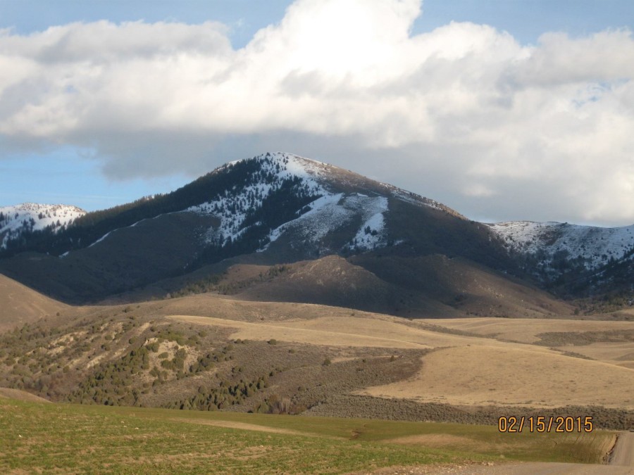
Cottonwood Peak in the southern Portneuf Range as viewed from the old pioneer Grant Ward Cemetery east of Downey, Idaho. Russ Durrant Photo
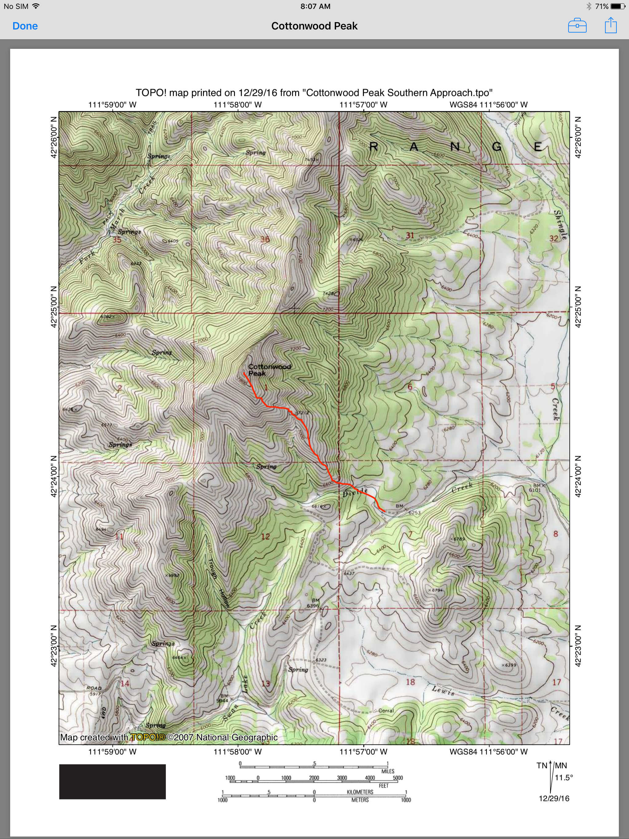
Russ Durrant’s route map.
Additional Resources
Regions: Portneuf Range->SOUTHERN IDAHO
Mountain Range: Portneuf Range
Longitude: -111.96601 Latitude: 42.41039