Elevation: 9,216 ft
Prominence: 356
Climbing and access information for this peak is on Page 366 of the book. The first entry below by Matt Durrant provides updated information for the standard route covered in the book. The second entry by Livingston Douglas covers his new routes on the peak. USGS Egan Basin. Updated October 2018
Standard Route, Class 2 by Matt Durrant
Cub Peak sits at the east end of Cub River Canyon. Its east ridge forms the divide between Snowslide Canyon and the North Fork of Saint Charles Canyon. It is seldom climbed even though the actual summit is only about 150 feet above the well-used High Line Trail. It sits on the Franklin/Bear Lake County line but the actual high point is just to the west of the line in Franklin County.
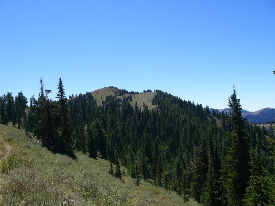
Cub Peak. Matt Durrant Photo
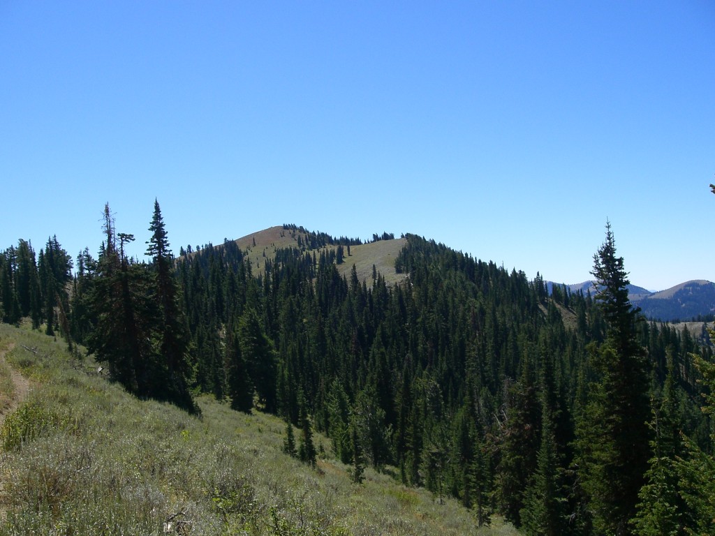
From the west, the mountain just looks like the high point of a pine-covered ridge, but from all other directions it looks like an actual peak. The east side is mostly bare and rocky whereas the west side is steep and thickly forested. Cub Peak is only about a mile north of the Franklin County High Point (Peak 9484) and it offers a spectacular view of the highest portion of the Bear River Range to the south, Franklin Basin, the Cache Valley, Bear Lake, and most of the major peaks in the Idaho portion of the range. It has been officially surveyed by the Forest Service and there is an intact USGS benchmark on the summit.
The climb is easy Class 1 and there is only about 150 feet of off-trail bushwhacking. It is an easy summit to reach and the summit views are very rewarding. The main challenge to this mountain is that you must hike for some distance to even get to it, regardless of the direction from which you come.
The best approach is from Preston, ID. Go south on US-91 until you get to the Cub River Road (about halfway to Franklin, ID). Turn left/east on this road. Don’t turn anywhere on this road until it splits well past the National Forest Boundary. If you go straight at the road split, you will end up at the Hull Valley BSA camp. You should turn right at this road split/junction so that you are heading towards the Willow Flat Campground. There is a sign for the campground at the road junction. Follow this road until you get to the campground. You will need to go over a bridge, take the first left, and follow this road to the end. It is very short. Park at the end of the road. This is the trailhead.
From the trailhead, follow the Bloomington Lake Trail to the top of the ridge. It is well used and well marked. This first part is actually the most difficult because of the elevation gain. The trailhead is at just over 6,000 feet and it climbs to an elevation of about 8,500 feet within about 1.5 miles. There are very few switchbacks and the trail is quite rocky as well. The other thing about this section of the trail is that there is not much timber and therefore not much shade, so it is best to hike the trail in the early morning while it is still cool.
Once you get to the top of the ridge, there is an intersection of the High Line Trail with the Bloomington and North Fork Saint Charles Canyon Trails. There is a large stone cairn at the intersection and there are a few badly damaged signs on it. From here, take the High Line Trail south for about two miles. This section is very easy hiking with mostly smooth elevation gain/loss. Cub Peak will be visible as soon as you get around Point 8897. The trail will go about 150 feet below the summit. From there, just leave the trail and bushwhack to the top. There is a USGS benchmark on the summit.
East Ridge/Snowslide Canyon Route, Class 2 by Livingston Douglas
Access
Drive up Saint Charles Canyon Road/FSR-412 from just north of Saint Charles, ID on US-89. At the 8.0-mile point (just past the turnoff for Cloverleaf Campground and just before the turnoff for North Fork Campground), you will find a large parking area on the RHS of the road. If you reach the turnoff for the North Fork Campground, you’ve gone about 100 yards too far. Turn around at the campground entrance and park along FSR-412. You can drive into North Fork Campground to reach the trailhead parking area, but you must pay a $7 day use fee. The elevation at the parking area along FSR-412 is 6,925 feet. For additional updated access information for this climb please refer to the Bear River Range page: Bear River Range
The Climb
From the North Fork Saint Charles Creek trailhead, hike (or ride a MC) 1.9 miles up FST-318 to a signed junction with the Snowslide Trail/FST-319 to your left. Thankfully, FST-318 has two excellent footbridges across the raging North Fork Saint Charles Creek and a third footbridge across the more modestly-flowing Snowslide Canyon Creek. The elevation at the junction of FST-318/FST-319 is approximately 7,450 feet. Follow FST-319 west up much steeper terrain than you experienced on FST-318. If the MCers are not out of bed yet, you just might see some elk on FST-319 as I did. After about a mile, FST-319 crosses a small stream (even in late summer) and turns sharply left/south. This is your departure point. Stop and take a few minutes to study your USGS topo map here. If you didn’t bring a USGS topo map, shame on you.
Bushwhack west then northwest up through easy forest to quickly reach open terrain at the base of the cliffed south side of the east ridge of Cub Peak. Good thing you found this open terrain because the forest bushwhack was about to get much worse. Scramble west along the base of the cliffs. You will almost immediately see a nice ramp angling diagonally up the south side of the east ridge. Hike up the easy Class 2 ramp then turn right just before reaching a prominent rocky buttress. Scramble up a gully/chute of sorts to reach the east ridge at a point that is just below an area of black lava rock. The terrain from the ramp to the east ridge is solid, easy open terrain (broken rock + short scrub).
Once on the ridge crest, you will encounter sporadic pine trees and more veg, but the climbing is pretty straightforward. The left/south side of the ridge crest seems to work best. You will reach a leftward bend in the ridge at a forested ridge hump at 9,000 feet. After crossing this hump, drop 40 feet to a minor saddle then proceed to climb the final section of the east ridge. This section is more of a face than a ridge, as the USGS map shows. The terrain here is steep, but is easy broken rock and short scrub. The summit of Cub Peak is a gentle hump with a USGS Benchmark (“CUB”) in a ground boulder. Nothing else was on the summit, not even a cairn. I took a triangulation post (which was laying on the ground nearby) and built a talus cairn to stick it in. Now Cub Peak stands tall and proud.
Additional Resources
Regions: Bear River Range->SOUTHERN IDAHO
Mountain Range: Bear River Range
Longitude: -111.59335 Latitude: 42.11391