Elevation: 8,020 ft
Prominence: 360
This peak is not in the book. Published December 2020
Deadhorse Ridge is one of many named ridges in this part of the Caribou Range. It is located between Red Ridge to its east and Lightning Ridge to its west. While the north summit is open and has a tall cairn, the south summit measures as the high point and is measured at 8,019 feet. I respectfully disagree with LOJ’s assessment of the high point of Deadhorse Ridge. I stood atop both summits just to be sure. USGS Red Ridge
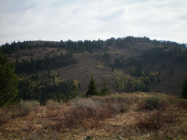
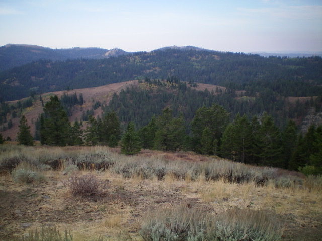
Deadhorse Ridge (the skyline) as viewed from the southwest. The bare north summit (left hump) is slightly lower than the forested south summit (right hump). Livingston Douglas Photo
Access
From the signed turnoff on US-26 at the bridge crossing of the Snake River a few miles west of Swan Valley, drive south on Snake River Road for 7.3 miles to a signed junction with Long Gulch Road/FSR-059 (signed for Camp Ta-Man-A-Wis). Turn right/west onto Long Gulch Road and drive 4.1 miles to the large trailhead parking area for the Red Ridge Trail/FST-264 (a MC trail). The trailhead is at the southeast end of the parking area. Camp Ta-Ma-A-Wis is a private camp and is next to the parking area. It is gated and has “No Trespassing” signs. The elevation at the trailhead is 6,900 feet. Please be aware that there is another trail (FST-059, an ATV trail) that leaves from the north end of the parking area. That trail is NOT shown on the USGS topo map.
North Ridge, Class 2
The Climb
Hike up FST-264 for about ½ mile to a junction. Go right/east to stay on FST-264 (“Red Ridge Trail”) but be aware that the old signage indicates that the trail is now FST-035 (which it is NOT). There is an old jeep track heading straight/south here; ignore it. About two miles up from the trailhead, reach a well-signed trail junction at about 7,900 feet. Go right/west onto FST-263. Please note that this trail junction occurs about ½ mile sooner than the USGS topo map indicates and at a lower elevation. This new trail position reduces the up-and-down associated with crossing Red Ridge. And that’s a good thing.
Follow FST-263 up over Red Ridge. The trail turns left/south, crosses a shoulder, and heads down to a saddle. It then bends right/west and crosses a minor ridge then drops to another saddle. From this saddle, the trail heads southwest, climbs over a hump, and drops slightly to a final saddle. The ridge then heads south-southwest diagonally upward to reach the crest of Deadhorse Ridge in an open area. The [lower] north summit is a short bushwhack through brush/sage from here. There is a tall cairn atop it.
The true/south summit is a short but unpleasant bushwhack south from FST-263. The bushwhack is a combination of aspen/pine forest and a narrow ridge crest of talus/boulders and thick brush. The summit is a rocky, narrow ridge crest point. It is five feet higher than the north summit according to my altimeter. Due to the thick forest, a visual comparison of the two summits is impossible.
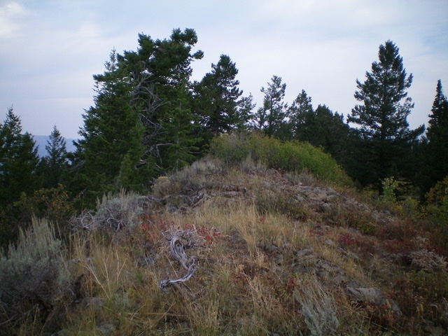
The summit area atop the true/south summit of Deadhorse Ridge, looking north. Livingston Douglas Photo
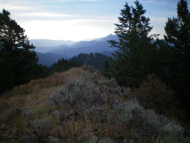
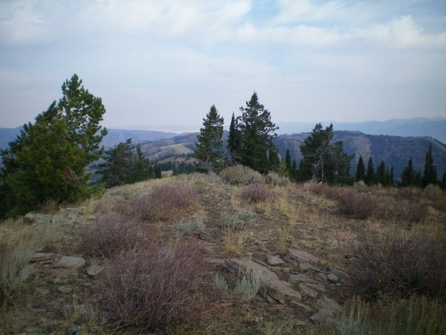
Looking south along Deadhorse Ridge from the true/south summit.
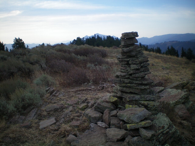
The tall summit cairn atop the north summit of Deadhorse Ridge. Livingston Douglas Photo
Peak 7794 (mid-ground, mostly bare) and Lightning Ridge (forested, behind Peak 7794) as viewed from Deadhorse Ridge to the northeast. Livingston Douglas Photo
Looking north along Deadhorse Ridge from the north summit. Livingston Douglas Photo
West Face, Class 2
The Descent
Only the bushwhack back to FST-263 is Class 2. From the true/south summit, return to FST-263 and follow it west-southwest to the connecting saddle with Peak 7794 at 7,500 feet. There is a signed trail junction here. FST-263 does a few LONG switchbacks to descend from Deadhorse Ridge to this saddle. The USGS topo map erroneously shows the trail descending directly to the saddle. You can descend more directly to the saddle via remnants of an old trail through the thick sagebrush.
Please be advised that if you stay on FST-263 and do the long switchbacks, there is a signed trail junction partway down. Be sure to go left/south at this junction in order to continue the descent to the connecting saddle. This concludes the first leg of today’s three-peak journey. Peak 7794 is up next.
Additional Resources
Regions: Caribou Range->SOUTHERN IDAHO
Mountain Range: Caribou Range
Longitude: -111.3612 Latitude: 43.3361