Elevation: 7,740 ft
Prominence: 400
This peak is not in the book. Published December 2020
Deadhorse Ridge North is a ranked summit at the north end of Deadhorse Ridge. It is most easily accessed from Fall Creek Road via FST-140 and FST-267. A short scramble up the northeast face puts you on top. The Caribous have many named ridges and this is one of them. Deadhorse Ridge North is best climbed in combination with nearby Peak 7701 and with Peak 7391 to its north-northwest along FST-267. USGS Commissary Ridge
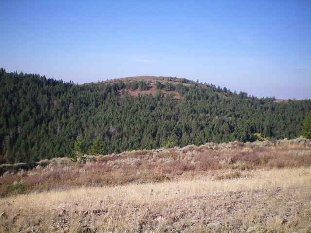
Deadhorse Ridge North as viewed from the northeast. Livingston Douglas Photo
Access
From US-26 north of Swan Valley, ID, turn right/south at a signed junction just before a bridge crossing of the Snake River a few miles west of the junction of US-26 and ID-31 in Swan Valley. This junction is signed for Snake River Road and “Fall Creek Road 1 mile.” Drive 1.2 miles south on Snake River Road as it follows the west side of the Snake River and reaches a [signed] junction with Fall Creek Road/FSR-077. Turn right/west on Fall Creek Road and drive 4.5 miles west to the [signed] trailhead for Horse Creek Trail/FST-140 on the left/southeast side of the road. The trail has an immediate ATV/foot bridge crossing of Fall Creek that is visible from the road. Park in the open grassy area at the trailhead (5,500 feet).
Northeast Face, Class 2
The Climb
From Fall Creek Road, hike southeast up FST-140 (an ATV trail) to a signed “T” junction with FST-267 at 7,005 feet. FST-267 is an ATV trail heading north from here but it is a MC trail heading south from here. Both are good for hiking. Please note that the USGS topo map does not show FST-140 at all, though it does show FST-267. The aforementioned trail junction is at a saddle just south of Peak 7391. From that junction, go right/south on FST-267 and follow it for about a mile to the 7,340-foot connecting saddle between Deadhorse Ridge and Peak 7701.
From the open saddle, follow FST-267 up the northeast face of Deadhorse Ridge until the trail makes a sharp left/east turn and tops out. Leave the trail and bushwhack straight up the brushy, steep slope in forest then open terrain to reach the north summit of Deadhorse Ridge, which is unofficially called Deadhorse Ridge North. Go right/west on the open, rocky ridge to reach the high point. The summit has a nice cairn and a USGS benchmark.
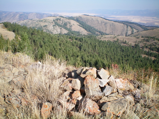
The summit cairn atop Deadhorse Ridge North, looking northwest. Livingston Douglas Photo
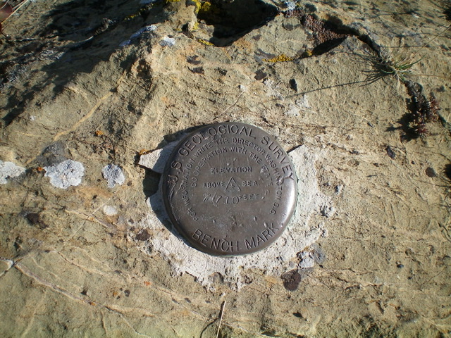
The USGS benchmark atop Deadhorse Ridge North. Livingston Douglas Photo
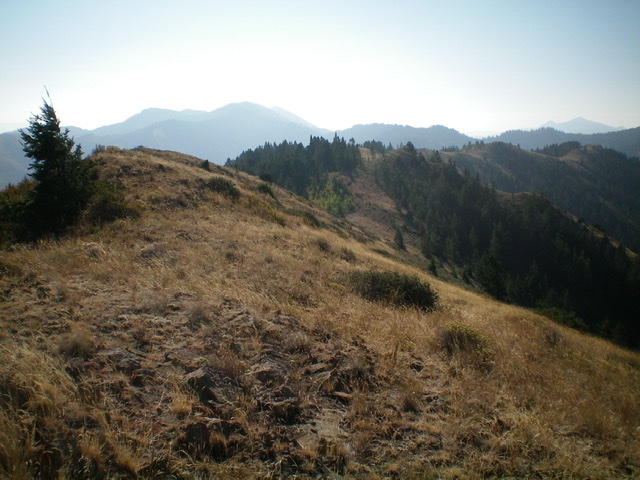
Looking southeast at bumpy, undulating Deadhorse Ridge from the summit of Deadhorse Ridge North. Livingston Douglas Photo
Additional Resources
Regions: Caribou Range->SOUTHERN IDAHO
Mountain Range: Caribou Range
Longitude: -111.38179 Latitude: 43.37001