Elevation: 5,204 ft
Prominence: 374
This peak is not in the book. Livingston Douglas provided the new route information set out down the page. Updated December 2019
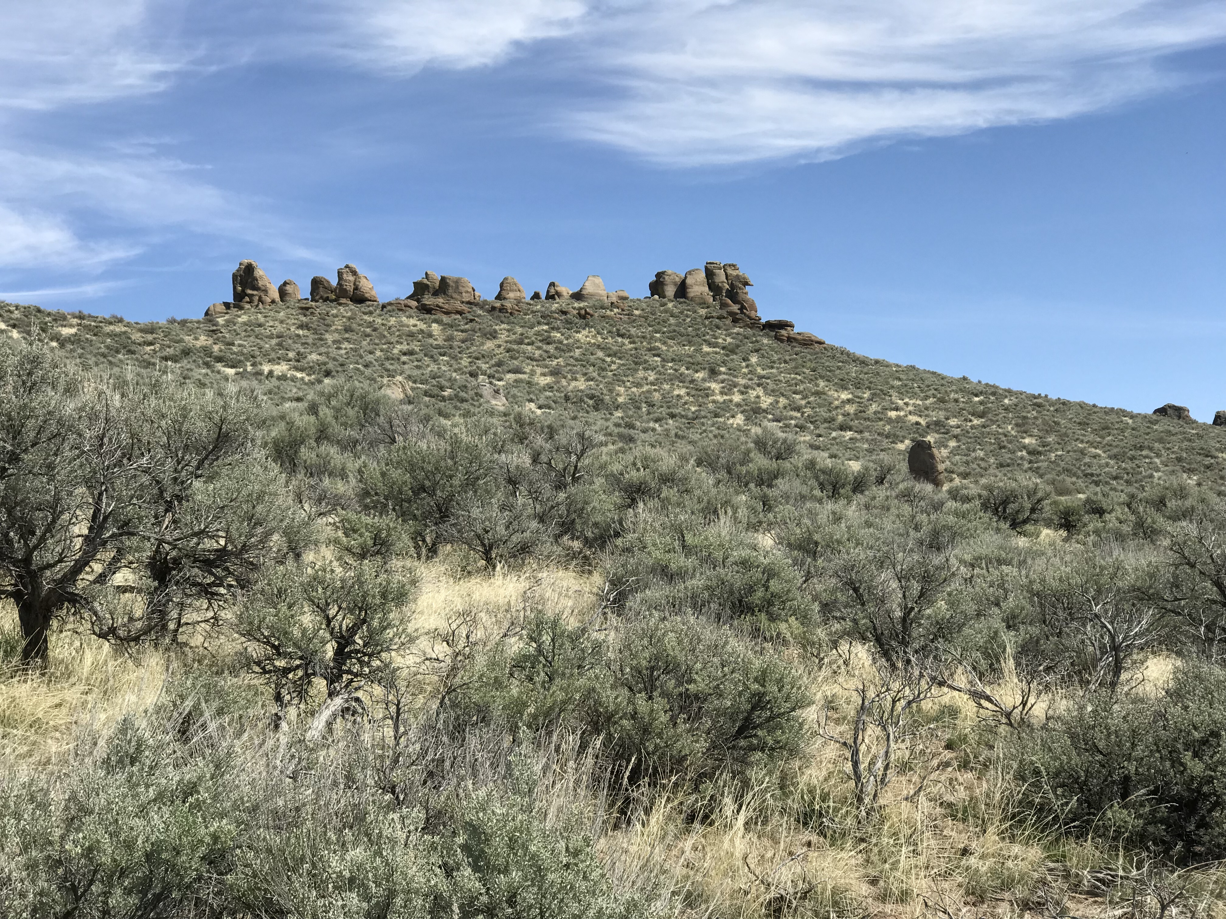
Dinosaur Ridge is located west of ID-75 and southeast of Magic Reservoir. This peak is named for the stegosaurus-like rock towers on its summit ridge. USGS Shoshone Ice Cave
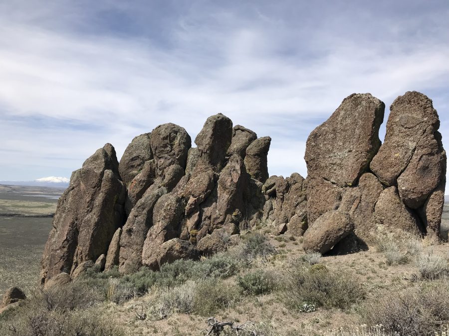
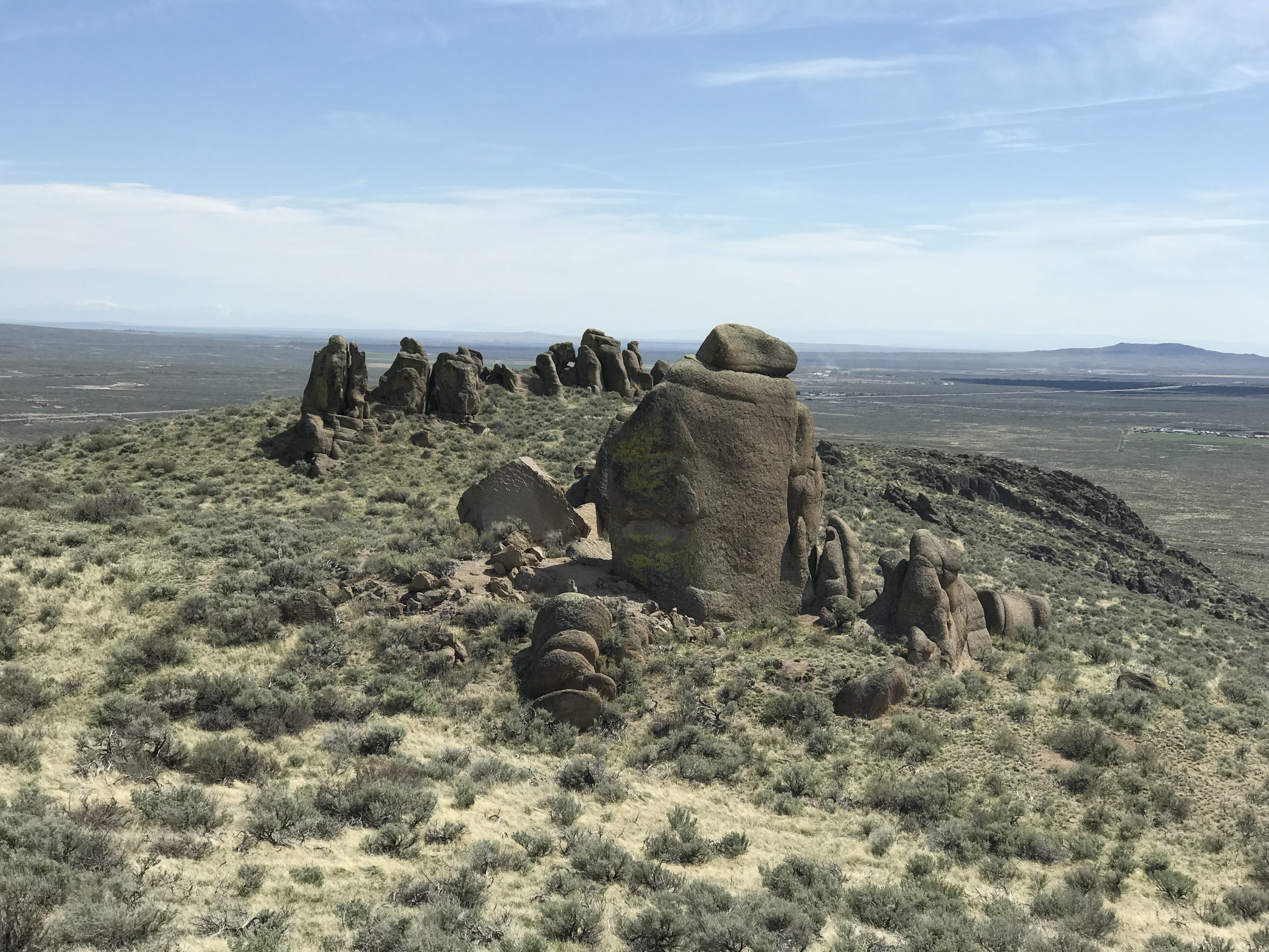
The summit of Dinosaur Ridge is in this cluster of rocks.
Access
Access this peak from ID-75. Turn west onto the Big Wood River Access Road, which leaves ID-75 exactly 6.6 miles south of the ID-75/US-20 junction. This road will be difficult to drive when wet. Follow this occasionally-maintained road as it heads west. You will come to a major junction signed for the Richfield Diversion to the left. Here, keep right and follow the road northwest until you are directly west of the summit. Keep your eyes peeled for a 2-track road on the north side of the main road. You can either park at this point or follow the 2-track road about a hundred yards farther to a parking spot. From here, you can make a gentle ascent to the peak’s summit ridge. The only obstacle you will encounter is a BLM fence that you must either cross or go under. See the map below.
West Face/South Ridge, Class 3
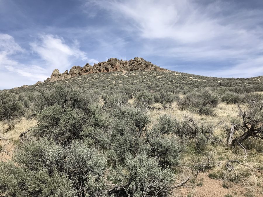
From the parking spot, climb up the west face while aiming for the ridge top to the right of the summit and left of the large grouping of pinnacles shown in the photo below. Once on the summit ridge, turn north and make the short climb up to the highest group of pinnacles.
The rocks comprising the peak’s highest point require a short stretch of Class 3 climbing with some exposure. See the photo below for my route. Be warned that the exposure will bother some climbers. My route was 1.0 mile round-trip with 347 feet of elevation gain.
From the parking area, climb to the summit ridge on the left side of this photo.
The summit pinnacles
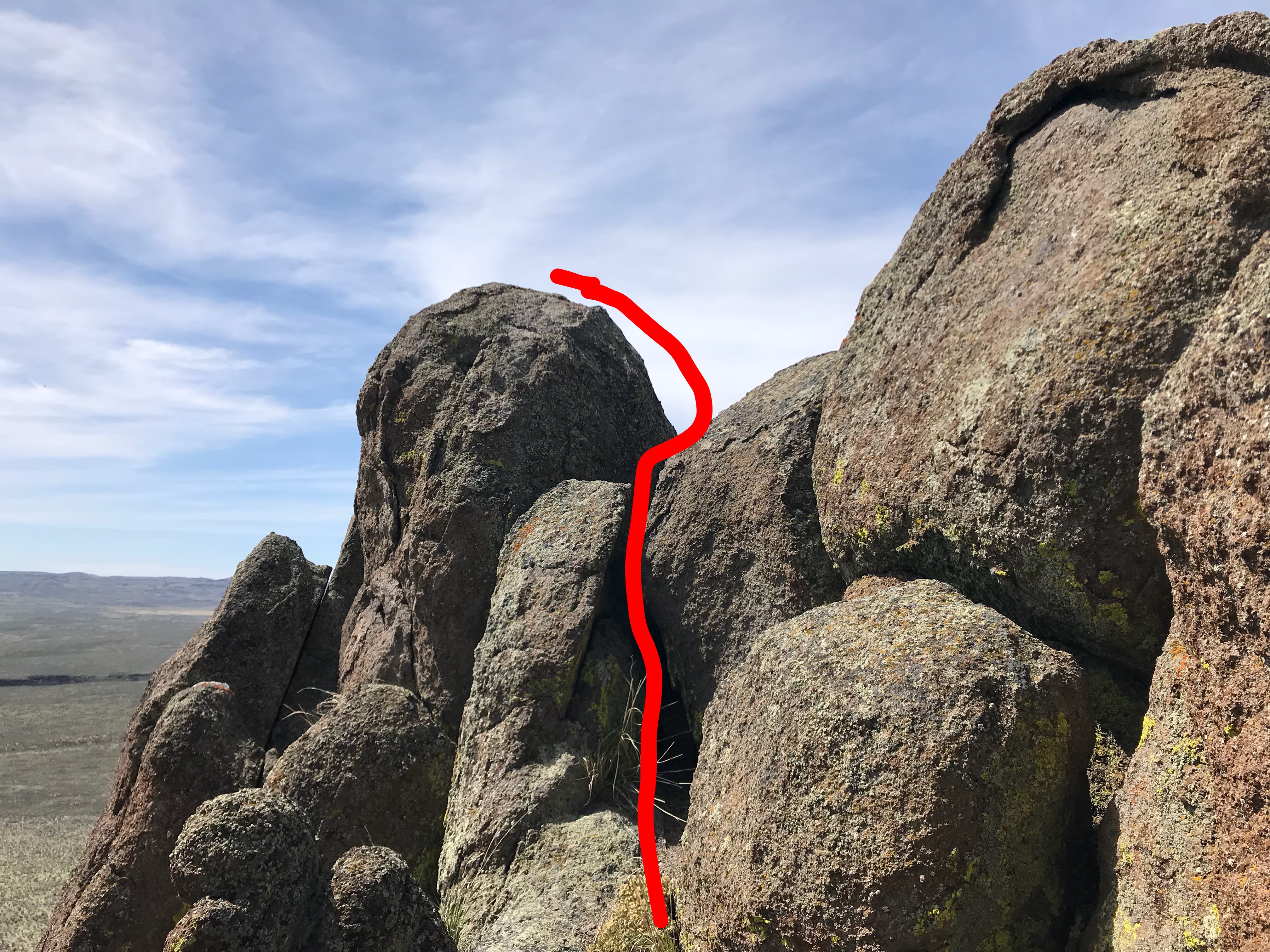
My scramble to the summit followed this line.
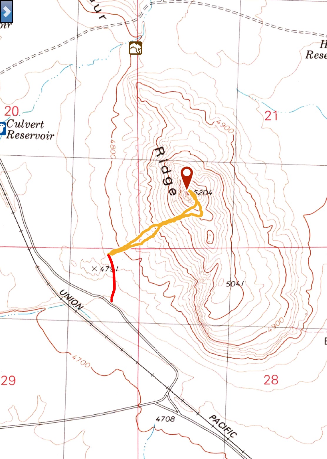
My GPS track. The red dots represent the 2-track road that is not shown on the USGS map.
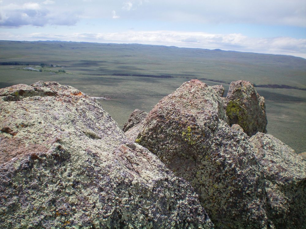
Looking south down the summit ridge from the high point.
Northeast Shoulder and North Ridge Routes by Livingston Douglas
Northeast Shoulder, Class 3
Access
Big Wood River Access Road is unsigned and is a muddy, badly rutted, 2-track jeep road. I only made it 0.2 miles along this road and parked in a pullout. This is a good place to park because this route leaves the road at the 0.5-mile point. This road is located on the west side of ID-75, exactly 6.6 miles S of US-20. The elevation at the parking pullout is 4,810 feet.
The Climb
This route is mostly Class 2. Only the summit blocks are Class 3. From the parking pullout on Big Wood River Access Road, follow the road west for 0.3 miles. Leave the road and scramble through desert scrub to head directly up the [obvious] northeast shoulder of Dinosaur Ridge. Decent gaps in the sagebrush make this a tolerable endeavor. Upon reaching the summit blocks, work your way up the northeast side of them (the only feasible way) to reach the highest, airy block.
North Ridge, Class 3
Access
Same as for the northeast shoulder
The Descent
This route is mostly Class 2. Only the summit blocks are Class 3. Carefully navigate your way off of the summit blocks to reach the easier terrain of the north ridge. Weave your way around rock blocks/boulders on gravel and easy scrub. The rocky terrain morphs into a sagebrush slope. Lower down, follow the right/east side of a fence row to reach the base of the ridge at a pass.
The massive summit blocks atop Dinosaur Ridge. Livingston Douglas Photo
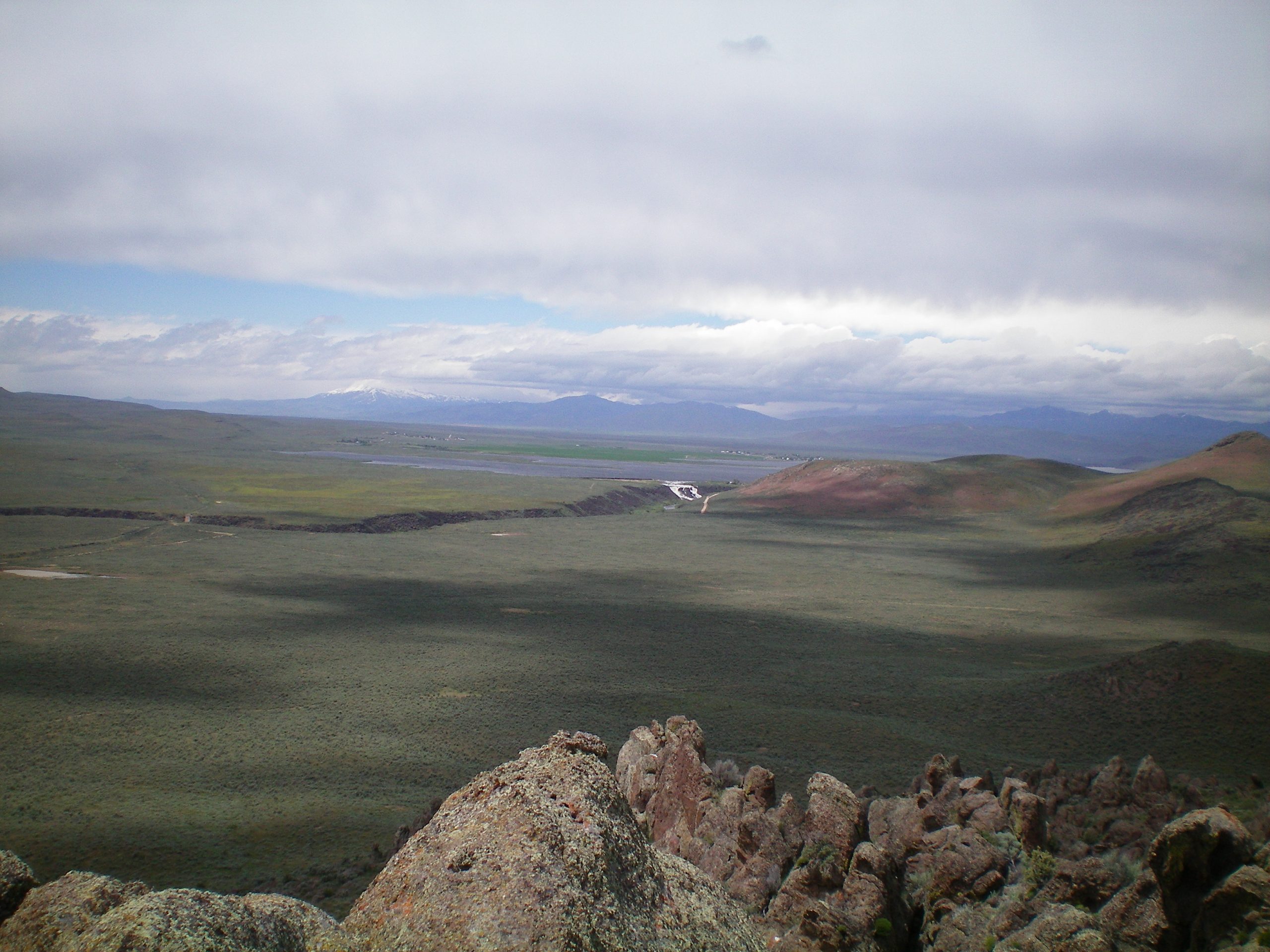
View of Magic Reservoir and its rushing outflow creek (in dead center, white) from the summit of Dinosaur Ridge. Livingston Douglas Photo
Additional Resources
Regions: SNAKE RIVER PLAIN
Mountain Range: Bennett Mountain Hills
Year Climbed: 2018
Longitude: -114.33219 Latitude: 43.23169