Elevation: 6,638 ft
Prominence: 538
This peak is not in the book. Published November 2022
Dollar Mountain is developed as a ski hill by the historic Sun Valley Resort to compliment the resort’s main downhill installation on Bald Mountain. It sits due south of the resort and has a few chairlifts on its north slopes. Dollar Mountain is most easily climbed via its northeast shoulder from the junction of Elkhorn Road and Village Way. A foot trail will get you up to the northeast shoulder. USGS Sun Valley
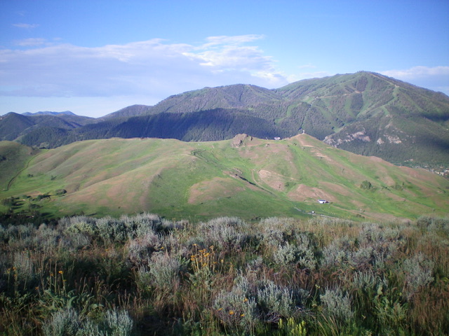
Dollar Mountain (mid-ground) as viewed from Prospect Hill to its northeast. Livingston Douglas Photo
Access
From the junction of Sun Valley Road and Dollar Road in Sun Valley, drive 0.6 miles east up Dollar Road to its “T” junction with Elkhorn Road. Turn right/south onto Elkhorn Road and drive 0.7 miles south to a signed junction with Village Way. Park in a pullout on the east side Elkhorn Road just north of the junction (6,105 feet).
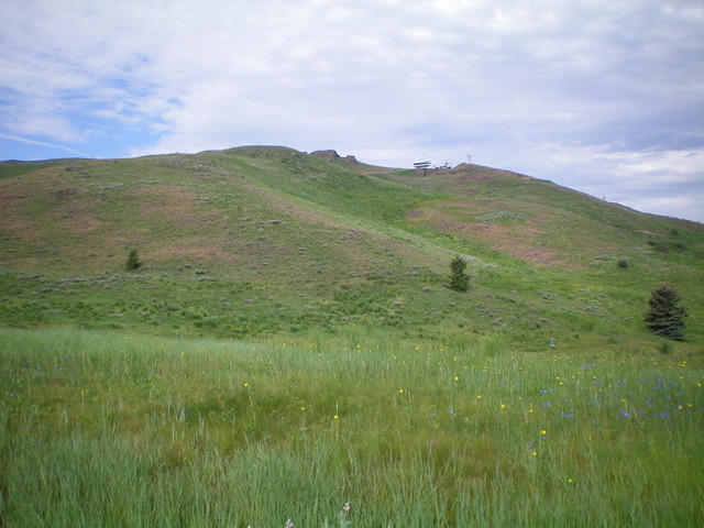
Dollar Mountain as viewed from the road junction (start of hike). Ascend the shoulder left of center. Livingston Douglas Photo
Northeast Shoulder, Class 2
The Climb
From the road junction, walk about 30 yards south along Village Way on a bike path to find an unsigned foot trail that heads right/west. Follow this trail as it heads west across a forested section of the Elkhorn Golf Course then turns right/north. When the trail crosses the northeast shoulder, leave it and bushwhack up the shoulder and find a foot trail higher up that follows the shoulder to a junction with a service road high up. Follow the service road right/west to the official summit hump, which has a radio tower atop it.
There is a rugged, rocky outcrop southeast of the official summit that measures at 6600+. I stood atop this nice outcrop and, visually, it seems to be slightly higher than the antenna-clad, official summit. It’s certainly a more fun climb than the boring, road-to-the-top, official summit. I even saw 5-6 buck mule deer huddled below the highest gondola between the rocky, unofficial summit and the true summit. These deer apparently are aware of the “no hunting” rules in the city limits of Sun Valley because they were totally unconcerned with my presence.
My altimeter has the official summit and the rocky, unofficial summit of equal height. When I stood atop the official summit, the unofficial summit looked slightly lower (and vice-versa). I’d like to think that the nice, rocky outcrop is the actual high point of Dollar Mountain but I can’t prove it.
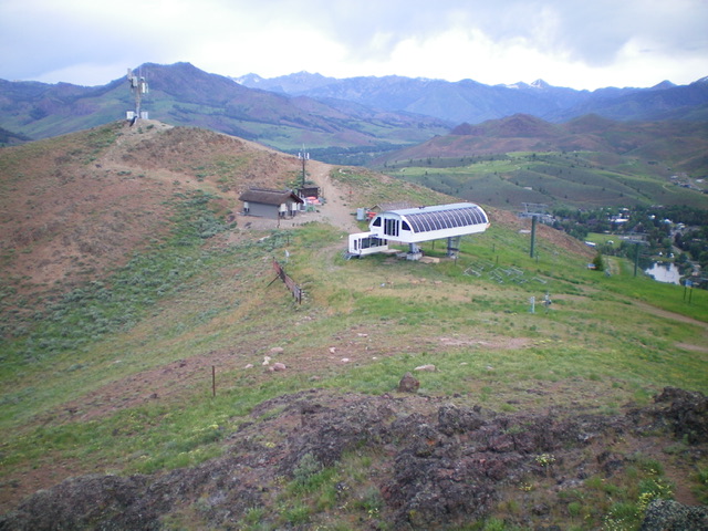
The summit area of Dollar Mountain. Looking at the [official] antenna-clad summit hump from the [unofficial] rocky Point 6600+ which may actually be the high point. Notice the buck mule deer beneath the gondola. They must know that Sun Valley is a “NO SHOOTING” zone! Livingston Douglas Photo
North Gully, Class 1
The Climb
There is a service road that comes up the north gully and heads directly to the summit ridge, with one branch of the road going directly to the antenna-clad, official summit and another branch of the road heading south along the ridge crest to a lower ridge point. You may be able to hike up the service road from the Sun Valley Ski Resort at its base or, if not permissible, you can intercept the service road by hiking farther north on the aforementioned foot trail of the Northeast Shoulder Route to where it intercepts the service road.
Additional Resources
Regions: EASTERN IDAHO->Pioneer Mountains
Mountain Range: Pioneer Mountains
Year Climbed: 1997
Longitude: -114.34839 Latitude: 43.68301