Elevation: 7,113 ft
Prominence: 653
This peak is not in the book. Published November 2023
Dutchler Mountain is an impressive mountain that separates Squaw Creek from the East Fork Spring Creek in the Bitterroot Mountains. It is most easily climbed from its west side and FSR-042/Dutchler Mountain Road. Old mining roads(now just grassy ramps) lead up its west face all the way to the high ridgeline north of the summit hump. USGS Ulysses
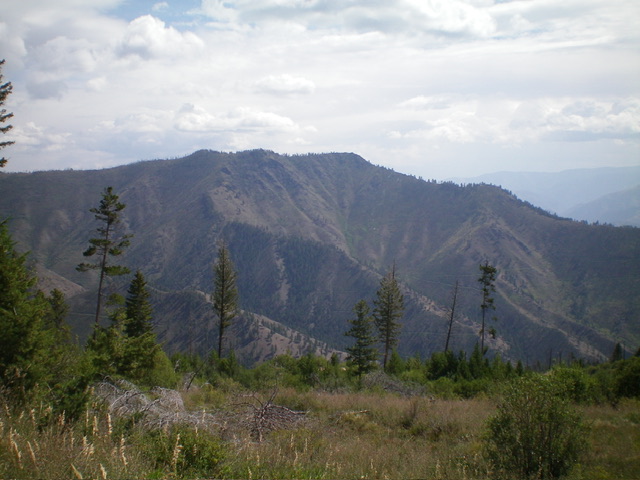
Dutchler Mountain as viewed from Peak 4550 to its southeast. Livingston Douglas Photo
Access
From US-93 at North Fork, drive west on FSR-030/Salmon River Road for 16.3 miles to a signed junction with FSR-038/Spring Creek Road, just after passing the Spring Creek Campground on the left/south side of the road. Turn right/north onto FSR-038 and drive 2.1 miles to a signed junction FSR-042. Park at this junction (4,045 feet). FSR-042 is narrow and rutted with the possibility of treefall on or near the road. It is also rocky in sections and requires a 4WD vehicle with good tires.
Southwest Ridge, Class 2+
The Climb
From the road junction, hike (or drive) north-northeast up FSR-042 for about a mile to the base of the southwest ridge. Leave FSR-042 just before it crosses to the left/west side of the creek via a culvert under the road. Bushwhack east up through easy pine forest to reach the forested ridge. Once on the southwest ridge, scramble northeast up the semi-open terrain to a right/east bend in the ridge at about 6,100 feet. The ridge terrain to this point is a mix of scattered ridge pines, field grass, underlying loose talus/scree, and annoying deadfall.
The ridge steepens after reaching this rightward bend. The ridge terrain becomes a mix of willows, brush, slippery field grass, deadfall, and some ridge rock (Class 2+). The southwest ridge reaches the high summit ridge just south of the summit hump. Scramble left/north up through a tedious mix of field grass, thick brush, deadfall, and boulders. The summit has two boulder clumps of similar height. Stand atop both to claim victory. There is no summit cairn. The summit offers wide-open views of the surrounding area.
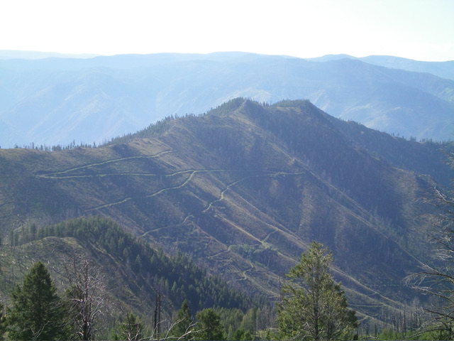
Dutchler Mountain (in mid-ground) as viewed from Peak 7420 to its northwest. Livingston Douglas Photo
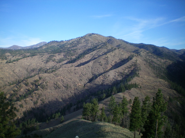
Dutchler Mountain as viewed from the west. The southwest ridge (my ascent route) is in dead center, heading diagonally up and left to the summit area. Livingston Douglas Photo
Additional Resources
Regions: Bitterroot Mountains->NORTHERN IDAHO
Mountain Range: Bitterroot Mountains
Longitude: -114.2408 Latitude: 45.4426