Elevation: 8,300 ft
Prominence: 520
This peak is not in the book. Published November 2023
Eagle Mountain is a forested hump that is located on a high ridgeline west of the Continental Divide in the Beaverhead Mountains. It sits above the confluence of Sheep Creek and Little Sheep Creek. Based on my altimeter measurements, the high point of Eagle Mountain is the south summit (Point 8266), not the official/north summit. USGS Shewag Lake
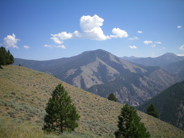
Eagle Mountain (dead center) as viewed from the northeast. Livingston Douglas Photo
Access
From US-93 at Gibbonsville, turn right/east onto [signed] Gibbonsville Road/FSR-079 and drive 9.6 miles to Big Hole Pass (7,055 feet). Park here or drive south on FSR-078 to an unsigned junction with FSR-735 if road conditions permit. You will need a 4WD with good tires (but not high clearance) to navigate FSR-078. You may also need high clearance to navigate [rougher] FSR-735.
Map Errors
The USGS topo map includes an erroneous 8,280-foot contour line in the middle of the high summit ridge. The actual high point of Eagle Mountain is the measured south summit (8,266 feet).
Northeast Ridge, Class 2
The Climb
From Big Hole Pass, hike (or drive) south on FSR-078 to its unsigned junction with FSR-735. This junction is at 7,944 feet (map) where FSR-078 makes a sharp right/northwest turn. Eagle Mountain is quite visible to the south from here. Follow rocky, rugged FSR-735 west then south as it descends to a 7,780-foot saddle at the base of the north ridge of Eagle Mountain. The road has a turnaround loop in this saddle. Walk to the south end of the turnaround loop to find that the road continues southward up the north ridge of Eagle Mountain.
Hike up the north ridge on the rocky road until it ends in an area of old mining activity. From the end of the road, bushwhack southwest up the narrow ridge on a weak, on-and-off, game trail to reach a semi-open ridgeline and a high point. This is the official high point (the north summit) but it has no summit cairn. Continue scrambling south for a short distance to reach the south end of the open ridge at Point 8266.
I built a cairn on the south summit since it measures 5 feet higher than the official/north summit, according to my altimeter. Visually, the south summit appears to be slightly higher than the north summit. The open, unobstructed view from the south summit is splendid. The terrain on the northeast ridge forested but semi-open. There is some ridge rock but nothing serious. Scramble around ridge pines and some deadfall on your way to the summit. There are a surprising number of ups and downs on the northeast ridge, so be prepared for that.
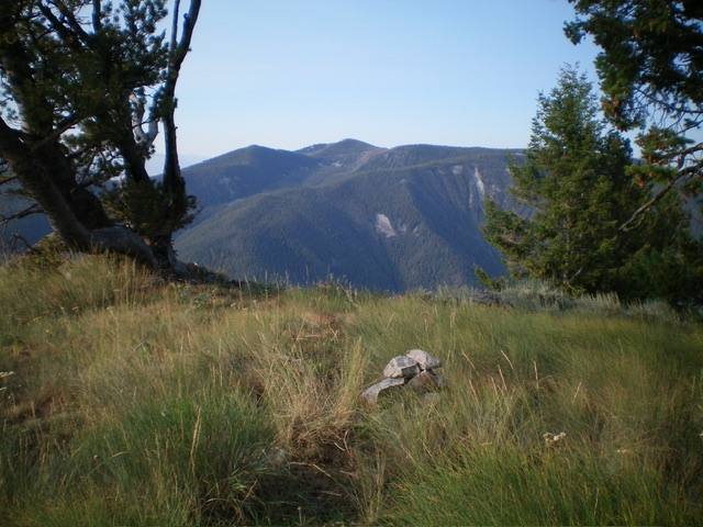
The newly-built summit cairn atop Eagle Mountain. Livingston Douglas Photo
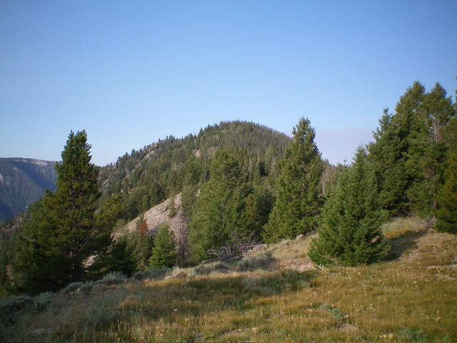
Eagle Mountain as viewed from Peak 6020 to its west. Livingston Douglas Photo
Additional Resources
Regions: Beaverhead Range->EASTERN IDAHO
Mountain Range: Beaverhead Range
Longitude: -113.8451 Latitude: 45.4983