Elevation: 7,646 ft
Prominence: 1,106
This peak is not in the book. Published December 2020
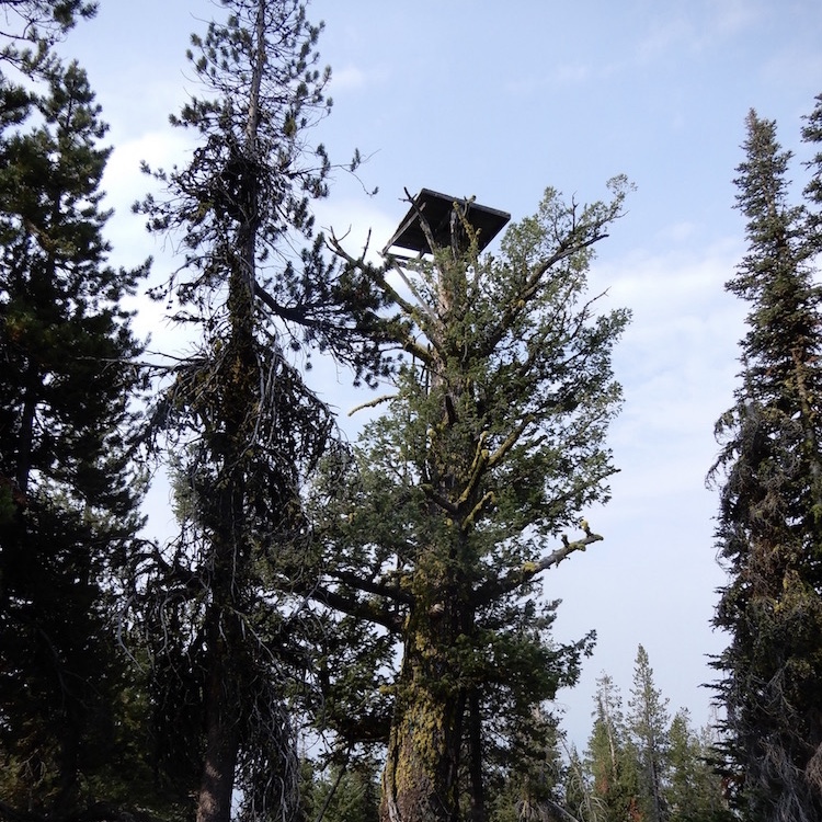
Eagle Nest is located northeast of Cascade, Idaho. It was an early fire lookout comprised of a platform built high in a tree. USGS Eagle Nest
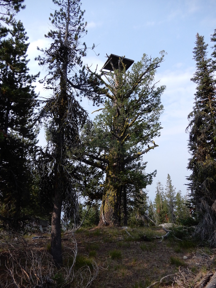
The nest on the Eagle Nest. John Platt Photo
Access
There are various access routes in this area of many roads.
Eagle Nest Trailhead. The road to the Eagle Nest trailhead is signed on the Warm Lake Highway. According to John Platt: “it is in pretty good shape and sedan accessible.” This trail is part of the mountain bike loop described in John’s trip report (linked below). “The trail from there was all rideable (in good shape). But doesn’t quite go all the way to the lookout- 30 minutes of light bushwhacking required,” according to John.
Gold Fork Lookout Road. None of the roads are in good condition. FS-411 and FS-411A lead to the Gold Fork Lookout site and pass by the Eagle Nest’s west slopes. The road is accessed from Warm Lake Highway [(C)(1) on Page 138]. From ID-55, follow Warm Lake Highway east for roughly 11.0 miles to the signed junction for the Gold Fork Lookout. Turn left onto FS-411 and follow it north to a signed trailhead for the Eagle Nest. Beware: the farther you drive, the more the road deteriorates. The trail to the Eagle Nest has not been maintained for many years.
Routes, Class 2
I have not visited this summit. As noted above and in the linked trip reports, trails get you close to the summit. The last part of the ascent has no trail. See John Platt and Dave Pahlas’ trip reports linked below for additional details.
Additional Resources
Mountain Range: Western Salmon River Mountains
Longitude: -115.94189 Latitude: 44.60739