Elevation: 11,133 ft
Prominence: 379
Climbing and access information for this peak is on Page 234 of the book. Elevation and prominence figures are based on recent LiDAR measurements. The USGS Quad shows an elevation of 11,108. Updated October 2026
Climb Easley Peak and traverse over to Cerro Ciento to make it a 2-peak day. USGS Easley Hot Springs
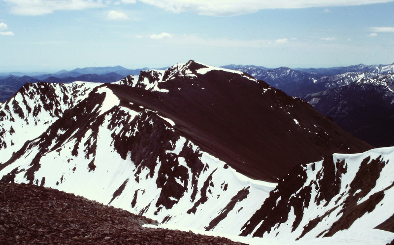
Easley Peak as viewed from Cerro Ciento.
Southwest Ridge by Livingston Douglas
Please note that I completed this climb in 2010 so the current access situation has not been confirmed, though I am not aware of any changes since 2010 in the King Creek Trailhead access. The condition of the old 2-track road and/or the King Creek Trail may have changed since my climb of Easley Peak.The Prairie Campground, referred to on the website and probably the starting point for the Southwest Ridge Route referenced in the book, no longer exists. The book is correct in stating that the King Creek Road is closed to motor vehicles and has been for decades now.
Access
Neither the book nor the website details a route that begins at the ID-75 crossing of King Creek and the King Creek Trailhead. This is a new access point. The Prairie Creek crossing referred to in the book is farther south on ID-75 and is a longer route to the top. The King Creek Trailhead is a much more sensible approach to climb Easley Peak from ID-75 via the southwest ridge. The King Creek Trailhead is poorly marked. It is located just before reaching the “King Creek” road sign. The gravel parking area is 0.4 miles south of Spring Creek Road. The elevation at this starting point is 7,050 feet. This climb covers 7.5 miles with 4,075 feet of elevation gain round trip.
Southwest Ridge, Class 2-3
The Climb
From the trailhead parking area, follow the old King Creek Jeep Road (now just a foot trail), which is very overgrown at its start. It becomes easier to follow in the forest and it crosses [tiny] King Creek twice early on. The trail disappears after it enters a large grassy field higher up. The old road reappears later (as a trail mostly) on the southeast edge of a forested area with a huge, open grassy field on its right/southeast side.
The old road/trail dies out before the end of the open field, so hike up to the northeast end of that field. From there, bushwhack up through 800 vertical feet of relatively easy forest (fallen timber early on) to tree line at the bottom of a boulder/talus field that is quite visible from below. Scramble up through 600 vertical feet of firm boulders, talus, and some scree (Class 2-3) to reach a better-defined “ridge.” The southwest ridge is quite rounded so this climb is more of a face climb than a ridge climbanyway. Continue up Class 2 scree and rock and plod your way to the rather unimpressive summit.
When descending, be careful to not veer too far left (as I did and as the fall line pulls you) at the top of the boulder field, at the bottom of the forest, and in the open field as you drop to find the top of the indistinct old road/trail.
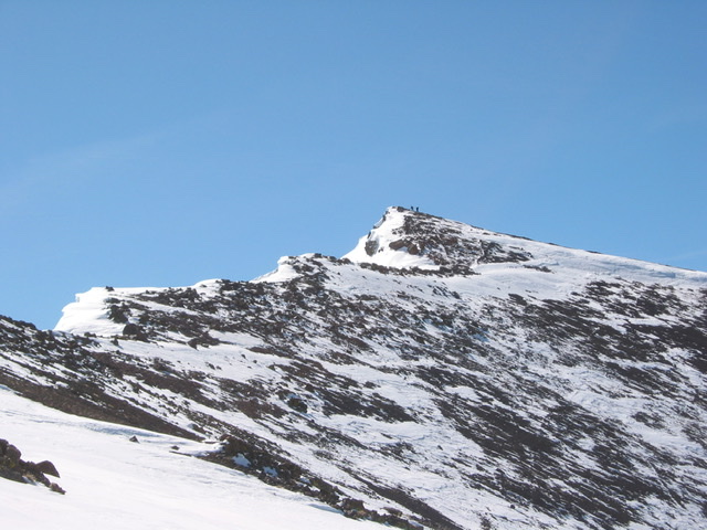
Easley Peak. John Platt Photo
Additional Resources
Regions: Boulder Mountains->EASTERN IDAHO
Mountain Range: Boulder Mountains
Year Climbed: 1988
Longitude: -114.5822 Latitude: 43.8516