Elevation: 8,747 ft
Prominence: 324

This peak is not in the book. Published October 2018
Fitsum Benchmark is located roughly 3.0 miles due east of Lick Creek Summit. There is no easy way to reach this peak. John Platt described the climb as a brutal bushwhack. USGS Enos Lake
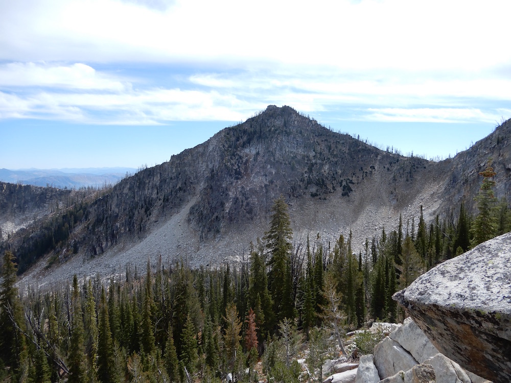
Fitsum Benchmark. John Platt Photo
Access
Yellow Pine Road/FH-48 [(B)(3) on Page 136]. Follow this road over Lick Creek Summit and then descend east. See the map below for the parking spot.
West Ridge, Class 2+
John Platt’s trip report (linked below) and his map below are the best resources for climbing this peak. I will not try to paraphrase his complicated route for fear of causing confusion. Needless to say, if you manage to follow this route, you are a true Lick Creek Subrange connoisseur. Once you reach it, the West Ridge is an easy ascent. John’s route covered 6.6 miles and gained over 4,500 feet round trip.
Fitsum Benchmark. John Platt Photo
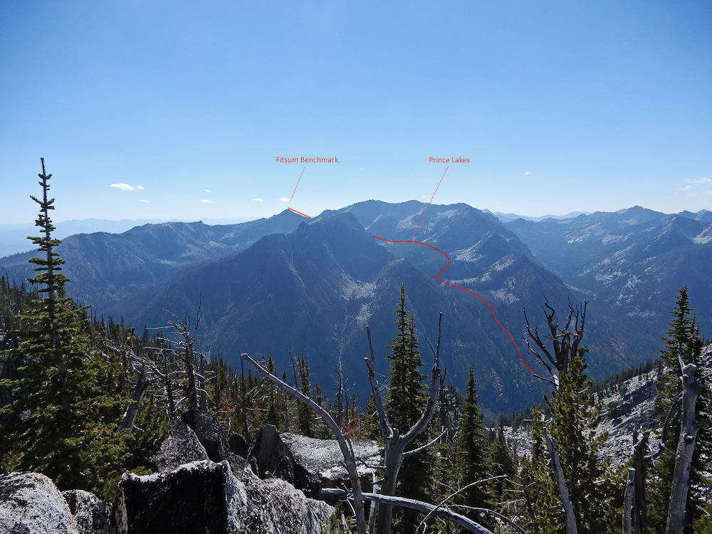
Fitsum Benchmark and the West Ridge Route. John Platt Photo
Additional Resources
Mountain Range: Western Salmon River Mountains
Longitude: -115.84611 Latitude: 45.03089