Elevation: 7,809 ft
Prominence: 229
This peak is not in the book. Published November 2019
Flatiron Mountain is the 4th-highest peak in the South Hills. It gets little notice because it is an unranked summit and is positioned southeast of nearby Trapper Peak (the 2nd-highest peak in the South Hills). The upper reaches of Trapper Creek separate the two peaks. Flatiron Mountain has a unique, V-shaped summit plateau. The south summit is the high point and is an easy scramble from FSR-533 to the west. It bears no resemblance to the beautiful Flatirons of Boulder, Colorado. USGS Trapper Peak
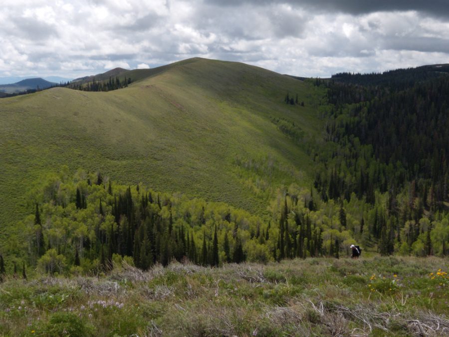
Flatiron Mountain. John Platt Photo
Southwest Face, Class 2
Access
From the [signed] junction of FSR-538 and FSR-533, drive ¼ mile north on FSR-533 (downhill) to a small meadow with an informal campsite. Park here (7,580 feet in elevation). You are now at the base of the southwest face of Flatiron Mountain. You can see the mountain rising above the patch of pine forest at the base of the face and at the far side of the meadow.
The Climb
From the meadow, bushwhack northeast up through a short section of dense forest (pines, aspens, and deadfall) to reach a steep scrub/grass slope. Scramble up the steep, but easy, slope to reach the ridge crest. Scamper briefly northward to reach the high point of Flatiron Mountain. There was no evidence of previous ascent. The summit area is characterized by protruding talus “fins” and short scrub. When you descend back to the road, it is surprisingly difficult to find the meadow, due to a hidden gully amongst the thick forest. Just keep bashing your way west when you reach the forest and you’ll find the road.
What is the true elevation of Flatiron Mountain?
The USGS map shows the elevation of the south summit (the high point) as 7,809 feet. However, there is no 7,800-foot contour on the USGS map (the highest contour line is 7,760 feet), so how can the summit be that high? Oh, but it gets more confusing. The ACTUAL HEIGHT of Flatiron Mountain is about 7,860 feet, far above the USGS contour lines and the USGS point estimate. My altimeter (which I use endlessly during the summer climbing season) pegged the summit at 7,860 feet.
It was a calm, sunny morning and the climb took only 10 minutes or so. I calibrated the altimeter at the meadow, which is clearly shown at 7,580 feet on the USGS map. Consequently, I have 100% confidence that the altimeter was dead-on accurate with its measurement of this summit. Immediately after climbing Flatiron Mountain, I climbed nearby Trapper Peak and the same altimeter came within two feet of the actual height of the summit of Trapper Peak (7,892 feet) so I know that the altimeter was working properly.
For some reason, the USGS quads for the South Hills have several cases where the point measurements are inconsistent with the contour lines on the same map. It is baffling to me. Flatiron Mountain is simply one illustration of this problem and inconsistency. When you climb it, you will unequivocally KNOW that you covered well over 200 feet of uphill (280 feet in actuality). The USGS has simply, and undeniably, MISMEASURED the elevation of the high point on Flatiron Mountain. I am sure of it. And, in the case of Flatiron Mountain, the USGS is WAY OFF (and THAT is unusual, even with the erroneous South Hills quads).
Additional Resources
Regions: South Hills->SOUTHERN IDAHO
Mountain Range: South Hills
Longitude: -114.19749 Latitude: 42.14129