Elevation: 4,700 ft
Prominence: 360
This peak is not in the book. Published May 2021
Friday Butte is located north-northwest of Ola, Idaho and southwest of Tripod Peak. Although a low elevation peak, this summit harbors extensive views of this little-known but beautiful area. This peak has two nearly identical summits separated by a shallow saddle. The westernmost summit is the high point. There are two summit cairns on the true summit ridge. The larger of the two is not on the high point. There is a register under the smaller cairn on the high point. USGS Dodson Pass
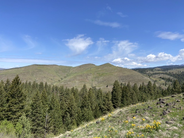
Friday Butte as viewed from the south and the slopes of Peak 4504.
Access
Friday Butte is accessed from FS-601. Google Maps provides accurate driving directions. Search for Friday Butte, Idaho. Follow FS-601 east past the Forest Service boundary to the first good-sized pullout and park. As an alternative, you could continue to the Kyaott Trailhead shown on the map where there is a camping spot and start the climb from there.
Southeast Slopes, Class 2
From the parking spot, climb steeply north-northwest through the pine forest to the open slopes above. Continue climbing toward Point 4634, the peak’s eastern summit. At roughly 4,500 feet, contour north-northwest around Point 4634 to reach the low saddle between the two summits. Ascend to the summit from the saddle. The only obstacles on the route are patches of low brush which can be easily avoided.
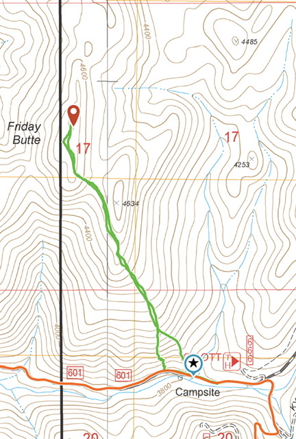
My GPS track. The round trip was 2.4 miles with 840 of elevation gain. The black line is the National Forest boundary. There is no campsite on the south side of the road despite what the map shows.
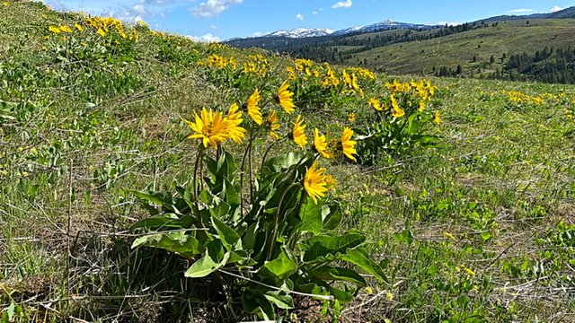
This hike is a great place to experience Spring flowers in early May.
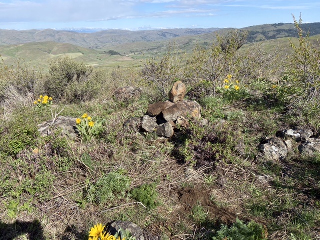
The summit cairn
Additional Resources
Regions: West Mountains->WESTERN IDAHO
Mountain Range: West Mountains
Year Climbed: 2021
Longitude: -116.25239 Latitude: 44.28929