Elevation: 9,300 ft
Prominence: 920
This peak is not in the book. Published November 2023
Grizzly Hill sits on the Continental Divide in the Beaverhead Mountains north of Leadore. It is most easily reached from Bannock Pass via FSR-012. A forest bushwhack is required to reach the summit. USGS Bannock Pass
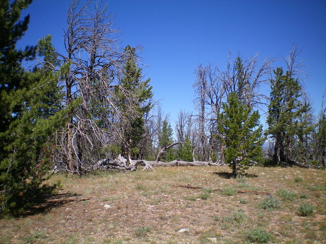
The official/northeast summit of Grizzly Hill. Livingston Douglas Photo
Access
From the signed junction of ID-28 and ID-29 in Leadore, drive northeast on ID-29 for 13.5 miles to reach the crest of the highway at Bannock Pass (7,681 feet). Leave ID-29 and drive southwest on [signed] FSR-012. At 5.0 miles, reach an unsigned junction with FSR-3906. Go straight here to stay on FSR-012. At 5.1 miles, reach a signed junction with FSR-192. Go right onto FSR-192 and drive 0.1 miles to its end at an antenna installation. Park in a large parking/camping area here (9,005 feet; 44⁰47’13”N, 113⁰20’43”W).
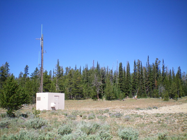
The antenna-clad starting point for the Grizzly Hill bushwhack. Hike up the faint 2-track (right of center) to intersect the CDT. Livingston Douglas Photo
Map Errors
The USGS topo map incorrectly places the CDT on the Continental Divide but it is well below the Continental Divide on its east side and skirts well below Grizzly Hill. This is a major error because the map makes it look like you can hike up the CDT to the summit of Grizzly Hill, but that is most certainly NOT the case. The CDT is of very little help in reaching the summit of Grizzly Hill.
Southeast Face/South Ridge, Class 2
The Climb
From the parking area, find a weak 2-track heading right-ish/northeast from the antenna facility. Follow this old road and quickly intercept the [signed] CDT at a fence row. Hike up the CDT as it heads northwest and follows the right-hand side of a split-rail fence. The CDT follows this fence row for a short distance then bends right/north to leave the fence row behind. Leave the CDT a short distance after this bend in the trail. Bushwhack west then northwest up through a thick pine forest to reach the ill-defined, rounded, forested south ridge of Grizzly Hill.
Head north up the rounded ridge to reach the open southwest summit. I found a dead cow skull and the remains of a small cairn here. Not sure if this was the high point, I headed northeast to look for a higher hump. I soon found the official/northeast summit, which is pretty close. The northeast summit measured slightly higher on my GPS but slightly lower on my altimeter. Stand on both summit humps just to be sure. I suspect that the southwest summit is slightly higher than the northeast summit. The northeast summit is a bit more open and offers a better view of the surrounding area. There was no summit cairn on the northeast summit.
East Face, Class 2
The Descent
From the northeast summit, descend east through a somewhat-thick pine forest with some large deadfall to work around. Keep bushwhacking until you intercept the CDT then follow it south back to the split-rail fence row. Continue left/southeast on the CDT back to the fence crossing and old 2-track road. Follow the old 2-track a short distance southwest back to the antenna facility and your parked vehicle. The CDT is well-beaten, signed, and easy to follow in the thick lodgepole pine forest. I sure wish that it went over the top of Grizzly Hill but, regrettably, it does not.
Additional Resources
Regions: Beaverhead Range->EASTERN IDAHO
Mountain Range: Beaverhead Range
Longitude: -113.3536 Latitude: 44.7961