Elevation: 7,400 ft
Prominence: 522
This peak is not in the book. I added the much easier and shorter east ridge route which Livingston refers to in his entry. I have set out this route below. Updated May 2020
Heglar Benchmark is on a high ridgeline that separates North Heglar Canyon from South Heglar Canyon. Its neighbor to the north, Cedar Creek Peak, is slightly higher at 7,464 feet. Its neighbor to the south, Sublett Benchmark, is a bit lower at 6,821 feet. This is a magnificent ridge and makes for a grand traverse of the Sublett Mountains. The easiest ascent route for Heglar Benchmark is from the east side via FSR-566. USGS North Heglar Canyon
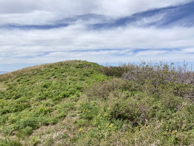
The summit
West Spur/South Ridge, Class 2
Access
From Exit 245 (Malta/Sublett) on I-84, drive east on Sublett Road (signed). Set your odometer to 0.0 on the bridge crossing over I-84. At 10.1 miles, enter the Sawtooth National Forest after passing the west side of the Sublett Reservoir. At 10.2 miles, reach a road junction (and the site of the old Sublett Campground). STRAIGHT is FSR-564/Lake Fork Road. RIGHT is FSR-578/Sublett Creek Road. Reset your odometer here and go STRAIGHT on FSR-564/Lake Fork Road. At 0.3 miles, go STRAIGHT. At 4.0 miles, park in a pullout on the left side of the road. The elevation here is 5,770 feet.
The Climb
Lake Fork Road has a confusing series of gullies and shoulders on its right/east side from the 3.5-mile point to the 4.3-mile point. All of these shoulders/spurs lead up to the summit ridge of Heglar Benchmark. The west spur/south ridge route starts at the 4.0 mile-point on Lake Fork Road and climbs the west spur (which has Point 6205 on it) to join the south ridge of Heglar Benchmark at Point 7220.
From the parking pullout at the 4.0-mile point, cross to the east side of Lake Fork Road and bushwhack southeast up a minor shoulder to reach the west spur. The terrain here is open desert scrub. You will find game trails here to help you navigate upward through the scrub. Once on the west spur, it is an easy scramble up the spur on short scrub and a stable scree base.
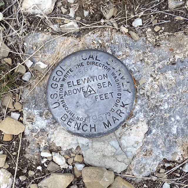
Higher up, the west spur bends left/northeast to join the south ridge just below Point 7220. After two minor ups and downs, you reach the summit of Heglar Benchmark. The summit has two USGS benchmarks in ground boulders and a few small rocks that used to be a cairn. I found lots of larger talus nearby and built a nice cairn on the summit high point (one of the USGS benchmarks is here).
North Ridge/Southwest Spur, Class 2
Access
Same as for the west spur/south ridge
The Descent
This route is part of a loop route with an ascent of the west spur/south ridge and a descent of the north ridge/southwest spur back down to Lake Fork Road. From the summit, descend the north ridge to Point 7381 on easy open terrain that is a mix of short scrub and broken scree. Continue to follow the north ridge for a short distance past Point 7381 to reach the top of the southwest spur. This is a beautiful sub-ridge that descends to the south side of the Moonshine Spring drainage and continues down to Lake Fork Road. The southwest spur meanders a bit. Initially, it descends southwest. It then takes a job west-southwest only to move back to a southwest trajectory afterward. Nothing serious but it does wiggle a little and is not a straight-line descent.
The descent begins on steep-ish scree and short scrub. The scree is loose here, so be careful. You will encounter a short, steep section of ridge with some rock bands embedded in the southwest spur. You can either skirt or downclimb the rock bands. Skirting them keeps the route at a Class 2 difficulty. After passing the rock bands, the terrain becomes rather “unfriendly,” as they say. Unfriendly, as in thick desert scrub. While there are some occasional cattle trails here, you must bash and thrash your way through this awful stuff, scraping your bare legs in the process.
You finally reach an easier ridge section as you approach Lake Fork Road. The ridge narrows here with gullies on each side. Near the road, you reach an old 2-track jeep road that heads up into the Moonshine Spring drainage. Follow this old road south briefly to its unsigned junction with Lake Fork Road at the mouth of a gully that is one drainage south of the Moonshine Spring drainage. Once back on Lake Fork Road, walk 0.3 miles southeast on the road to the pullout where your vehicle awaits you.
East Ridge, Class 2
Access
Via North Heglar Canyon/South Summit Canyon Road/FSR-565. This road is the primary north/south route through the Sublett Range. This road is accessed from I-84. For the northern approach leave the freeway at Exit 228. Head east on East Yale Road for 8.7 miles. Turn right on East Heglar Canyon Road and follow it 17.8 miles to the pass at the top North Heglar Canyon and South Summit Canyon. This road becomes FSR-565 when it reaches the National Forest boundary. The southern approach leaves I-84 at Exit 245. From the freeway follow the road east/southeast into the mountains for 11.0 miles to Sublett Reservoir. This road becomes FSR-565 when it reaches the National Forest boundary. Follow the road past the reservoir for 8.8 miles to the pass at the top of North Heglar Canyon and South Summit Canyon. At the top of the pass, turn west onto FSR-566 and follow it for 1.5 miles and a small saddle. Park on the saddle.
The Climb
Climb west up the steep west ridge which is covered in low brush. Turn north when you hit the summit ridge and continue a short distance to the top. This hike covers just over 0.3 miles with 354 feet of elevation gain round trip.
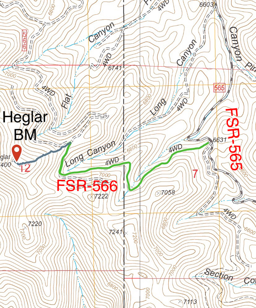
The green line marks the driving route from the pass. The blue line marks the hiking route.
Additional Resources
Regions: SOUTHERN IDAHO->Sublett Range
Mountain Range: Sublett Range
Year Climbed: 2021
First Ascent Information:
- Other First Ascent: West Spur/South Ridge
- Year: 2018
- Season: Summer
- Party: Livingston Douglas
- Other First Ascent: North Ridge/Southwest Spur -Descent
- Year: 2018
- Season: Summer
- Party: Livingston Douglas
Longitude: -113.01179 Latitude: 42.39339