Elevation: 7,300 ft
Prominence: 640

This peak is not in the book. Published January 2023
Helene Peak is a rather insignificant hump near the mouth of Hartley Canyon. It is most easily climbed via its south shoulder from Hartley Canyon Road. USGS Hartley Peak
Helene Peak (in mid-ground) as viewed from the south. Livingston Douglas Photo
Access
Hartley Canyon Road/FSR-578 is located along ID-37 about 22 miles south of the I-86 junction and 22.6 miles north of the west end of Holbrook. It is also 2.0 miles south of Big Canyon Road. Turn right/west onto [signed] Hartley Canyon Road and reset your odometer. At 3.4 miles, go straight (not left) at an unsigned junction. At 4.3 miles, the road changes from smooth gravel to rutted dirt. At 4.8 miles, go straight (not left) at a junction. At 5.0 miles, go through a wire cattle gate. At about 6.0 miles, reach the Sawtooth National Forest boundary. At 7.8 miles, reach an unsigned junction at a fork in the canyon. Harley Canyon Road turns sharply left/south at this junction. Park at this junction (6,255 feet). GPS coordinates: 42⁰25’02”N, 112⁰57’25”W.
South Shoulder, Class 2
The Climb
From the road junction, walk about 50 yards east to the toe of the [obvious] shoulder. There is an aspen-filled gully to its left/west. Bushwhack through a short patch of forest to reach the steep shoulder. The terrain on the shoulder is initially a mix of sagebrush, other scrub, underlying loose scree, and scattered trees (mostly junipers). Follow a game trail (as available) on or near the ridge crest to gain better footing. Upon reaching a ridge juncture high up, go right/east on the flattish summit ridge to reach the high point of Helene Peak near the east end of the ridge. Do not continue straight north to Point 7285. The summit had a small cairn so I built it up considerably. The open summit offers nice views of both Hartley Peak to the south and Peak 7420 to the southwest. The scrub on the south shoulder isn’t too bad but the steep, loose scree is.
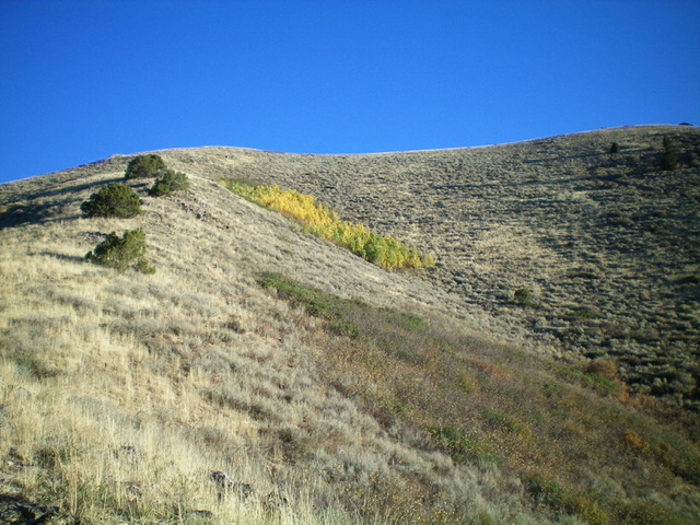
Looking up the south shoulder (left of center) of Helene Peak. The summit ridge is the skyline and the summit high point is just out of view to the right. This was my ascent route. Livingston Douglas Photo
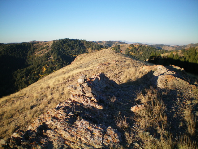
The summit of Helene Peak, looking west. Livingston Douglas Photo
Additional Resources
Regions: SOUTHERN IDAHO->Sublett Range
Mountain Range: Sublett Range
Longitude: -112.9514 Latitude: 42.4228