Elevation: 7,281 ft
Prominence: 491
This peak is not in the book. Published December 2020
High Point is a forested hump that is located southwest of Island Park and due south of Bishop Mountain. The easiest ascent route is probably via the east ridge and FSR-303. There are good views from the open area on the east ridge but none from the thickly-forested summit area. USGS Bishop Mountain
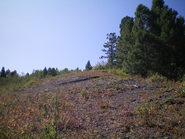
Looking up the steep, open area on the south side of the crest of the east ridge. The camera does not do justice to the STEEPNESS here. Livingston Douglas Photo
Access
From its signed junction with US-20, drive west up Little Butte Road/FSR-317 for about 3.5 rough miles to reach a [signed] “T” junction with FSR-553. Little Butte Road is a badly-rutted dirt road that sees little use (or maintenance) these days. Turn right/north onto FSR-553 for about 0.4 miles to a [signed] junction with FSR-303. Turn left/south and drive south on FSR-303 for 0.4 miles to a small pullout on the right/west side of the road. Park here (6,625 feet).
The better road access for FSR-303 is from the north, but I don’t have specific mileage figures. From south of Island Park on US-20, turn west onto [signed] Antelope Flat Road/FSR-168. Drive about 3.5 miles west on FSR-168 to a junction with FSR-771. Drive south on FSR-771 for just over a mile to a signed junction with FSR-303.
East Ridge, Class 2
The Climb
From the parking pullout, bushwhack southwest up through the dense pine forest (with thick veg to boot) to reach the open terrain of the south side of the east ridge. This [blessed] open terrain area is NOT shown on the USGS topo map but it is well worth finding. Scramble west up the ridge crest (or just left/south of it) in steep, open terrain of scree/gravel, grass, and short scrub to reach the east summit of High Point.
Follow a cattle/use trail in the forest from the [lower] east summit to reach the true/west summit. This entire area, including the summit, is thick with brush. There is no summit cairn or visible benchmark (as the USGS topo map indicates) and not much of a view from the top. The spur road to the top shown on the USGS topo map no longer exists. I found no remnants of any road up near the summit.
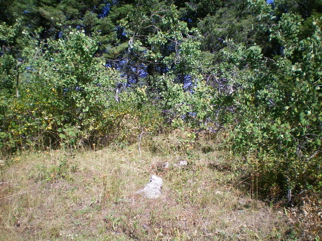
The summit area atop High Point. Livingston Douglas Photo
Additional Resources
Regions: Centennial Range->EASTERN IDAHO
Mountain Range: Centennial Range
Longitude: -111.55509 Latitude: 44.26809