Elevation: 8,842 ft
Prominence: 342
This peak is not in the book. Published December 2020
Horse Mountain is a ranked ridge hump on the LONG south ridge of Peak 9900/The Knuckle. It is a gentle giant when viewed from the south as it towers over Edie Creek to the east and The Bull Pen to the west. The easiest ascent route is the southeast side from Edie Creek Road. USGS Edie Creek
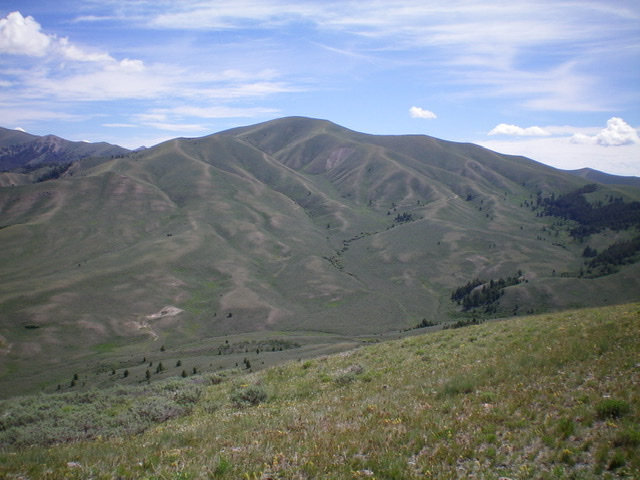
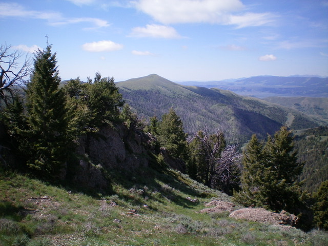
Horse Mountain as viewed from the south. Livingston Douglas Photo
Access
From I-15 at Dubois, ID, drive west on ID-22 for 5.9 miles to [signed] Medicine Lodge Road. Turn right/north onto Medicine Lodge Road and reset your odometer. At 21.0 miles, the pavement ends. At 25.7 miles, reach a [signed] road junction with Irving Creek Road. Turn right/northeast and reset your odometer. At 2.7 miles, reach an unsigned road junction with a cattle gate for each road. Go straight/north to continue up Irving Creek Road. Go right/east for Bull Pen Road. Turn right here to reach the Bull Pen. Go through the cattle gate and continue eastward to reach BLM land.
The road now gets much rougher. It is now a badly-rutted, 2-track dirt road and is getting overgrown with grass. But it is drivable if you have decent ground clearance, 4WD, and good tires. At 5.1 miles, reach the base of the northwest ridge of Horse Mountain. Since there is no parking pullout here, continue up the road. At 5.4 miles, reach a primitive side road to a dispersed campsite. Leave the road here and park at this dispersed campsite (7,450 feet).
Northwest Ridge, Class 2
The Climb
From the campsite, you have two options to reach the crest of the northwest ridge. The first option is to hike briefly down Bull Pen Road then leave the road to bushwhack south up through an open scrub slope (with scattered pines) to reach the west spur of the northwest ridge. Follow an old cattle trail up the west spur to reach the northwest ridge proper. This was my ascent route.The second option is a bit longer but is easier and involves hiking east through open forest to cross to the east side of a dry gully then bushwhacking east up onto the north spur of the northwest ridge. There is a game/use trail on the north spur that will expedite your ascent to the northwest ridge proper. This was my descent route.
Once you reach the northwest ridge, follow an old cattle trail on the ridge crest to make your way up through the endless sagebrush a bit easier. At times, the terrain is short scrub/grass and scattered pines. Higher up, the pines end and it is open scrub and short sagebrush up to the summit ridge. Go right/south on the summit ridge and hike up a final section of open ridge on short scrub and broken scree to reach the gentle summit hump. There was nothing on top, so I built a small summit cairn using the rounded rocks found on this peak. There was much more sagebrush on this climb than I expected. I thought it would be a cruise up short scrub the whole way but I was wrong.
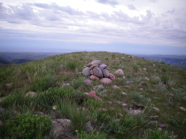
The newly-built summit cairn atop Horse Mountain. Livingston Douglas Photo
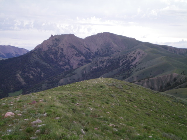
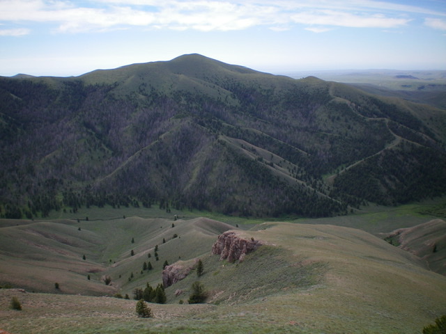
The gentle summit of Horse Mountain with The Thumb (rocky protrusion at far left) and The Knuckle (the hump in dead center) in the background. Livingston Douglas Photo
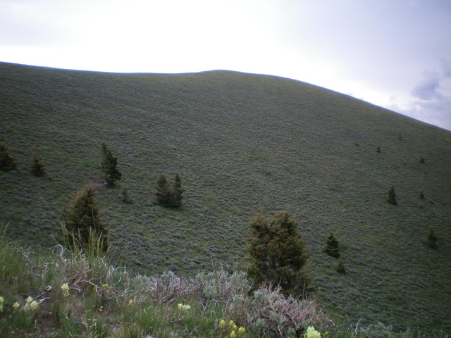
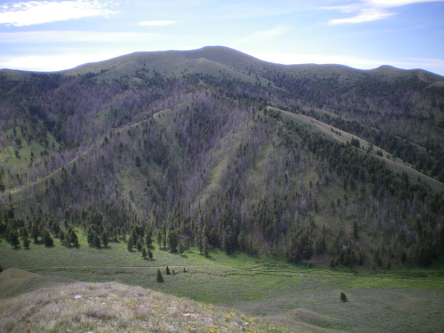
Looking up at Horse Mountain from high on the northwest ridge. Endless sagebrush. Livingston Douglas Photo
Horse Mountain (dead center) as viewed from the north. Livingston Douglas Photo
Horse Mountain as viewed from the north on the opposite side of the Bull Pen. Livingston Douglas Photo
The northwest ridge (ascent route) of Horse Mountain is in dead center of this photo. You can clearly see the north spur (left) and west spur (right) leading up to the ridge. The summit of Horse Mountain is the highest hump in the center of the photo. Livingston Douglas Photo
Additional Resources
Regions: Beaverhead Range->EASTERN IDAHO
Mountain Range: Beaverhead Range
Longitude: -112.55879 Latitude: 44.44391