Elevation: 7,700 ft
Prominence: 1,720
This peak is not in the book. Livingston Douglas added a new route for those wishing to climb the peak before the road melts out. Updated October 2025
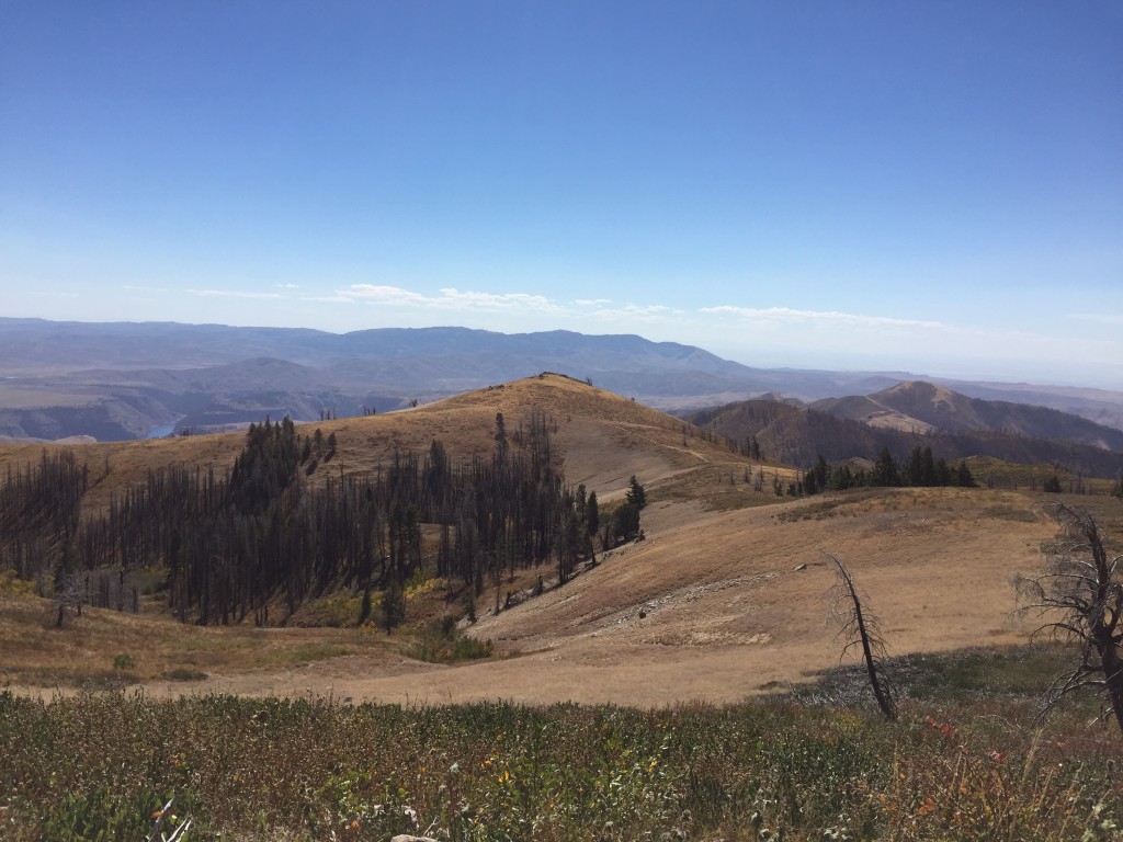
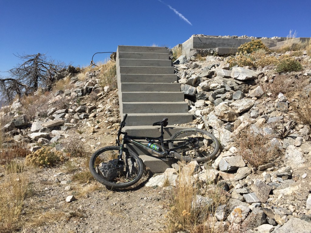
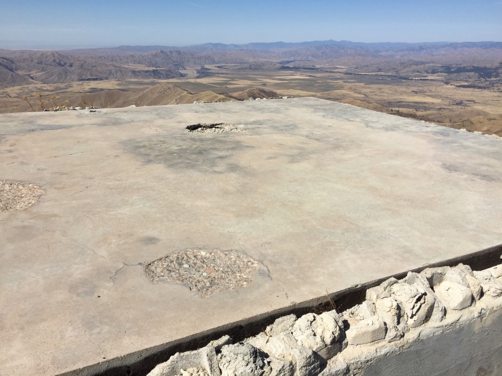
House Mountain is located in an isolated position southeast of Prairie, Idaho. While not an exceedingly high summit, it towers over the South Fork Boise River’s deep canyon which is on its southern flank. The peak had a fire lookout on its summit from 1931 to 1990. The last lookout building’s foundation is still present. The view from the summit is impressive. I have not found any historical information on the lookout but there are substantial concrete foundations for the lookout, an outhouse, and another building on the summit. USGS House Mountain
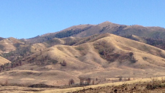
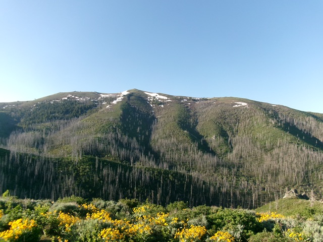
House Mountain as viewed from just south of Prairie
Access and Route, Class 1
Google Maps will give accurate directions to the summit. Basically, FS-128 runs east-to-west between Fall Creek and the Prairie, Idaho area. FS-137, the House Mountain Road leaves FS-128 at the high point between the two drainages at a signed intersection. FS-137 crosses three low ridges as it winds it’s way south from the pass. The road then climbs up the peak’s north side. Once it reaches the peak’s West Ridge, it turns back and climbs up the south slopes to the summit. In 2015, the road was smooth and well-graded until the last mile, where it was rocky. There are a number of side roads that leave FS-137 but none are as well used as FS-137. From the FS-128/FS-137 junction, it is 5.3 miles to the summit. The road has plenty of ups and downs for the first two miles as it crosses the low ridges and gains most of its elevation in the final three miles.
Another view of House Mountain
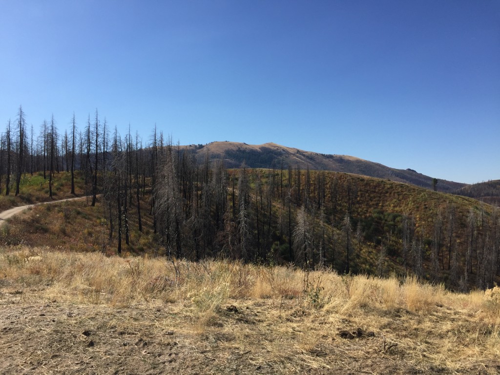
House Mountain in the distance as viewed from the approach
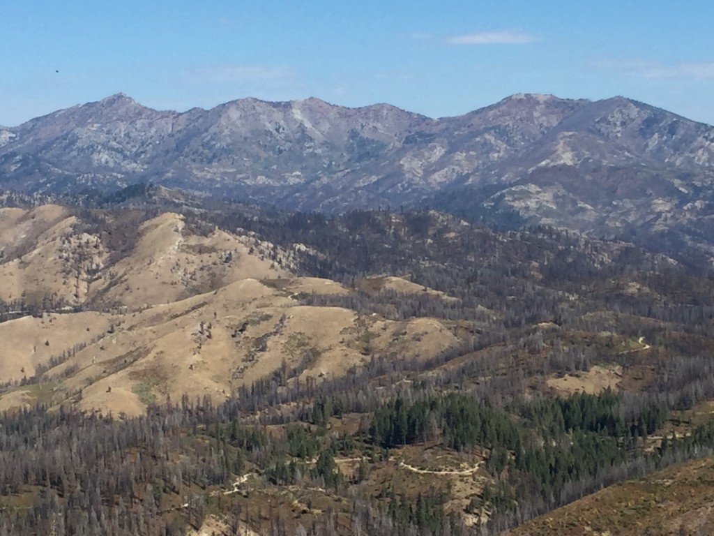
The Trinity Mountains to the north
Looking south from the summit toward Mount Bennett
The summit of House Mountain
The lookout foundation
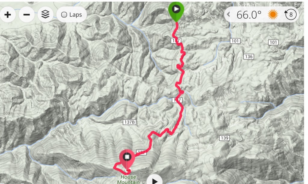
My GPS track. Note: I started 0.7 miles up the road from FS-128.
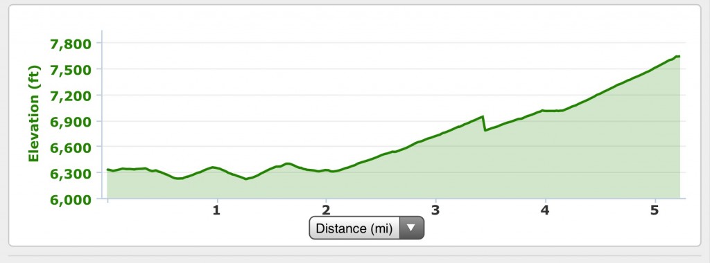
My elevation profile for the ascent.
Early Season North Ridge Route by Livingston Douglas
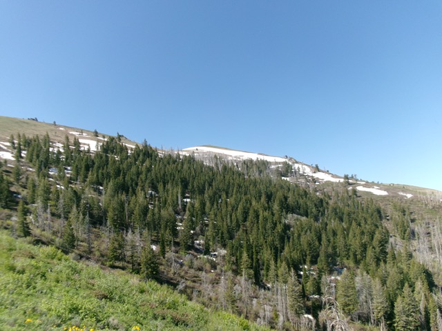
House Mountain as viewed from Peak 6336 to its north. Livingston Douglas Photo
Access
From downtown Prairie at a signed junction of Prairie Road and Smith Creek Road, drive east on Prairie Road. At 0.8 miles, reach a signed 4-way junction. Turn south onto an unsigned, smooth county road (soon to be signed as Meadow Creek Road) and drive 1.3 miles to a signed road junction. Reset your odometer here. Head east on Meadow Creek Road/FSR-128. At 5.5 miles, reach a signed junction with rugged FSR-137/House Mountain Road (right). Please note that House Mountain Road is signed as “South House Mountain Road.”
Turn right onto House Mountain Road/FSR-137 and reset your odometer. At 0.3 miles, reach a signed junction with FSR-101 (left). At 1.9 miles, reach a signed junction with FSR-136 (left). At 2.4 miles, reach an unsigned junction with a jeep trail (right). At 4.0 miles, park in a small pullout along the road near Point 6867 [6,814 feet; 43°26’28.2”N, 115°28’47.2”W].
Map Errors
The USGS topo map mis-labels Meadow Creek Road as House Mountain Road. The USGS topo map fails to show FSR-139. The USGS topo map shows a road heading west from House Mountain Road high up but that side road no longer exists.
North Ridge, Class 2
The Climb
From the roadside pullout, hike up House Mountain Road to reach the crossing of the north ridge. Leave the road and bushwhack left/south up a patch of steep pine forest to skirt the right/east side of a critical, rocky ridge outcrop. Scramble right-ish/southwest up large boulders to reach the ridge crest just above the rocky ridge outcrop. Once above the rocky outcrop, scramble south up open, easy tundra to reach the summit. There is no fire tower anymore, just a concrete foundation and concrete steps.
House Mountain (summit is just left of center) and the north ridge (skyline in center and right of center). This was my ascent route. This view is from the starting point on House Mountain Road. Livingston Douglas Photo
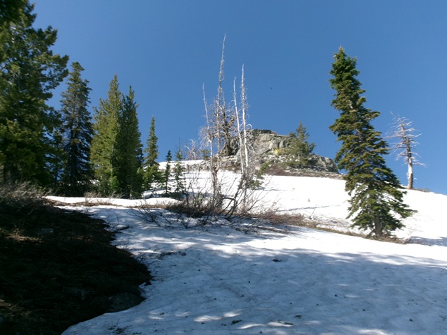
Looking up the north ridge from just above the road. Climb past the rocky outcrop on its left/east side. Livingston Douglas Photo
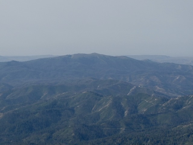
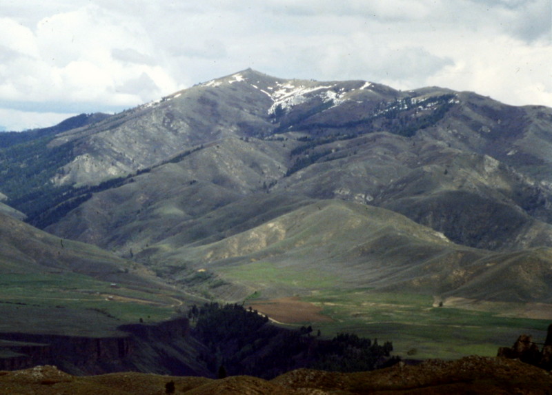
House Mountain viewed from Trinity Mountain
Dan Robbins climbed House Mountain from Prairie Road during a May outing when there was plenty of snow. Check out his trip report.
Additional Resources