Elevation: 2,852 ft
Prominence: 365
This butte is not in the book. Jackass Butte lies on public land managed by the Bureau of Land Management (BLM) and the Bureau of Reclamation (BOR). A tiny portion of the butte sits on private land on its west side. The challenge of climbing this peak is getting to it via county roads and public lands. I was chased away by a landowner on a day when I did not have a land status map stored on my phone. Make sure you have a map showing public and private land before following the directions set out below. I have included both Livingston Douglas’ and Margo Mandella’s versions of how to climb this peak to better insure you will be able to navigate the access route and reach the summit. Updated November 2022
Jackass Butte by Livingston Douglas
Jackass Butte is located in the Snake River Birds of Prey Natural Area at a sharp bend in the Snake River. This area is a mix of private and public land, so be careful. The private land that must be crossed to access this peak is not gated or posted in any way. Indeed, it seems that the public uses the jeep roads and ATV trails in this area rather frequently. Idaho Power owns a pumping station along the Snake River that is the beginning point for this hike. Most of Jackass Butte itself is on public land. USGS Jackass Butte
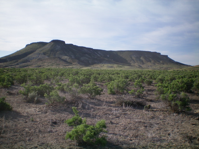
Jackass Butte as viewed from the northwest. Livingston Douglas Photo
Access
At about 10 miles northwest of Grandview on ID-78, turn north onto signed, paved Lemley Road. Reset your odometer. At 1.1 miles, turn right/north onto [signed] Robinson Road. At 3.5 miles, turn diagonally right/east onto an unsigned 2-track dirt road. You are now on private land. At 4.5 miles, reach the Idaho Power pumping station along the Snake River. Park here (2,335 feet) as the roads beyond the pumping station are badly rutted initially and are only suitable for ATVs.
Northwest Shoulder/West Face, Class 2-3
The Climb
From the pumping station, follow an ATV trail east as it follows the south side of the Snake River. The trail bends right/southeast and then right/south to enter a wide canyon that separates Jackass Butte from a lower butte to its west. Leave the ATV trail before it enters the canyon and scramble southeast up a shoulder to reach the cliff band that guards the summit plateau of Jackass Butte. From the ATV trail, the cliff band looks pretty ominous but it’s actually not.
Aim to reach the base of the cliff band near the northwest end of the butte. The northwest shoulder is initially a sagebrush bushwhack, then a mix of sand/scree and, finally, is a talus scramble. Once at the base of the cliff band, traverse right/south along its base to quickly find a Class 3 notch to climb to reach the summit plateau. The cliff band is only 10-15 feet high, much less than it appears to be from the valley below. If you traverse a bit farther south, you can find Class 2 notches/faces to climb to the summit plateau. The traverse at the base of the cliff band requires steep, loose side-hilling on shale scree, so the quicker you can leave it and climb up onto the summit plateau, the better.
The summit of Jackass Peak with the Snake River Canyon in the background. Livingston Douglas Photo
Once atop the tilted summit plateau, bushwhack southeast through mostly field grass with some sagebrush to reach the cairned summit. The summit plateau is over ½ mile from entry point to summit and it takes a bit of time to cover it. There is another potential high point about 70 yards to the south of the cairned summit. The south summit has a post on it and it looks awfully similar in height to the official/north summit. I checked out the south summit and, according to my altimeter, it is slightly lower in elevation than the north summit. Visually, when looking back at the north summit from the south summit, the official/north summit appears to be slightly higher.
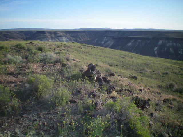
View of the Snake River from the base of the summit cliff band. Livingston Douglas Photo
Jackass Butte by Margo Mandella
Jackass Butte is a ranked peak that sits on the south side of the Snake River within the Snake River Birds of Prey Area in Owhyee County. Even though its 2,852-feet of elevation is taller than many points around it, the butte tends to blend into its surrounding landscape and can be easily overlooked. From a distance, you are more likely to see Jackass Butte’s more distinctive northwest neighbor Castle Butte. A striking feature of Jackass Butte is a cliff wall that surrounds the majority of the butte at its rim and makes the butte look difficult to impossible to climb in places.
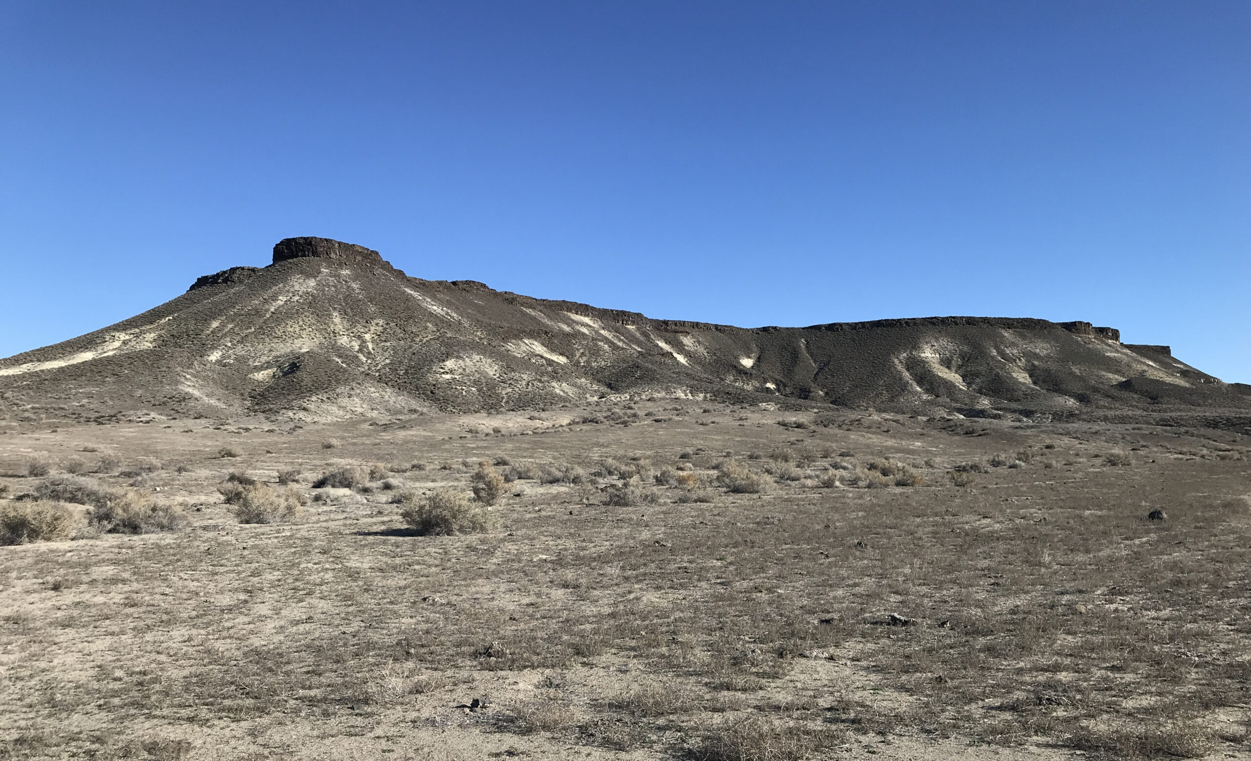
The northwest side of Jackass Butte. Steve Mandella Photo
Access
From Highway 78, turn north onto Lemley Road and then turn right at Robinson Road. Continue on Robinson and turn right at approximately 43.08711N, -116.25539W. Now you are on a perimeter track on BLM-managed public land that crosses onto BOR-managed public land. Continue to an intersection, turn left, and head toward the river. However, pay close attention to this intersection. You will want to turn correctly on your way back to retrace your route and avoid traveling on private property.
Continue and descend on a steep, rugged 4WD track segment (which is next to the aqueduct) and then head toward the pumphouse alongside the Snake River. Stay right where the track splits, and turn right on the rugged jeep track. Crawl toward the butte to where you want to start this climb. The best accesses are on the northwest to east sides, but it gets more difficult to travel the farther east that you drive. Steve and I recommend a high-clearance 4WD starting where you descend next to the aqueduct.
East Rib, Class 2
We started at the base of the east rib where we saw a large opening in the cliff wall. The lower portion of the rib is easy to travel on sandy soil with good footing. The short, easy rib leads to the massive summit plateau just a little off of the true summit. After enjoying the views, we descended the same way as our ascent for a mere 1-mile round trip that took less than 50 minutes, including summit dawdling. We climbed Jackass Butte in late March, and it was 71 degrees at the base when we started our climb at 5:30 p.m. If we had more time, we would have hiked along the plateau’s perimeter to see all sides of the butte from above.
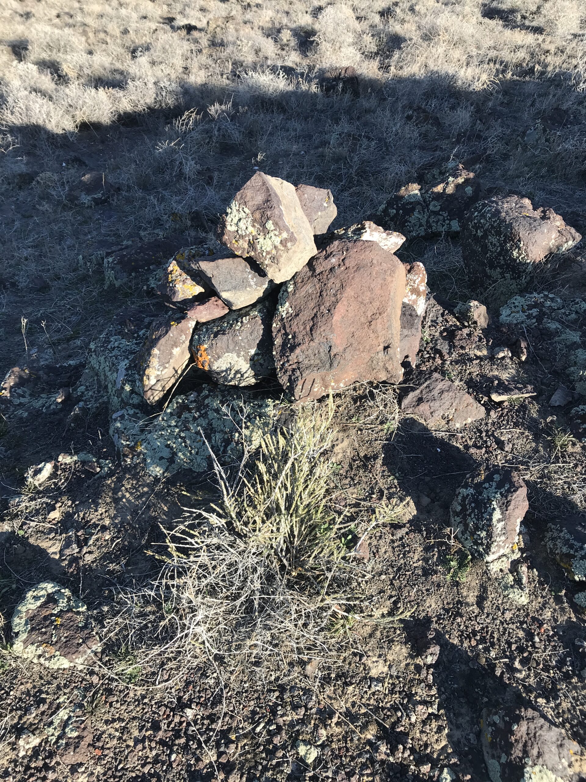
The summit/highpoint marker for Jackass Butte. We added a few more rocks.
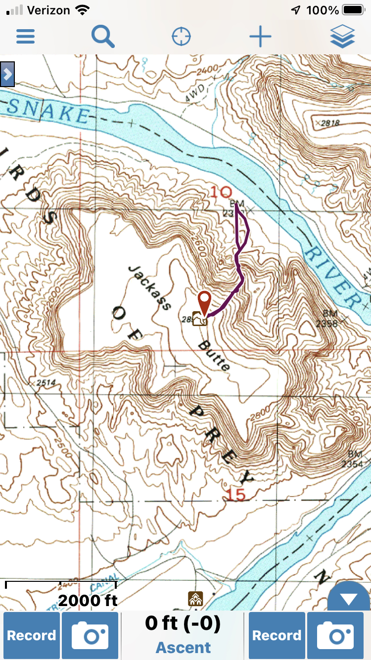
East rib approach GPS track
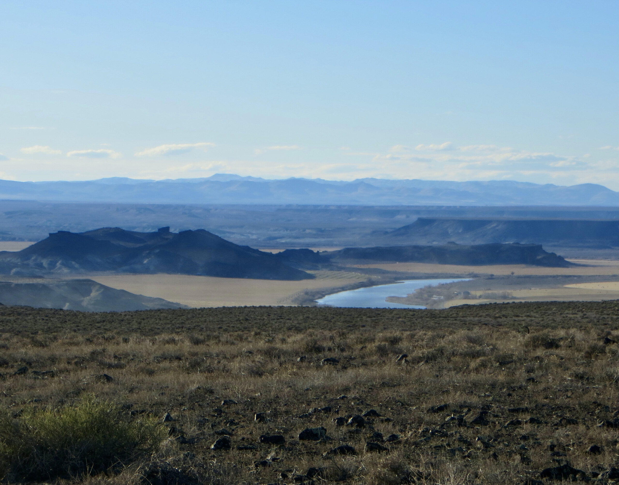
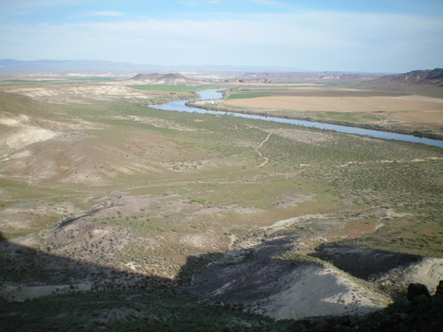
View of the Snake River to the west from the large summit plateau of Jackass Butte. Castle Butte is the black butte left of center. Steve Mandella Photo
Additional Resources