Elevation: 6,664 ft
Prominence: 54
This point of interest to County Highpointers is not in the book.
The Jefferson County HP is located on a side ridge that is west of the main summit ridge of Kelly Mountain. It is most easily reached from a 2-track service road (not shown on maps) that weaves its way up the north side of Kelly Mountain through a few of the ski runs of the Kelly Mountain Ski Resort. The bushwhack from the main summit ridge to the side ridge is a rather unpleasant, thick affair. USGS Heise
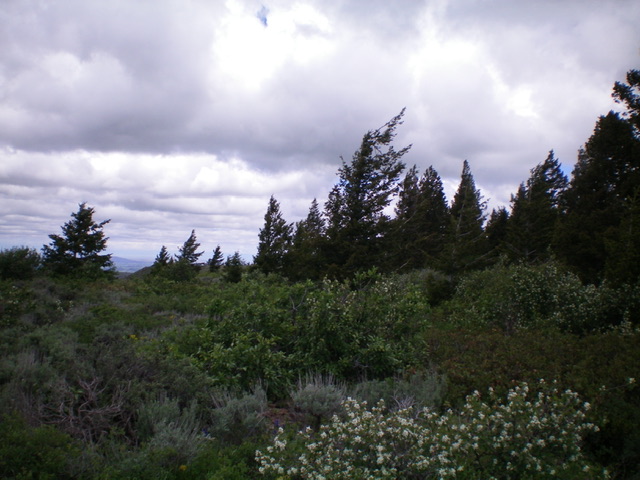
Jefferson County HP (forested ridge in distance) as viewed from the east on the north ridge of Kelly Mountain. Livingston Douglas Photo
Access
From US-26 northeast of Idaho Falls, turn left/north at the sign for the Kelly Mountain Ski Area. Drive 8.8 miles to reach the [signed] “Y” junction of FSR-218 and FSR-217. Park in a large parking lot alongside the road (6,230 feet). This parking lot has a bathroom and a trailhead for FSR-881 (gated and closed) and a service road that is not shown on any maps.
Map Errors
The USGS topo maps fails to show any of roads up Kelly Mountain. The Caribou-Targhee NF Map fails to show the service road that weaves its way up the north face of Kelly Mountain. The DeLorme Trail Map (Wolverine Creek Area Trails) shows FSR-881 but fails to show the service road that heads up the north face of Kelly Mountain. There are additional ATV trails that are high up on Kelly Mountain that are not shown on any maps. These map omissions are critical because the service road is the key to easily accessing both Kelly Mountain and the Jefferson County HP. With a correct, updated trail map, you can probably avoid most of the bushwhacking that I suffered through.
Northeast Face, Class 2
The Climb
From the parking area, walk around the closed road gate and hike about 100 feet up FSR-881 to an unsigned road junction. Leave FSR-881 and go right onto the unsigned, 2-track service road. You must cross another closed gate to hike up this road. Follow the service road into a large meadow at the base of a primary ski run. From here, either continue on the service road as it switchbacks its way up the north face of Kelly Mountain or scramble directly up the steep ski run (easy, open grass) to intercept the service road higher up.
The service road eventually reaches the top of a chairlift and continues up onto the summit ridge as an ATV trail. Follow the ridgeline ATV trail southeast briefly (or continue on it all the way to the summit of Kelly Mountain if you wish to climb that peak). Choose a spot to leave the trail and descend west through thick sagebrush and other veg to cross a dry gully and reach the ridgeline that has the Jefferson County HP atop it.
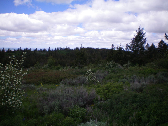
The thick brush and aspens make this bushwhack a very unpleasant affair. Worse yet, the high point is difficult to identify because of the thick brush on the summit ridge there. There is an ATV trail on the summit ridge but it doesn’t quite cross the high point. The Jefferson County HP seems to be on a brushy area that has some large ground boulders. There is no summit cairn. I ran my GPS to be sure that I was on the right spot.
The brushy summit of Jefferson County HP. Livingston Douglas Photo
Additional Resources
Mountain Range: Big Hole and Snake River Mountains
Longitude: -111.6281 Latitude: 43.6293