Elevation: 9,949 ft
Prominence: 1,129
Climbing and access information for this peak is on Page 248 of the book. Livingston Douglas has added new routes and photos to supplement the book entry. Updated November 2022
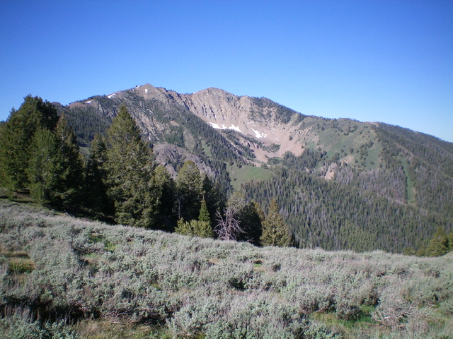
Johnstone Peak is a beautiful, big mountain located west of the main Pioneer Mountains Crest. It offers a fantastic view of the big Pioneer Mountains peaks. USGS Hyndman Peak
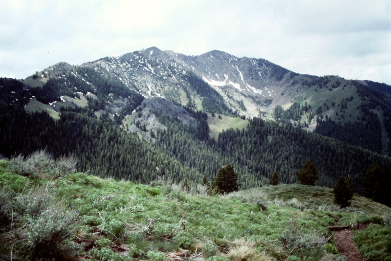
Johnstone Peak as viewed from the Pioneer Cabin Trail
South Ridge and South Face/South Rib Routes by Livingston Douglas
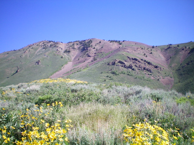
Johnstone Peak as viewed from the south. Livingston Douglas Photo
Access
From ID-75, drive northeast up [signed] East Fork Road to its unsigned junction with Hyndman Creek Road/FSR-203. Turn left/north onto Hyndman Creek Road and drive 2.7 miles to the signed [left] turnoff for the Bear Gulch trailhead. Drive 0.1 miles west on a primitive 2-track road to reach the trailhead. Park in the tall grass near the trailhead (6,700 feet). Aapparently this trailhead is only occasionally used. GPS coordinates: 43⁰41’00”N, 114⁰12’57”W.
South Ridge, Class 2
The Climb
From the Bear Gulch trailhead, scramble directly north-northeast up a steep face of sagebrush and other vegetation to reach the crest of the south ridge. Grind your way up the rounded ridge up through more sagebrush to reach easier scrub just below 8,000 feet. The ridge narrows and becomes better defined. Work through a flattish ridge section that never seems to end, with a few minor ups and downs. The terrain is still open scrub at this point. Reach the base of a steep, sagebrush slope at about 8,100 feet. Climb this steep ridge section of thick sagebrush and rocky outcrops (with loose scree underneath) to reach gentle Point 8823.
From Point 8823, the ridge heads left-ish/northwest and drops 10 feet through scattered pines and easy scree/dirt/scrub to reach a minor saddle. The ridge bends back to the right/north at this saddle and the slope steepens again. Bushwhack up through a section of sagebrush and other vegetation to reach the upper ridge at about 9,120 feet. The ridge bends noticeably left/northwest here and is a relentless, mostly-rocky grind up to the false [east] summit at 9,860 feet.
The terrain on this upper ridge section is a combination of talus slopes and scattered pines. From the east summit, descend west for 80 vertical feet through a thick pine forest (with rocky outcrops mixed in) to reach the small saddle between the false summit and the true/west summit. From the saddle, scramble west then northwest up a talus slope to reach the summit. There was no summit cairn so I built one.
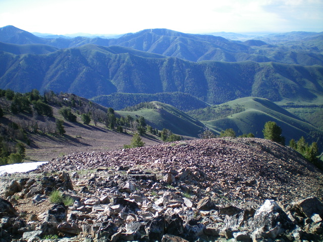
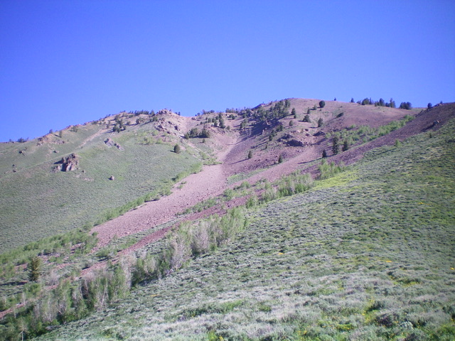
Looking down the south ridge (my ascent route) from the summit. The ridge is in mid-ground upper left diagonally down to the ridge humps on the right. Livingston Douglas Photo
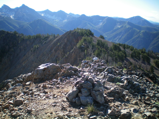
The newly-built summit cairn atop Johnstone Peak with the [lower] east summit (Point 9840+) in mid-ground. Livingston Douglas Photo
South Face/South Rib, Class 2+
The Descent
From the summit, descend back to the saddle below the false summit. Leave the ridge here and descend south on loose talus/scree. Angle right/southwest to reach the south rib, a narrow rocky ridge that heads steeply down to easier ridge terrain below. This upper section of the rib is rocky and rough, worse than I expected. Once down to about 8,400 feet, angle left/southeast to reach the easier, lower section of the rib. Bash diagonally downward through sagebrush and loose talus/scree to reach the rounded, gentle scrub ridge that awaits you.
Once on the easier section of the rib at 8,200 feet, follow the rib southward toward Bear Gulch. The rib steepens and the sagebrush is a bit more tedious as you approach Bear Gulch. Reach Bear Gulch at a fork in the gulch and quickly find the Bear Gulch Trail heading left/east (then south). Follow the well-beaten, but narrow, trail back to the Bear Gulch trailhead, crossing [small] Bear Gulch Creek a few times along the way.
The steep, upper south face of Johnstone Peak (my descent route). Livingston Douglas Photo
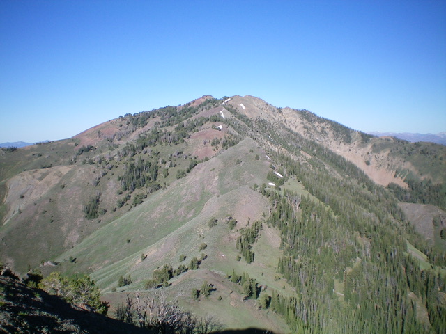
Johnstone Peak as viewed from Peak 9311 to its east. It is a BIG mountain. Livingston Douglas Photo
Johnstone Peak as viewed from the northeast. Livingston Douglas Photo
Additional Resources