Elevation: 7,464 ft
Prominence: 274
This peak is not in the book. Published November 2020
Knoll Benchmark (also called “Knoll”) is located on the Continental Divide in the South Beaverheads just west of Monida Pass at I-15. It is a relatively meaningless bump on the undulating, weaving Continental Divide. It is easily climbed from Modoc Road to its south. There is a lot of private land in this area so be careful. This climb is entirely on public (BLM) land. USGS Monida
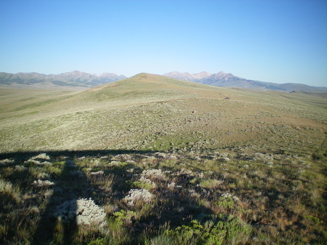
Knoll Benchmark is the gentle hump (dead center) as viewed from the east. Livingston Dough Photo
Access
From Exit 190/Humphrey on I-15, drive east to the frontage road on the east side of I-15. Reset your odometer. Drive north on the frontage road. At 2.6 miles, go left onto Modoc Road and through an underpass to reach the west side of I-15. After crossing underneath I-15, the road turns right/north. At 5.0 miles, the road bends sharply left/west and moves away from I-15. At 6.4 miles, the road turns hard left/south and crosses a small stream. Park here (6,842 feet).
East Ridge, Class 2
The Climb
Walk north briefly on Modoc Road and cross to the north side of the stream. Look for an old 2-track road heading right-ish/northeast from Modoc Road up onto a shoulder. Follow the old 2-track as it heads northeast then bends left/north and left again (northwest) to reach the east ridge of Knoll Benchmark. Follow the ridge crest westward, sometimes with the help of an old 2-track road, sometimes not. Be sure to stay to the left/south of a fence row that is well right/north of the ridge crest. That fence row is the dividing line between BLM land (left) and private ranch land (right), though I saw no signage or orange paint on the fence.
The terrain on the ridge crest is easy, short scrub so it goes quickly. There are a few ups and downs along the way. The summit of Knoll Benchmark has two separate benchmarks in ground boulders and lots of triangulation posts and a triangulation tripod laying on the ground. There was no summit cairn so I built one using talus from the nearby triangulation cairns.
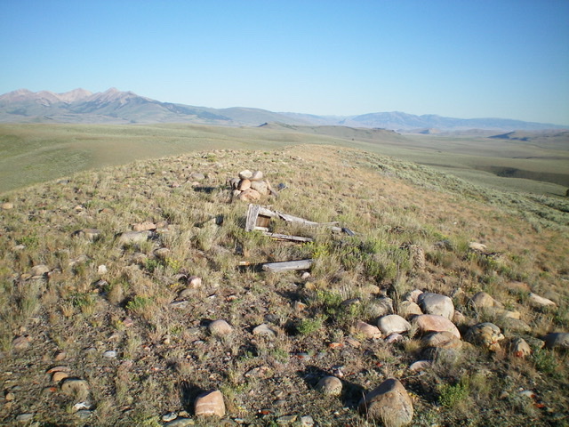
The summit area atop Knoll Benchmark, looking west. Livingston Douglas Photo
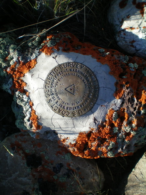
The primary benchmark atop Knoll Benchmark. Livingston Douglas Photos
Additional Resources
Regions: Beaverhead Range->EASTERN IDAHO
Mountain Range: Beaverhead Range
Longitude: -112.34119 Latitude: 44.53739