Elevation: 6,976 ft
Prominence: 876
This peak is not in the book. The summit of this peak is located on private property and although there is a mix of BLM and State of Idaho land on its slopes there is no known public access. I added a map below showing the land ownership mix below. You will need to secure permission to climb this peak. Published November 2022
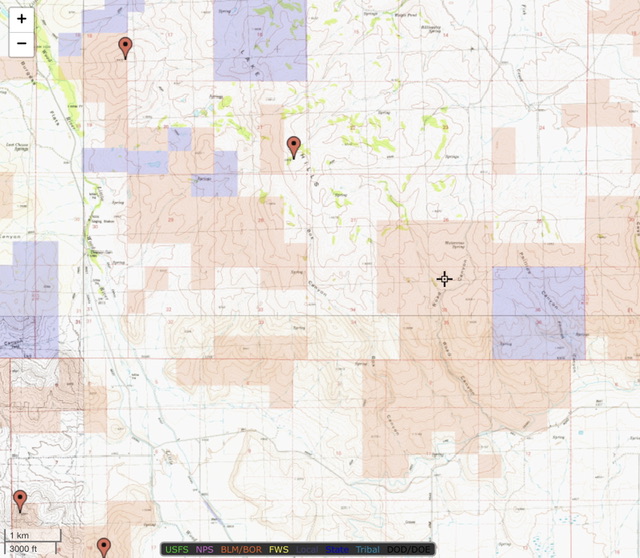
Land ownership on the peak’s slopes: Brown is BLM land, Blue is State of Idaho, and the rest is private ranch land.
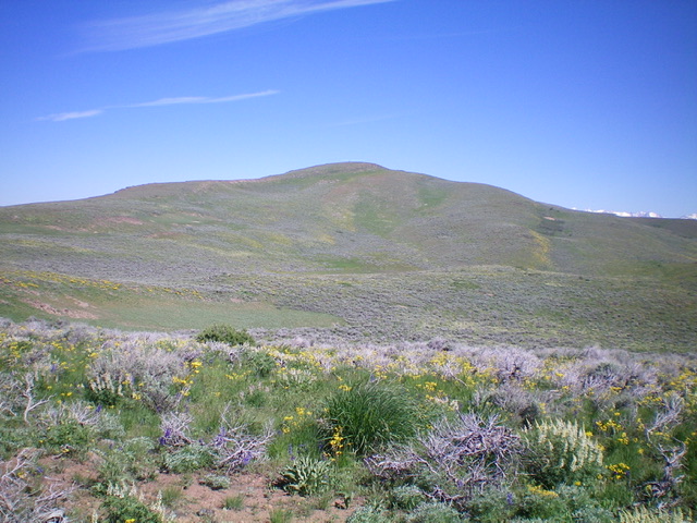
The Lake Hills HP sits atop a long northwest-southeast ridge that separates Road Canyon from Burgess Flats. It is located at the head of Box Canyon in the foothills of the Pioneer Mountains. Lake Hills HP is most easily climbed from Road Canyon Road. This peak is on private ranch land so you must obtain permission from the landowner before conducting this climb. USGS Lake Hills
Lake Hills as viewed from the southeast. Livingston Douglas Photo
Access
At a sharp right/east bend in US-20 just northeast of Carey, turn left/north onto [signed] Austin Road and reset your odometer. At 1.0 miles, reach a signed junction with Barton Road (left). Stay straight on Austin Road. At 1.6 miles, reach a signed junction with Road Canyon Road. Turn left/north onto Road Canyon. At 2.7 miles, reach Watercress Spring (on the USGS topo map) at an unsigned junction with a 2-track road heading left/west with a cistern and a large tractor tire. Park at this junction (6,080 feet). GPS coordinates: 43⁰23’12”N, 113⁰55’07”W.
Southeast Ridge, Class 2
The Climb
From the road junction, hike west then northwest up the overgrown 2-track road as it crosses a few minor gullies then heads north toward Point 6470 and the lateral cattle fence that separates BLM land from private ranch land. Leave the old 2-track at 6,235 feet after hiking up it for about ½ mile and drop diagonally northwest then straight west down to a deep, narrow gully. Cross the small stream in the gully and follow a steep fence row west up onto the southeast ridge in sagebrush, field grass, and other veg. The fence row ends before reaching the top of a headwall of sorts and you must scramble northwest up a section of steep boulders and brush to reach the gentle ridge crest.
After a short distance on the ridge, you leave BLM land and enter private ranch land, though there is no fencing or signage to indicate such. Follow the easy, open ridge west then north to reach the summit. The ridge has a bit of ups and downs and the sagebrush can be tedious at times. The summit is pretty bare but has an impressive, six-foot cairn. The view of Little Wood River Reservoir to the northwest is magnificent. Locals call this peak Stone Monument Peak.
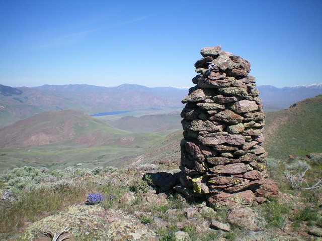
The tall summit cairn atop Lake Hills HP. Little Wood River Reservoir is in the distance. Livingston Douglas Photo
Additional Resources
Regions: EASTERN IDAHO->Pioneer Mountains
Mountain Range: Pioneer Mountains
Longitude: -113.95589 Latitude: 43.39929