Elevation: 6,661 ft
Prominence: 521
Climbing and access information for this peak is on Page 62 of the book.
Larkins Peak anchors the west end of the Mallard Larkins Pioneer Area, which forms the divide between the North Fork Clearwater and the Little North Fork Clearwater Rivers. This divide has a dramatic vertical rise of more than a mile in a short horizontal distance.
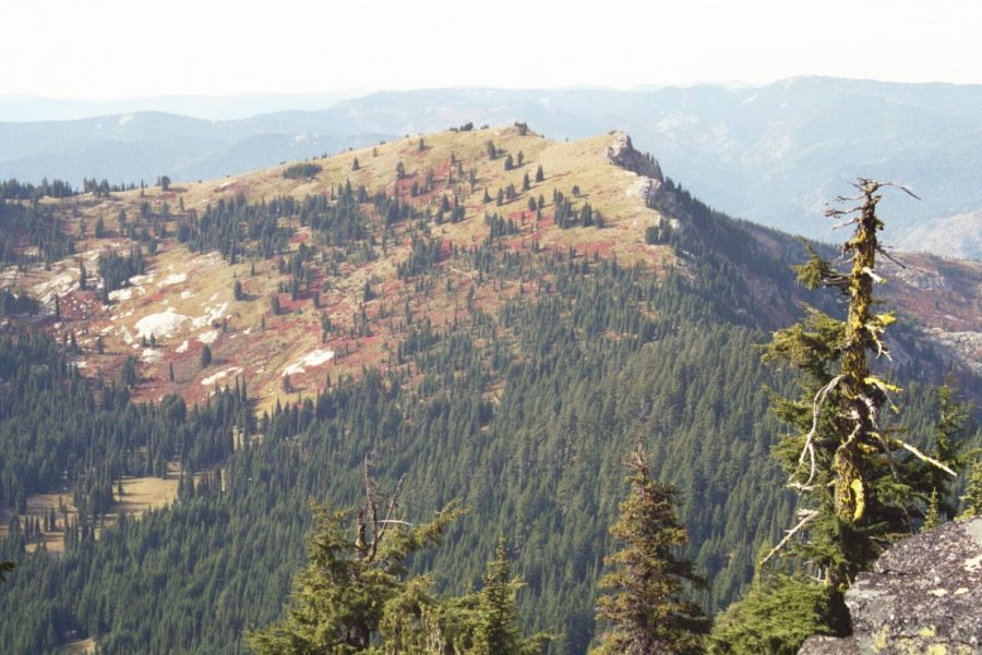
Larkins Peak is the most easily accessible Mallard Larkins summit. However, its summit is generally ignored by hikers seeking the many lakes found on the north side of the divide. The peak’s north side, formed of broken cliffs and slopes, provides a dramatic 1,100-foot backdrop to Larkins Lake. The summit is open with a mosaic of mountain hemlock and subalpine fir with grasses, bear grass, whortle berry, heather and other vegetation found just below tree line. USGS Mallard Peak

Larkins Peak as viewed from Crag Peak. Mike Hays Photo
The area receives relatively heavy summer use. In the Fall, hunters take over the parking areas and the slopes. Don’t ever expect isolation. In the fall, wear bright orange and, if possible, travel in groups.
Access
If coming from Lewiston, follow US-12 to the town of Orofino and turn east across the bridge over the Clearwater River into downtown. Follow the main road through town (Michigan Street) and climb the grade east of town. This paved road has some rough surfaces and bad corners. Keep on this road for 26.5 miles to the T-intersection at the Bald Mountain Ski Area turn off. Take a left on the main road (ID-11). Continue 7.3 miles to the next T-intersection at the small town of Headquarters.
Headquarters is a small group of buildings that is an administrative center for the Potlatch Corporation; there are no services. Turn left at Headquarters (FSR-247) and continue for 24 miles to the bridge of the North Fork Clearwater River. Immediately turn left off the pavement onto FSR-700. After about a mile, this road leaves the river and turns north up the Isabella drainage. After an additional two miles, the road turns to the left, leaving Isabella Creek. Continue along FSR-700, climbing for 10 miles to the trailhead where the road crosses Smith Ridge.
If coming from the south, take US-12 to Kamiah and continue approximately 15 miles to ID-11, which crosses the Clearwater River to the right at Greer. Then climb the steep 8 mile Greer Grade and continue about 12 miles to Weippe. Here, turn left and follow the signs to Pierce. Continue through Pierce about 5 miles to the Bald Mountain Ski Area turn off and then follow the directions above. One can also skip the Greer Grade and continue to Orofino on US-12 and follow the directions above.
South Ridge, Class 2
From the trailhead, FST-240 heads east for about 2 miles. Then the trail turns north with the main ridge for about 4 miles to Larkins Peak. An unofficial trail cuts across the southwest aspect of the summit and gives the impression that it may go to the top, but it does not. The trail probably peters out to the west of the summit or perhaps reaches some lesser known lakes in that direction. Most maps show a trail continuing up the South Ridge, but this trail has faded away. Regardless, that approach is still the easiest way to the summit.
On maps, the FST-240 trail follows the ridge line more or less the entire way. The trail was rerouted in recent years,. It is now a more continuous and gentle grade mostly on the north side of the ridge for the first 2 miles and on the west side in the vicinity the Goat Ridge high point. The trail is well-maintained and the trailhead is obvious. A hike to the summit is a simple detour off the main trail to the south summit ridge. Debris on the summit indicates the presence of a historic lookout or perhaps an observation station of some sort.
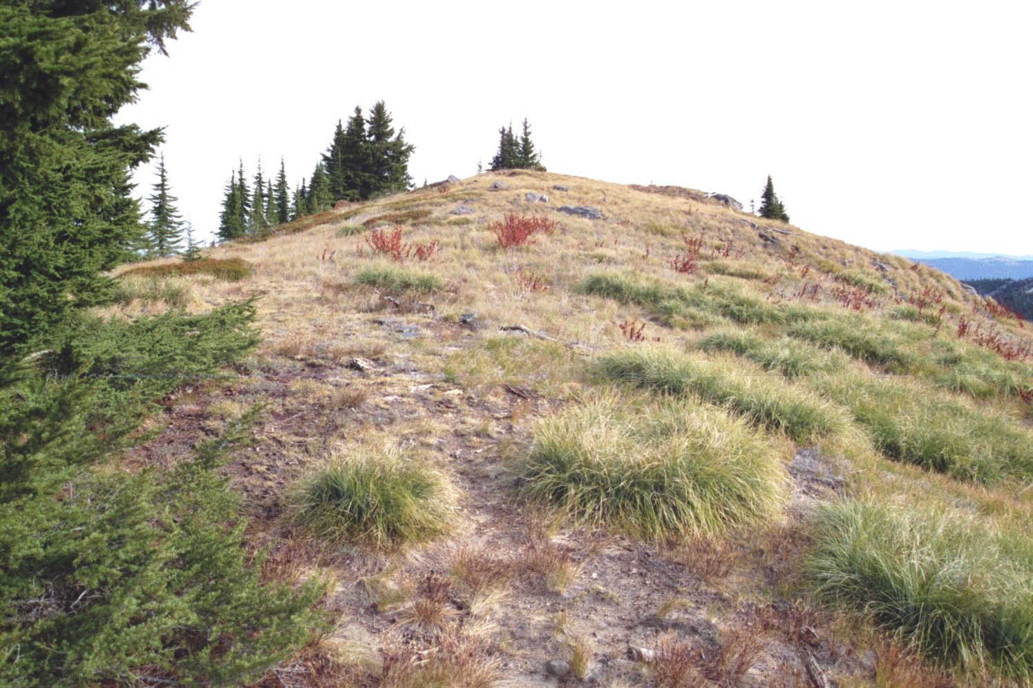
The summit of Larkins Peak. Mike Hays Photo
You can climb Larkins Peak via FST-95 and FST-96 that start near the end of the Isabella Creek Road/FSR-705. These longer routes climb from much lower elevations and require much more time.
Additional Resources
Mountain Range: Northern Clearwater Mountains
Longitude: -115.61989 Latitude: 46.94769