Elevation: 5,079 ft
Prominence: 149
This peak is not in the book. Published November 2023
Lava Butte is located southeast of Laidlaw Park and due north of Bear Den Butte. Bear Den Butte (5,104 feet) is the HP for Minidoka County but Lava Butte is located in Blaine County. USGS Bear Den Butte
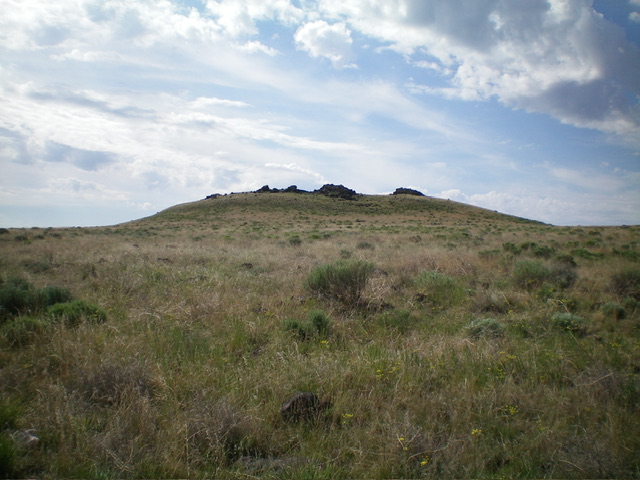
Lava Butte as viewed from the north-northwest. Livingston Douglas Photo
Access
From US-20 east of Carey, turn right/south onto [signed] North Laidlaw Road. This junction is 0.2 miles west of Fish Creek Road, which is well-signed. Drive south on North Laidlaw Road for 1.2 miles to an unsigned “T” junction. This is Laidlaw Park Road. It can also be approached directly from farther west on US-20 and the road quality should be fine. Turn left/southeast onto Laidlaw Park Road and drive 13.6 miles to reach a signed 4-way junction (5,078 feet on the USGS map).
Continue straight/east for another 4.5 miles to an unsigned road junction. Go diagonally right/southeast onto Bear Den Butte Road (unsigned). At 5.4 miles, the road bends right/south. At 8.1 miles, cross a cattle guard. At 8.6 miles, reach an unsigned junction with Bear Den Butte Spur Road. This junction is at 43⁰13’28”N, 113⁰31’43”W. Drive southeast for 0.3 miles on the spur road and park in a pullout just before it crosses the lava rock ridge (4,930 feet; 43⁰13’18”N, 113⁰31’25”W). With good tires, you can continue driving on the spur road all the way to the northwest side of Lava Butte and southward to Bear DenButte.
Map Errors
The USGS topo map fails to show the spur road that head southeast from Bear Den Butte Road to a good 2-track road that heads west then south from Lava Butte. The USGS topo map shows a 2-track road heading north into Little Laidlaw Park from a junction on Bear Den Butte Road. That road no longer exists.
Northwest Face, Class 2
The Climb
From the pullout, hike southeast along the spur road for about ¾ mile on lava rock. Continue another ¾ mile on an easier road section through scrub to reach a critical “T” junction at the base of Lava Butte. There are three cattle cisterns here. Leave the road and scramble south-southeast up through mostly grass and annoying tumbleweeds to reach the summit ridge/crater rim of Lava Butte. The official/north summit is not the high point. The southeast summit (a rocky outcrop) measures five feet higher. There is no summit cairn.
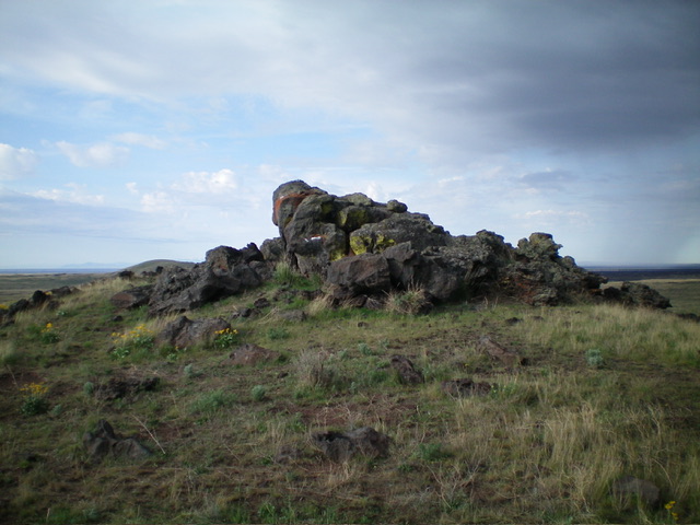
The southeast summit (high point) of Lava Butte. Livingston Douglas Photo
West Face, Class 2
The Descent
From the southeast summit, descend west through grass and tumbleweeds to intercept the north-south 2-track road (Bear Den Butte Spur Road). This concludes the first leg of today’s 2-peak adventure. Bear Den Butte is up next.
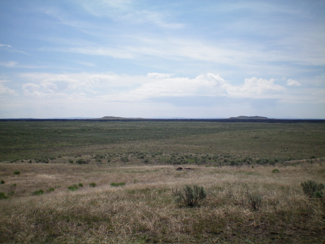
Lava Butte (left) and Bear Den Butte (right) as viewed from Potter Butte to the west. Livingston Douglas Photo
Additional Resources