Elevation: 8,180 ft
Prominence: 240

This peak is not in the book. Published June 2018
Lava Ridge is located northeast of Big Hazard Lake. The highest point on the ridge is situated at the South End and not at the North End where the USGS benchmark is located. John Platt climbed this peak by making a long ridge walk loop. USGS Black Tip
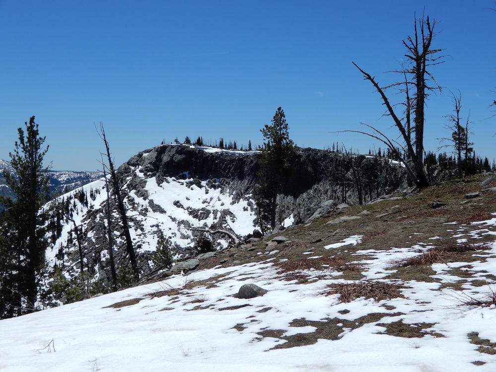
The summit of Lava Ridge. John Platt Photo
Access
Lava Ridge is easily accessed from FS-257 [(B)(1) on Page 134]. Start at the signed Big Dave trailhead.
South Ridge, Class 2
Climb the peak from Big Dave Creek by heading southeast to the high point. If you want to follow John’s route, your round-trip hike will cover 5.4 miles with 1,375 feet of elevation gain.
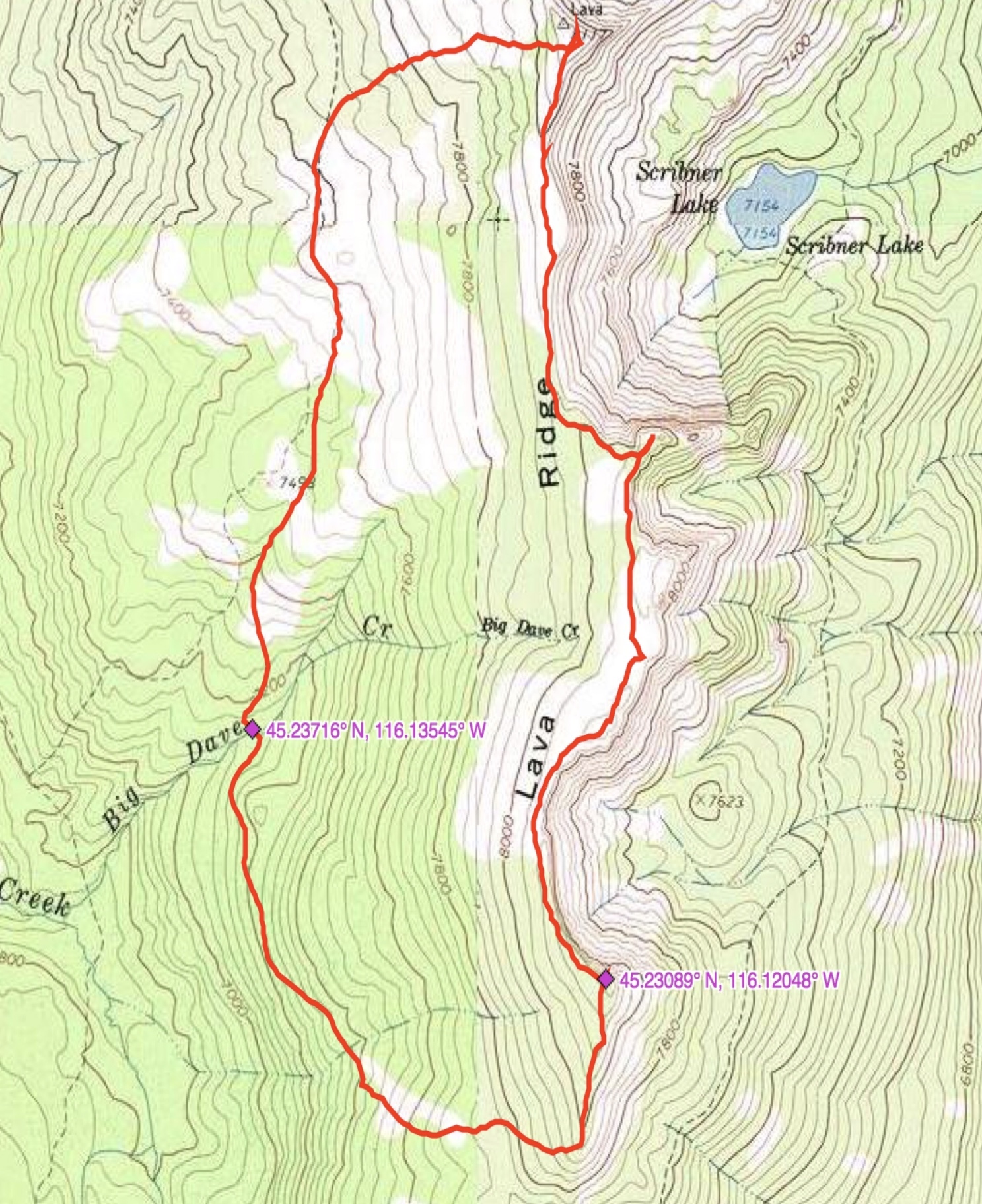
John Platt’s GPS track for his loop route.
Additional Resources
Mountain Range: Western Salmon River Mountains
Longitude: -116.12039 Latitude: 45.23069