Elevation: 8,453 ft
Prominence: 673
This peak is not in the book. Published November 2023
Leadore Hill is an impressive, rock-and-forest hill and sits due south of Leadore. It is quite visible from ID-28 to its east. Due to extensive private land in this area, the best climbing route is via the east ridge from Cold Springs Road. USGS Sheephorn Peak
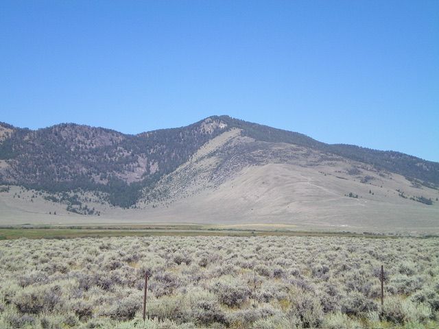
Leadore Hill (dead center) as viewed from the southeast. Livingston Douglas Photo
Access
From ID-28 at virtual MM83.8 (6.2 miles south of Leadore), turn left/west onto [signed] Tex Creek Road. Reset your odometer here. At 0.8 miles, go left/south at a signed junction with Cold Springs Road. At 1.7 miles, reach a hard-to-see, unsigned junction with an overgrown 2-track road on the east ridge of Leadore Hill. At 1.8 miles, reach a decent pullout area on the left/east side of Cold Springs Road. Park here at 6,365 feet (44⁰34’44”N, 113⁰20’06”W). This area is a mix of private and public land, so be careful. This climb is entirely on BLM land.
East Ridge, Class 3
The Climb
From the roadside pullout, walk about 0.1 miles north on Cold Springs Road to reach the indistinct junction with the overgrown 2-track that heads up the east ridge. Hike up the weaving 2-track (which becomes rocky, steep, and almost nonexistent higher up) for just under 1-1/4 miles to its end. A large ridge cairn marks the end of the road. From the road’s end, bushwhack west along the easy, grassy ridge a short distance to the edge of a forest of mountain mahogany. Head right/northwest here and climb up through scattered mountain mahogany and grass/scrub to reach the crest of the upper east ridge.
Once on the upper east ridge, scramble left/west up through mostly-open terrain in a mix of scattered pines/mountain mahogany and grass/scrub to reach an open slope of field grass. Cross this field grass to reach the pine forest above. After a short, easy bushwhack up through the pine forest, the forest levels out and the rocky summit ridge/block is directly to the left/southwest. Surprisingly, there is a good, semi-open line of steep-ish scrub/scree and deadfall that leads up onto the intimidating, forested summit ridge rather quickly.
Once on the narrow ridge crest, follow it right/northwest to the small summit. Drop about 20 vertical feet from a rocky ridge point early on and scramble up over (or around) boulders and a tedious mix of ridge rock, brush, and firs with a few minor ups and downs to eventually reach the rocky summit. The summit of Leadore Hill has a USGS benchmark plus triangulation posts and a small summit cairn. There are only partial views from the summit due to nearby pine trees.
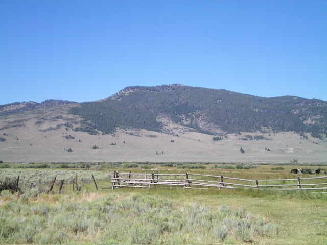
Leadore Hill (dead center) as viewed from the northeast. The forested summit hump is in dead center and requires a tedious bushwhack across the ridgeline of rock and pines to its left. Livingston Douglas Photo
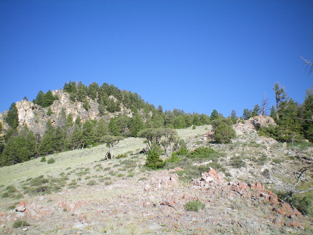
The final push up the east ridge to the imposing, rocky summit ridge (left of center). The summit hump is not yet visible. Livingston Douglas Photo
Additional Resources
Regions: EASTERN IDAHO->Lemhi Range
Mountain Range: Lemhi Range
Longitude: -113.3801 Latitude: 44.5885