Elevation: 7,171 ft
Prominence: 471
This peak is not in the book. Published November 2019
Lehman Butte is a ranked summit located just south of the Mackay Fish Hatchery on BLM land. Drive to the Fish Hatchery area and park at the final road junction just before a side road heads to the fish hatchery itself. Barton Cemetery sits at the base of the north ridge of Lehman Butte. The butte is a rough, rocky outcrop with lots of brush mixed in. There are lots of ways to twist an ankle or take a fall on this peak. Don’t take it lightly. There is private land nearby (on the southeast side). Be careful to avoid it. USGS Lehman Butte
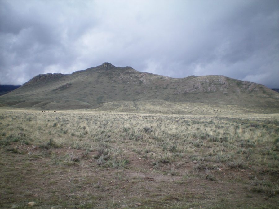
Lehman Butte viewed from the northeast at the 4-way road junction. The summit is the highest rocky hump, just left of center. Livingston Douglas Photo
North Ridge, Class 3
Access
Fish Hatchery Road is located 8.9 miles north of the north end of Mackay, ID on US-93. Turn left/west onto [signed] Fish Hatchery Road and reset your odometer. At 2.5 miles, bear left at a 3-way road junction signed for the Fish Hatchery. At 3.7 miles, turn left/south at a road junction signed for the Fish Hatchery. At 5.1 miles, reach a 4-way road junction. Park here in a large pullout area (6,255 feet).
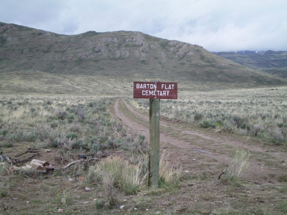
Sign for “Barton Cemetary” (mis-spelled) at the 4-way road junction. The easy, lower section of the north ridge of Lehman Butte is in the background. Livingston Douglas Photo
The Climb
From the parking area at the 4-way road junction, hike 0.4 miles up Barton Cemetery Road to the small, fenced cemetery. Bushwhack through thick sagebrush to reach the toe of the obvious north ridge of Lehman Butte. The north ridge is a mix of rock ribs, lichen-covered ground boulders, and sagebrush. There are some areas of open ground as well.
The summit area is a raised section of large boulders and sagebrush. It is a Class 3 scramble even when dry. When wet, it is treacherously slick due to the lichen covering the boulders. The summit high point is on a narrow ridge crest and is quite small. There is a USGS benchmark in a ground boulder and a small cairn on top. The north ridge isn’t too bad until you approach the summit on the narrowing ridge crest and the boulders and thick brush take over. It then gets ugly in a hurry.
South Ridge, Class 3
Access
Same as for the north ridge
The Descent
From the summit, follow the narrow ridge crest southward. The combination of lichen-covered boulders and sagebrush is wicked. It is a full-on Class 3 endeavor. You will soon reach a minor saddle and encounter the worst section of the south ridge—the Class 5 south summit. Skirt the right/west side of the narrow, steep rock/cliffed south summit. After passing the south summit, the ridge is much easier to handle.
Follow the south ridge down to a jeep road at its base. Hike northeast then north along the jeep road as it passes a private ranch on the right/east side. A cattle fence demarcates the private/public land boundary here. Be sure to stay on the left/west side of this fence. After passing the ranch, the road takes a sharp right/east turn and drops to BLM Road #491. It reaches that road just north of the entrance to the ranch. The road turns sharply left/north here and heads north to the 4-way road junction and the parking area.
Additional Resources
Regions: EASTERN IDAHO->White Knob Mountains
Mountain Range: White Knob Mountains
Longitude: -113.83519 Latitude: 43.96339