Elevation: 6,478 ft
Prominence: 654
This peak is not in the book. Published November 2021
Leslie Butte is located on the southwest side of US-93 between Mackay and Arco just south of the [unsigned] hamlet of Leslie, Idaho. The butte is particularly obvious when driving up from Arco. There is a lot of posted private property in this area, so public access is quite limited. This route is entirely on BLM land. USGS Darlington
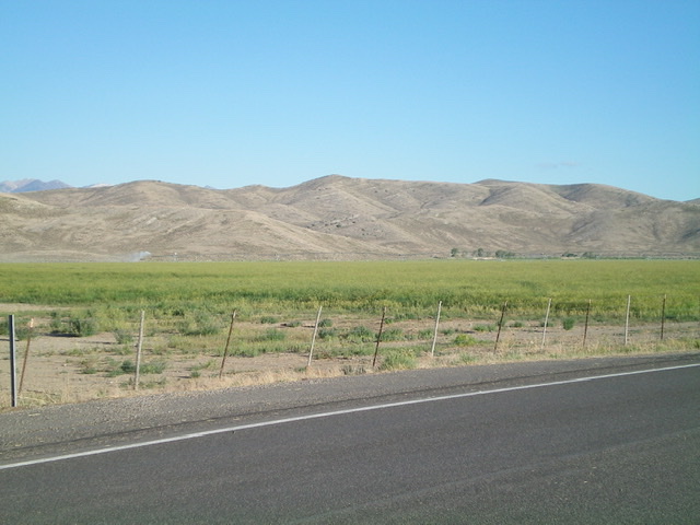
Leslie Butte as viewed from US-93 to its east. Livingston Douglas Photo
Access
From the signed junction of US-93 and Houston Road in Leslie, Idaho (just north of the Mormon Church on US-93), turn south on Houston Road and reset your odometer. This junction is just south of the well-signed junction with Pass Creek Road and is about 8 miles south of Main Street in Mackay. At 0.4 miles, the road turns sharply right/west. At 1.1 miles, reach a parking pullout at the base of an unsigned jeep road (not shown on maps) on the left/southeast side of the road. Park here (5,735 feet). GPS coordinates: 43⁰51’20”N, 113⁰28’51”W.
Map Errors
The USGS topo map mis-spells Houston Road as “Huston Road.” It also fails to show the numerous 2-track roads on and around Leslie Butte.
North Ridge, Class 2
The Climb
This climb is mostly on old jeep roads (Class 1). From the parking pullout, hike south-southeast up the 2-track road to a shoulder crossing at a saddle. Continue on the road to a second shoulder crossing and another saddle. Leave the road here and scramble left/northeast up a minor shoulder (or face) to reach the north ridge just south of Point 6460. The terrain on this somewhat-steep scramble is a combination of scrub, loose shale, and rocky outcrops. Once on the north ridge, follow it south then southeast down to a saddle on easy scrub and broken scree.
At the saddle, find a weak 2-track road and follow it southeast to a ridge hump and pick up an old mining road here. Go left/east onto the old mining road and follow it along the weaving, undulating ridge crest to another saddle. From that saddle, continue south along the mining road up a steep-ish shoulder to reach a crest in the road. Leave the road here and scramble west-southwest up easy, open scrub and broken scree to the summit of Leslie Butte. The summit is somewhat rocky and has a triangulation post/wiring and a summit cairn.
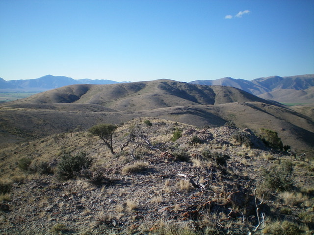
The summit of Leslie Butte (dead center) as viewed from near Point 6460 on the north ridge. Livingston Douglas Photo
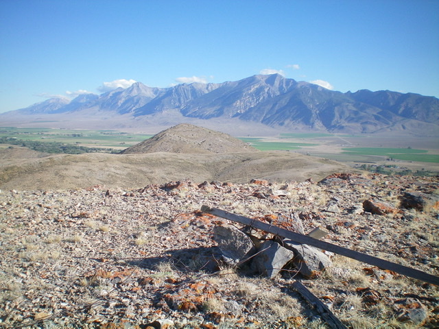
The summit of Leslie Butte, looking north toward Point 6460 (hump left of center). The Lost River Range is in the distance. Livingston Douglas Photo
Additional Resources
Regions: EASTERN IDAHO->White Knob Mountains
Mountain Range: White Knob Mountains
Longitude: -113.46429 Latitude: 43.84009