Elevation: 5,742 ft
Prominence: 195
This peak is not in the book. Published November 2022
The high point of the Little City of Rocks Wilderness Study Area is located on the south side of the City of Rocks Road in the Bennett Hills. This hike is entirely on BLM land. This is an impressive, rocky buttress with a tall cairn that is visible for miles. It is well worth the effort to stand atop it if you are in this part of the Bennett Hills. USGS McHan Reservoir
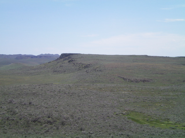
Little City of Rocks WSA HP as viewed from the west. Livingston Douglas Photo
Access
From ID-46, drive west up the City of Rocks Road for 2.9 milesand park at an unsigned road junction at 5,535 feet just before a sharp right/northwest bend in the City of Rocks Road. An old 2-track road (closed to motor vehicles) heads south from this junction. GPS coordinates: 43⁰10’42”N, 114⁰42’11”W. Please refer to the Mount Bennett Hills page for more information about the City of Rocks Road.
West Ridge, Class 2
The Climb
From the road junction, hike south on the 2-track road for about ½ mile to reach the base of the [obvious] west ridge. Leave the road here and scramble east up the rounded ridge. The terrain is open ground, gapped sagebrush, and embedded boulders. You must still avoid areas of thick sagebrush and there are some minor ups and downs on your way to the summit plateau. Once atop the tilted plateau, head left/north to reach the rocky summit area. The summit has 2-3 large cairns. The tallest cairn is six feet high and is at the north end of the tilted summit plateau. It is the high point of the Little City of Rocks Wilderness Study Area. This WSA HP seems to see a fair share of visitors.
Additional Resources
Regions: Bennett Mountain Hills->WESTERN IDAHO
Mountain Range: Bennett Mountain Hills
Longitude: -114.69059 Latitude: 43.17309