Elevation: 5,184 ft
Prominence: 303
This peak is not in the book. The elevation and prominence figures reflect recent LiDAR updates. Updated January 2025
Little Grassy Ridge is an obscure, volcanic ridge that can be reached most easily via ATV trails in the area. The rocky summit is not visible until you are almost on top of it. The best access is from the south and ID-33. USGS Market Lake NE
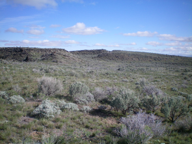
The summit area of Little Grassy Ridge as viewed from the south. Livingston Douglas Photo
Access
From Exit 143 on I-15, head east on ID-33 for 5.7 miles to an unsigned junction. Turn left/north and drive 0.3 miles up a 2-track road to an unsigned “T” junction. Park here (4,910 feet). The GPS coordinates at this junction are: 43⁰49’44”N, 112⁰04’19”W. Alternatively, you can leave ID-33 4.7 miles from I-15 and then drive north then east on a 2-track road to the water tank referred to in the route description to shorten this hike.
There are other 2-track roads in this area that make navigation and map usage confusing. The conditions of these 2-track desert roads (including the ones shown on the USGS topo map) may be difficult or impossible at times. Contact the BLM for up-to-date road conditions and travel restrictions in this area.
South Face, Class 2
From the “T” junction, walk briefly north on the 2-track road. Leave the road as it turns right/east. Bushwhack northeast then north-northeast through easy, open short grass and well-gapped sagebrush to reach a large water tank that is visible early on and is a critical navigational mark. From the water tank, head right/east at an unsigned junction and follow this road east then northeast to another unsigned junction. Head left/north at this second junction until it reaches an unsigned “T” junction. Go left/northwest here to reach the base of the south face of the Little Grassy Ridge massif. Scramble north up through sagebrush to reach the rocky, volcanic summit ridge area. Skirt the right side of Point 5170 to reach the summit ridge. Continue north to the rocky summit.
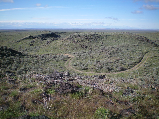
The alternative, more direct route from the water tank (given the confusing road situation there) is to bushwhack northeast then north to reach the base of the south face of Little Grassy Ridge. Thankfully, the terrain is open with minimal sagebrush, so it goes quickly. The summit area is rocky and is a narrow ridge crest. The summit has a nice cairn and has somewhat of a crater area next to it. Needless to say, if road conditions permit (or you have an ATV), you can shorten this hike considerably as there is a 2-track road that skirts the south side of the summit ridge, separating Point 5170 from Little Grassy Ridge’s high point (5,175 feet). That 2-track road negates the need to climb the south face to reach the final summit ridge.
The large summit cairn atop Little Grassy Ridge. Livingston Douglas Photo
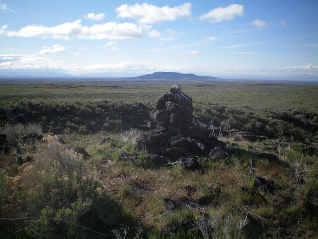
Looking at nearby Volcano Benchmark from the summit of Little Grassy Ridge. Livingston Douglas Photo
Additional Resources