Elevation: 7,056 ft
Prominence: 276
This peak is not in the book. Published December 2020
Little Star Benchmark is a wonderful little hump on the south side of Deer Creek in the Webster Range. It is an easy scramble from Deer Creek Road/FSR-156 with minimal bushwhacking. The views from the open summit are splendid. Little Star Benchmark even includes a nice summit cairn and a USGS benchmark. It almost qualifies as a soft-ranked summit. Of the five peaks that I did along Deer Creek Road, I enjoyed Little Star Benchmark the most. USGS Thayne West
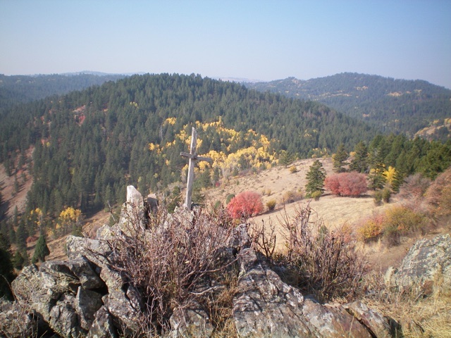
The summit cairn and cross atop Little Star Benchmark. Livingston Douglas Photo
Access
From the major intersection at the Mormon Church in the center of Freedom (WY), drive south on a paved county road for 1.4 miles. Turn right/west at an unsigned junction onto a good gravel/dirt road. This road becomes Deer Creek Road/FSR-156. Reset your odometer at this junction. At 1.5 miles, reach the Caribou National Forest boundary at a cattle guard. At 3.4 miles, reach a large, grassy dispersed campsite in a meadow on the left/south side of the road at the base of an obvious gully. Park here (6,535 feet).
Northwest Gully/West Ridge, Class 2
The Climb
From the meadow, cross [small] Deer Creek on sticks/logs or boulders. Once across the creek, follow a cattle/use trail south-southeast up the dry gully (mostly forested with aspens) to reach a 6,780-foot ridge saddle between Point 7150 and Little Star Benchmark. Follow a cattle trail east-northeast up the open right/south side of the ridge crest until it ends. From the end of the cattle trail, stay to the right/south of the forest and scramble east up easy, gapped scrub and flattened field grass to reach the crux: a minor headwall of talus/boulders with brush mixed in. Climb up this headwall and continue along the semi-open ridge to the rocky summit.
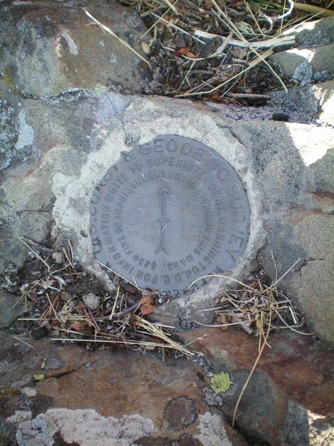
The U.S. Coast & Geodetic Survey marker atop Little Star Benchmark. Livingston Douglas Photo
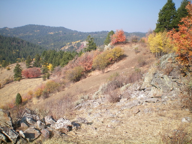
Looking back down the west ridge of Little Star Benchmark from the summit. The ridge goes from upper right to left center in the photo. Livingston Douglas Photo
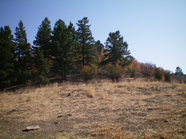
Looking up the west ridge of Little Star Benchmark. The crux is behind the trees: a minor headwall of talus/boulders and brush. Livingston Douglas Photo
Regions: Peale Mountains->SOUTHERN IDAHO->Webster Range
Mountain Range: Peale Mountains
Longitude: -111.0888 Latitude: 42.9492