Elevation: 5,167 ft
Prominence: 212
This benchmark is not in the book. Published December 2019
Magic Benchmark is a hump that is located just west of ID-75 and about four miles south of US-20. While the shortest ascent route is via the east face from ID-75, the safer ascent route is from East Magic Reservoir Road to the north. It can also be climbed via its west shoulder from a spur road going south from East Magic Reservoir Road. It is one of many scrub hills in this area, but it is distinguished by having a USGS benchmark atop it—not just any benchmark, but the namesake benchmark for this entire area around Magic Reservoir—MAGIC Benchmark. USGS Magic Reservoir East
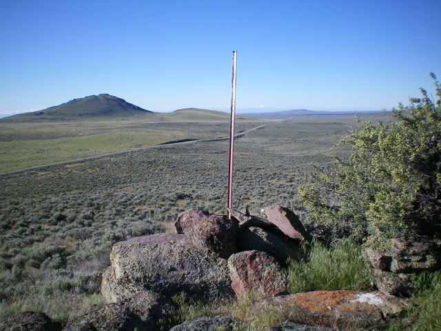
The summit cairn and summit post atop Magic Benchmark. Wedge Butte is in the distance, with ID-75 diagonally in between. Livingston Douglas Photo
Northwest Face, Class 2
Access
East Magic Reservoir Road (signed) is located 3.7 miles south of US-20 on ID-75. The turnoff is on the west side of ID-75. Drive 0.7 miles west on East Magic Reservoir Road to an unsigned junction on the northwest side of Magic Benchmark. Park here (4,960 feet).
The Climb
From the road junction, bash southeast through thick sagebrush and drop to a small marshy area. Climb up out of that lush spot and weave your way through sagebrush (which thins out as you go higher) to reach the small ridgeline summit area. The summit has two large summit cairns, one of which has a steel post in it. A tall triangulation “cross” lays on the nearby ground, among the sagebrush. Surveyors have been here, though I could not locate the USGS benchmark. It is either underneath the large rocks of the summit cairn or is in a ground boulder hidden in the thick sagebrush. The summit overlooks ID-75 to the east and has a nice view of Wedge Butte to the south.
Regions: Bennett Mountain Hills->WESTERN IDAHO
Mountain Range: Snake River Plain
Longitude: -114.308367 Latitude: 43.275517