Elevation: 7,432 ft
Prominence: 492
This peak is not in the book. Published November 2020
Mahogany Ridge is one of many named ridges in the Caribou Range of eastern Idaho. It is most easily reached via the Rash Canyon ATV Trail/FST-306 from Fall Creek Road. Caution is advised as this trail is a mess, with numerous mud holes and crossings of Rash Canyon Creek. It was difficult to hike due to the numerous diversions that must be made to avoid problems with the trail and/or the creek. It’s probably not the easiest trail to ride an ATV or MC up. USGS Commissary Ridge
Access
Same as for Peak 7340. This is the second leg of a two-peak journey that begins at a spur road alongside Fall Creek Road.
Southwest Face, Class 2
The Climb
From the saddle at the base of the southwest face, climb northeast up a face of scrub to reach Point 7128. From Point 7128, drop through forest/brush to reach a hidden saddle then scramble up steep scrub (not fun) to reach the easy short scrub/scree on the summit ridge. There is some mountain mahogany to navigate on the initial ascent from the saddle. The summit of Mahogany Ridge has a torn-down cairn on the narrow ridge rock that is the high point (at or near the east end). The summit offers a beautiful view of the Tetons.
Rash Canyon Descent, Class 1
From the saddle at the base of the southwest face of Mahogany Ridge, follow the Rash Canyon ATV Trail/FST-306 down to Fall Creek Road then hike about 1.5 miles southwest up Fall Creek Road to your parking spot on the spur road at the base of the northwest ridge of Peak 7340. One would expect this hike down FST-306 through the forest to be a cruise. It is anything BUT a cruise. This trail is awful. It crosses Rash Canyon Creek numerous times, never with any help from a log or a foot bridge. In addition, the trail is steep, loose, and has mud holes to skirt around. This trail descent was not a pleasant experience. Thankfully, raging Fall Creek flows under the road/trail through a massive pipe, allowing you to reach Fall Creek Road without getting your feet wet.
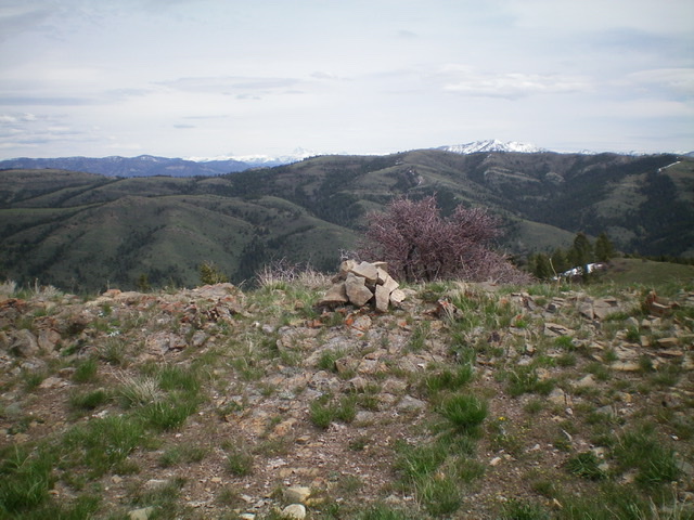
The newly-built summit cairn atop Mahogany Ridge with the snow-clad Tetons in the distance. Livingston Douglas Photo
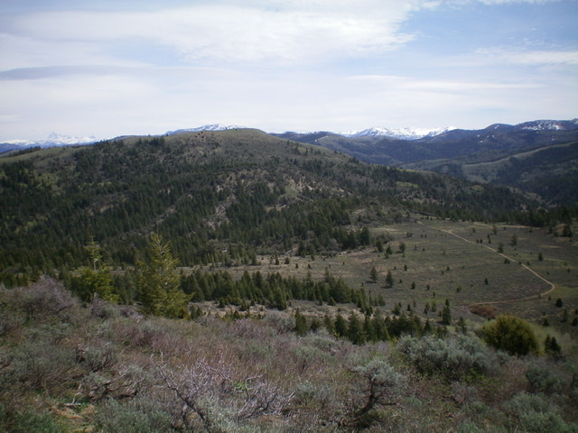
Looking west at Peak 7340 from the gentle summit of Mahogany Ridge. Livingston Douglas Photo
Additional Resources
Regions: Caribou Range->SOUTHERN IDAHO
Mountain Range: Caribou Range
Longitude: -111.42669 Latitude: 43.34989