Elevation: 7,904 ft
Prominence: 484
This peak is not in the book. Published December 2019
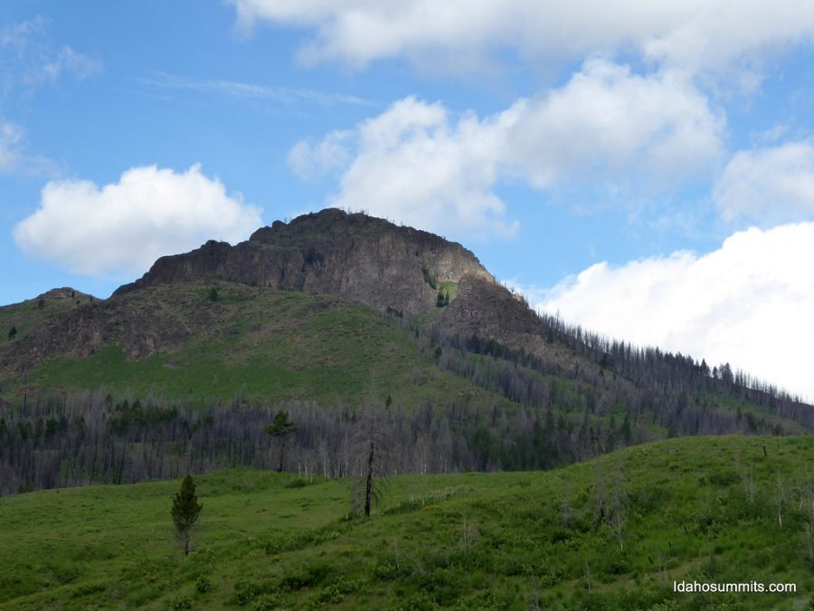
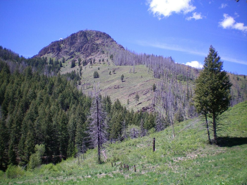
Mahoney Butte is a rocky outcrop with no easy ascent route. Do not take this climb lightly. This peak has a lot of cliffs and very loose rock. In addition, this is a burn area and the charred pines don’t help the off-trail scramble required to get close to the summit area. In spite of being located rather close to Mahoney Creek Trail/FST-821 and the Greenhorn Trailhead parking area, this peak sees few visitors. It is simply too rugged for most people. Mahoney Butte is clearly visible from the trailhead parking lot. It is magnificent! USGS Mahoney Butte
Mahoney Butte. Dan Robbins Photo
East Shoulder/South Ridge, Class 3
Access
Greenhorn Road is located 5.3 miles north of the stoplight at Albertson’s in Hailey, ID on ID-75. It is signed and has a stoplight. Turn left/west onto Greenhorn Road and drive 3.5 miles to its end at the large trailhead parking lot (5,900 feet). Three trails leave this trailhead parking area: Greenhorn Creek Trail (FST-156), Cow Creek Trail (FST-180), and Cow Creek Connector Trail (FST-153).
Please note that the USGS topo map is incorrect in its placement of the end of Greenhorn Road. The road goes about ¼ mile farther up Greenhorn Creek (to just before the trail shown on the map crosses the creek), exactly 0.5 miles past the Sawtooth National Forest boundary.
The Climb
From the trailhead parking area, follow the Greenhorn Creek Trail/FST-156 as it immediately drops to cross Greenhorn Creek on a good footbridge. The trail then follows Greenhorn Creek upstream to a signed trail junction at Mahoney Creek. Go right/northwest onto Mahoney Creek Trail/FST-821 and follow it up Mahoney Creek for about ten minutes to reach 6,165 feet. Leave the trail to bushwhack across Mahoney Creek and climb a very steep, wooded face (thick veg and burnt forest) to reach open terrain on the east shoulder at 6,700 feet.
Scramble south-southwest on the rocky ridge crest to reach Point 7109. What you see here will greatly discourage you. The summit is still 800 vertical feet higher and there is nothing but pure ugliness between you and the elusive summit. How could a BUTTE be this hard? Well, it is. From Point 7109, scramble west along the rocky ridge as it drops to a minor saddle, rises over another ridge point, and then drops to a second saddle at the base of the massive cliffs of the east face of Mahoney Butte. The East Shoulder dead-ends here.
From the saddle, angle diagonally upward and left/northwest to find a gully on the east side of the south ridge, just past the impassable east face cliffs. Climb briefly up this gully on loose talus/scree/gravel and veg. Exit the gully leftward and climb up onto the south ridge. Very quickly, you find that the south ridge is not a go. It becomes knife-edged with impossible blocks/cliffs. But an upward leaning, parallel gully on its right/east side will work. It requires climbing up face rock, reasonable ledges, and slots. It goes at Class 3.
The parallel gully leads to another gully higher up. This higher gully soon ends and you must exit rightward up onto a ridge. Scramble briefly on an open, flat area of this ridge to soon reach the flat area shown on the USGS topo map at 7,600 feet on the south ridge. You must do a short downclimb to reach this [blessed] flat area. You are now past the worst section of the south ridge and it is a cruise to the top. From the flat area, scramble up easy Class 2 terrain on a scree/veg combo then a bit of easy rock scrambling to reach the small, rocky summit area. There is a decent summit cairn on top.
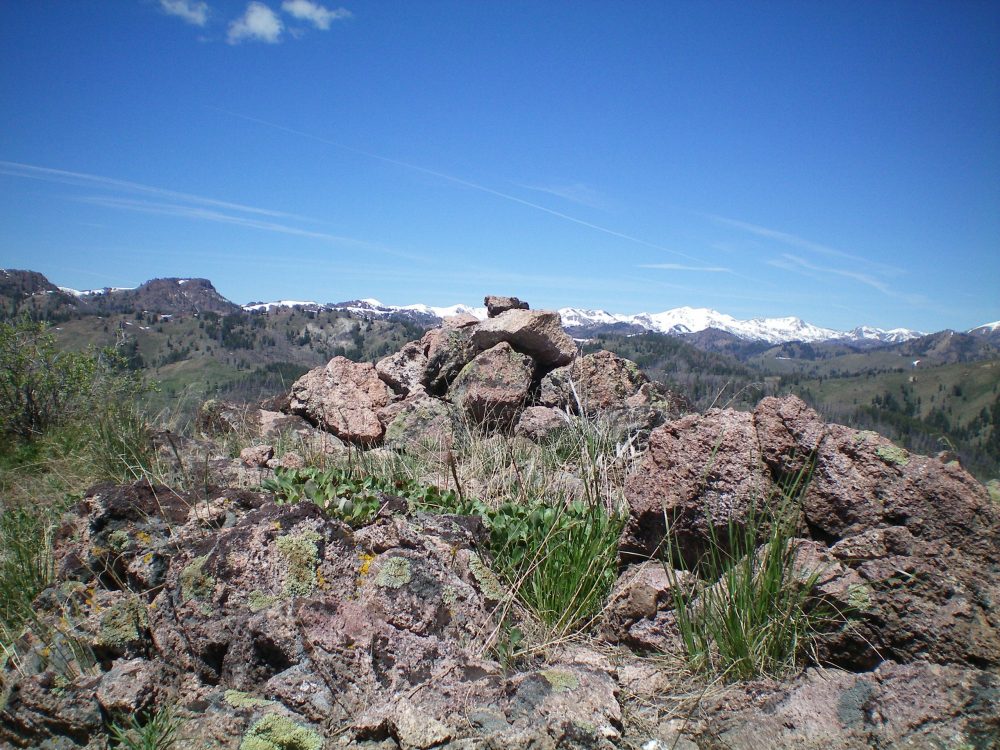
The summit cairn atop Mahoney Butte. Livingston Douglas Photo
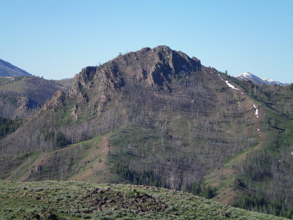
The north side of rugged Mahoney Butte. The north couloir is visible in dead-center, with small snow patches in it. The summit is the highest hump just right of center. Livingston Douglas Photo
The northeast side of Mahoney Butte. The upper section of this route may or not go. Livingston Douglas
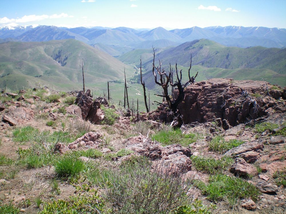
View from the summit of Mahoney Butte, looking east at the mouth of Greenhorn Gulch in the distance. The top of the north couloir is in the foreground, just in front of the rocky outcrop and burnt tree. Livingston Douglas Photo
North Couloir/Northeast Slopes, Class 2+
Access
Same as for the east shoulder/south ridge
The Descent
From the summit, there is an obvious (and nearby) chute/couloir heading steeply down and to the north. It is loose terrain (with some leftover snow patches) but it is workable because there are no hidden cliff bands. Descend this somewhat treacherous couloir (Class 2+) on loose talus/scree, skirting burnt tree branches/logs and snow patches as necessary. Once at the bottom of the couloir, descend right-ish/northeast through a wicked charred pine forest of snags, burnt logs, thick veg, and a very loose talus/scree base. This is NOT FUN.
When you finally reach mad-rushing Mahoney Creek, look for a fallen tree to cross it. Once across the creek, climb 70 vertical feet of steep uphill to reach Mahoney Creek Trail. The uphill is mostly thick veg and aspens. You will be most happy to reach the trail. Cruise down the trail to the Greenhorn Creek Trail. Then follow the Greenhorn Creek Trail downstream to the trailhead parking area.
Additional Resources
Regions: Smoky Mountains->WESTERN IDAHO
Mountain Range: Smoky Mountains
First Ascent Information:
- Other First Ascent: East Shoulder/South Ridge
- Year: 2019
- Season: Summer
- Party: Livingston Douglas
Longitude: -114.45269 Latitude: 43.59679