Elevation: 8,441 ft
Prominence: 381
This peak is not in the book. Published July 2018
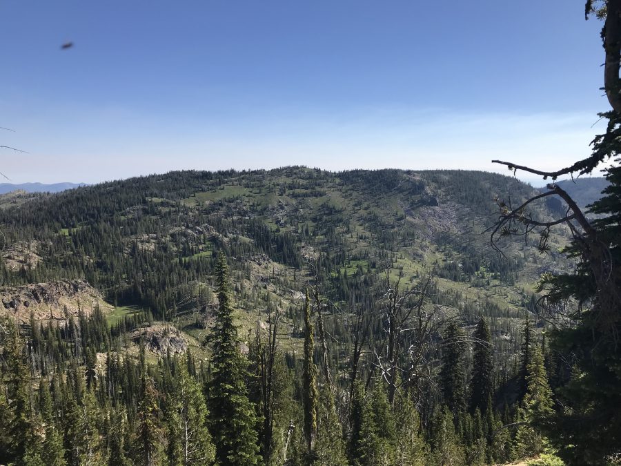
Marshall Mountain is a large mountain that quickly rises up above the main Salmon River north of the old mining town of Secesh. The peak has a mile-long East/West summit ridge which makes for a great walk. The views from the summit extend to the Seven Devils in the west, the Gospel-Hump Wilderness in the north, the Montana/Idaho border in the east and the Lick Creek Subrange to the south. USGS War Eagle Mountain
Marshall Mountain as viewed from the south.
Primary Access and Route, Class 1
An ATV trail leads to the summit from FS-320. FS-320 can be accessed from the west via FS-318 or from Secesh in the south via FS-325. The best route uses FS-320. Google Maps will give you directions. From Warren Wagon Road, turn north onto FS-246 which quickly leads past the Burgdorf Hot Springs Resort. Turn onto FS-318 about 5 miles past the resort. Follow this road, reportedly suitable for high-clearance vehicles, for 6.7 miles where is junctions with FS-320. Follow FS-320 east for roughly 0.9 miles until you spot an ATV track on the left. Follow the ATV track to the summit.
Alternate Access and Hiking Route, Class 2
Pat McGrane and I hiked to this summit from California Lake, which is located to the south along FS-325. Google Maps will not give you directions for this route. From its junction with the Burgdorf Road/FS-246, continue east on Warren Wagon Road for 2.7 miles. Turn north onto FS-325. This road is shown as an improved road on the Payette National Forest map and there are bridges along the way but the farther you go, the worse the road becomes. It is no longer an improved road. A 4WD vehicle with AT tires is recommended. The road reaches California Lake in 7.8 miles. From the lake, it is another 5.0 miles to the junction with FS-318 and FS-320 at the West End of Marshall Mountain’s summit ridge. This 5.0 miles definitely requires a real 4WD vehicle and good tires. There are 2 good campsites at the lake.
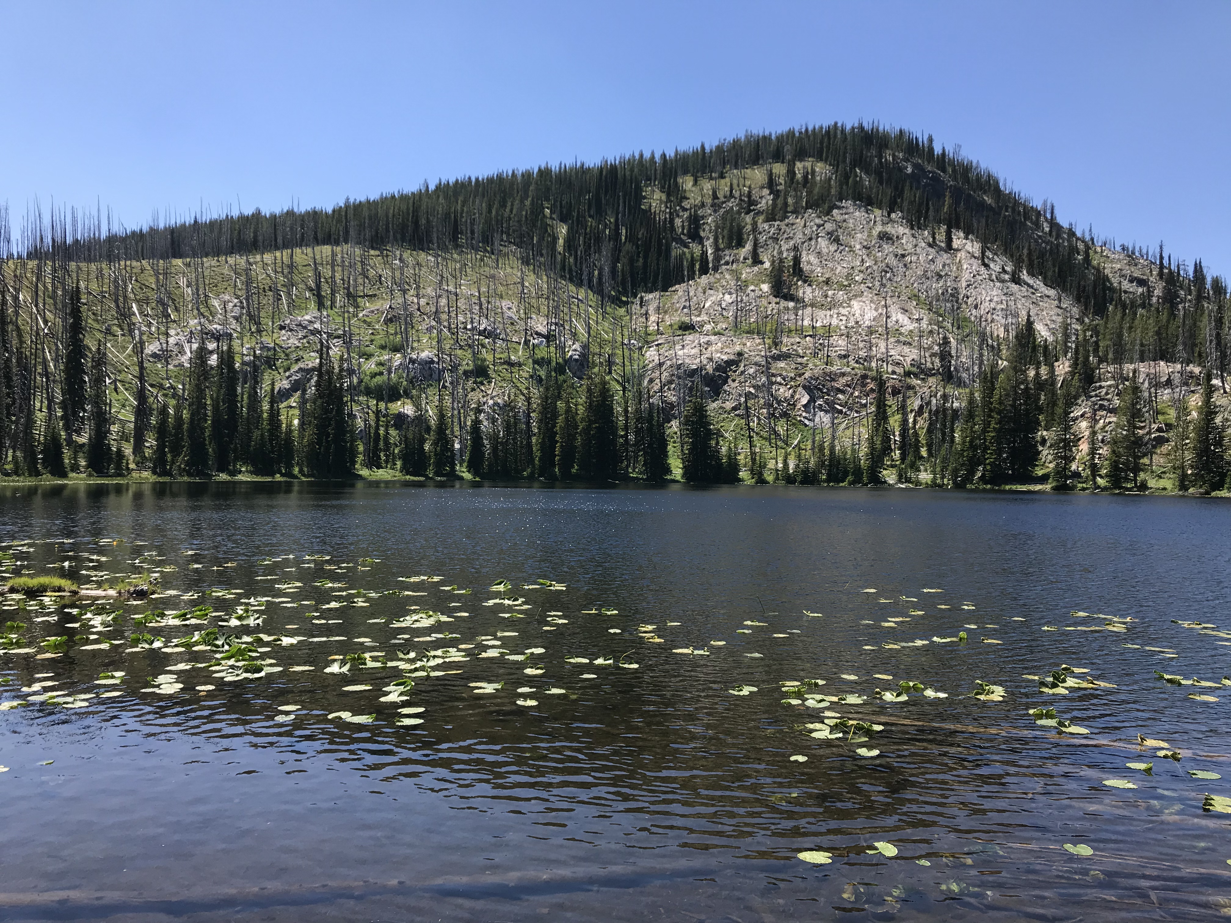
California Lake represents one of the many types of terrain found in the northwest corner of the Salmon River Mountains.
There is a ridgeline that begins north of the lake which leads over two peaks, both with an elevation of 8,460 feet (according to the Lists of John website), and on to Marshall Mountain. The route we followed is shown on the map below. We followed the ridge to Marshall Mountain and returned on the road. The total route was 11.0 miles with 2,527 feet of elevation gain.
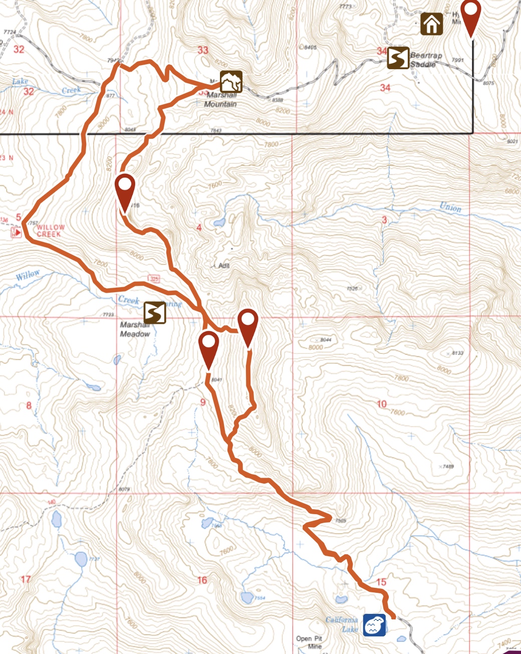
My GPS track for Marshall Mountain and the two peaks with an elevation of 8,460 feet. I highly recommend this scenic ridge walk.
Additional Resources
Regions: Northwest Corner Peaks->Salmon River Mountains->WESTERN IDAHO->Western Salmon River Mountains
Mountain Range: Western Salmon River Mountains
Year Climbed: 2018
Longitude: -115.84649 Latitude: 45.37429