Elevation: 8,844 ft
Prominence: 324
This peak is not in the book.
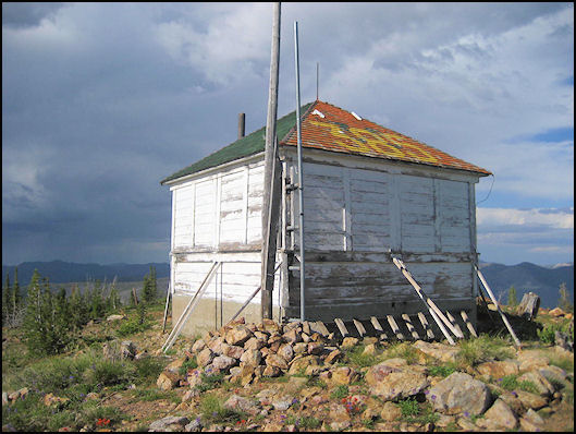
Meadow Creek Lookout is a remote peak. However, it is reached by a road because it is the location of a mothballed Forest Service fire lookout dating from the 1930s. The summit is approximately 8 miles southeast of Yellow Pine, but you will have to follow a circuitous route of nearly 25 miles to reach the lookout. USGS Chilcoot Peak
The Meadow Creek Lookout in 2012. National Historic Lookout Registry Photo
Access
From Yellow Pine, take FS-412 east for 8.0 miles, then turn left onto FS-375. Follow FS-375 for 6.0 miles then turn right onto FS-640. Follow this road for 9.0 miles then turn left onto FS-441A. The lookout is another bumpy 1.5 miles away. A 4WD is required.
Additional Resources
Mountain Range: Central Salmon River Mountains
Longitude: -115.38889 Latitude: 44.86829