Elevation: 7,966 ft
Prominence: 466
This peak is not in the book. Published November 2020
Middle Creek Butte is a magnificent, triangular-shaped butte with steep east and west aspects. It is located just north of the convergence of Dry Creek and Middle Creek. It is most easily climbed via its south face or southeast ridge from Middle Creek Road. Unfortunately, private land may be an issue in driving up Middle Creek Road as most of the road crosses private land from its beginnings at Indian Creek Road, which is a short distance up from Medicine Lodge Road. The route discussed below avoids the access issues of Middle Creek Road by climbing the peak from Edie Creek Road to the west. USGS Edie Creek
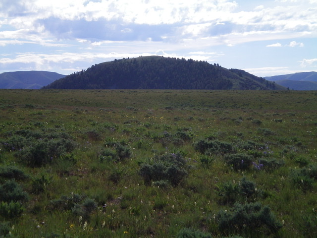
Middle Creek Butte as viewed from a high bench to its west. Livingston Douglas Photo
Access
From I-15 at Dubois, ID, drive west on ID-22 for 5.9 miles to Medicine Lodge Road (signed). Turn right/north onto Medicine Lodge Road and reset your odometer. At 21.0 miles, the pavement ends. At 22.5 miles, reach a [signed] road junction with Webber Creek Road/FSR-196. At 22.7 miles, reach a [signed] road junction with Edie Creek Road. Go right/east on Edie Creek Road and drive 2.1 miles to a road junction. Go right/east here, ford Edie Creek (small), and park in a pullout along the side road immediately after the creek ford (6,660 feet). Edie Creek Road is a decent, but narrow, dirt road to the 2.1-mile point after which it degrades into a weak 2-track jeep road.
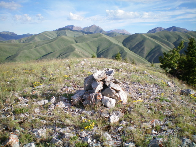
The newly-built summit cairn atop Middle Creek Butte, looking north. Livingston Douglas Photo
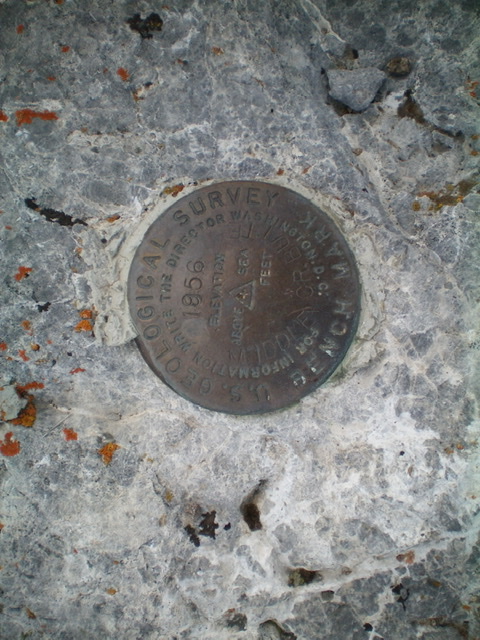
The USGS benchmark atop Middle Creek Butte. Livingston Douglas Photo
The Approach, Class 2
From the parking pullout, bushwhack east through thick sagebrush up onto a shoulder. Follow the shoulder east-northeast and cross a few dry gullies and benches to reach the final north-south bench that sits directly west of, and above, the Dry Creek drainage. Middle Creek Butte is in full view by now and is impressive. To this point, the bushwhack has been easy scrub at times (on the benches) and thicker sagebrush at other times (in the dry gullies).
Descend east through sagebrush and cross a dry gully to reach a shoulder that drops to Point 7241. From Point 7241, descend east down a steep sagebrush slope to reach the Dry Creek jeep road and Dry Creek. This concludes the approach to the base of the west face of Middle Creek Butte. The climb begins here.
West Face/West Ridge, Class 2
The Climb
Find a willow-free spot to jump across [small] Dry Creek. After crossing to the east side of Dry Creek, climb east up a steep but easy scrub slope that eventually has scattered mountain mahogany to navigate through. Once on the west ridge, follow it east then northeast to the summit. The ridge crest is easy scrub with a scree base. The summit of Middle Creek Butte has two USGS benchmarks but no summit cairn so I built one.
Middle Creek Butte is surprisingly rugged for a butte. Stay to the right/south when ascending it from the west to avoid ridge/face cliffs with thick forest mixed in. The summit is gentle, but the rest of it is NOT. The approach is a bit tedious and time-consuming but the climb up the west face/west ridge is magnificent! On the return to Edie Creek Road, I took a higher (more northerly) line when crossing the benches and dry gullies and, although a bit longer, this route was faster due to less onerous sagebrush than the ascent route/approach.
Additional Resources
Regions: Beaverhead Range->EASTERN IDAHO
Mountain Range: Beaverhead Range
Longitude: -112.52029 Latitude: 44.40869