Elevation: 6,836 ft
Prominence: 6
This peak is not in the book. Published November 2023
Mineral Hill is a minor hump that is located a few miles west of Leadore. It is a foothill that sits above the Lemhi River. Mineral Hill sits on the long southwest ridge of Grizzly Hill (9,300 feet) which is all the way up on the Continental Divide. It can be easily climbed from Lemhi Road to its southwest. USGS West of Leadore
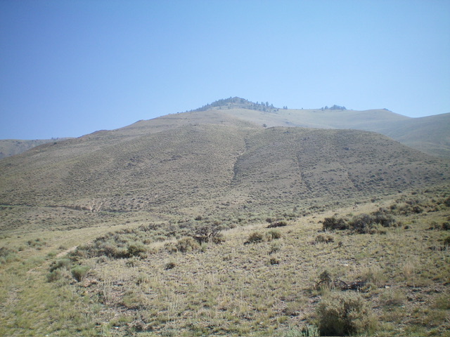
Mineral Hill is the scrub hill in mid-ground. This view is from low on the southwest face, my descent route. Livingston Douglas Photo
Access
From the signed junction of ID-28 and ID-29 in Leadore, drive 0.2 miles northeast on ID-29 to a signed junction. Turn left/north onto [signed] Lemhi Road and drive 4.3 miles to an active gravel pit on the right/east side of the road. Park near the gravel pit (5,830 feet; 44⁰43’32”N, 113⁰24’50”W). This area is a mix of private and public land, so be careful. This climb is entirely on BLM land.
Map Errors
There are many more old mining roads in this area than are shown on the USGS topo map.
South Shoulder/West Face, Class 2
The Climb
From your parking spot along Lemhi Road, walk northwest to just past the active gravel pit. Leave the road and follow a 2-track road (not shown on maps) that heads north-northeast then north up a steep shoulder to reach a “T” road junction at the head of a dry gully that is to the right/east. Leave the roads here and scramble east up a steep slope directly at the summit. The terrain is a mix of old mining road cuts, scrub, and steep gravel/dirt. The summit is a small, rocky spot that drops a short distance northeast to a gentle saddle and then climbs steeply northeast to a forested ridge hump higher up. I built a modest cairn on the high point of Mineral Hill.
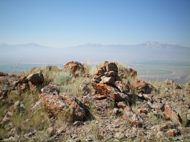
The summit of Mineral Hill with its newly-built summit cairn. Livingston Douglas Photo
Southwest Face, Class 2
The Descent
From the summit, descend southwest then south down a shoulder of scrub, gravel, and road cuts to reach a road junction below (shown on the USGS topo map). Follow an old 2-track road southwest down to the gravel pit area and leave it to contour left/southeast onto a low shoulder (one of several). Follow that shoulder southwest down to Lemhi Road just southeast of the gravel pit. Walk northwest a shirt distance to return to your parked vehicle.
Additional Resources
Regions: Beaverhead Range->EASTERN IDAHO
Mountain Range: Beaverhead Range
Longitude: -113.4030 Latitude: 44.7345