Elevation: 7,260 ft
Prominence: 560
Climbing and access information for this peak is on Page 144 of the book. The book calls this peak, Mores Peak based on an old map. The official name is Mores Mountain. The measured elevation of 7,237 feet is on the [lower] East Summit. The West Summit is the high point of Mores Mountain at 7,260 feet. Updated July 2022
As discussed in the book, there is a popular trail that will take you to this summit. The Forest Service charges $5 to park at the trailhead. The trail begins as a nature trail and forks shortly after it starts. Of course, as a loop trail, you can go either way. I prefer the left fork for the ascent. The trail to the left crosses under the peak’s South Slopes. After climbing about 500 vertical feet, the trail turns north and then drops down a bit. This is the spot to make the short climb to the summit, which is a short climb above you.
From the summit, you can return to the trail or head north through a shallow saddle to the peak’s other summit. The trail is just north of the second summit and then descends back to the trailhead. This is an easy hike of 2.3 miles. Taking the left fork gets you to the point where you leave the trail in just 0.7 miles. It’s another 0.08 miles to the summit with no trail and a total elevation gain of 540 feet. My GPS track is set out below. USGS Shafer Butte

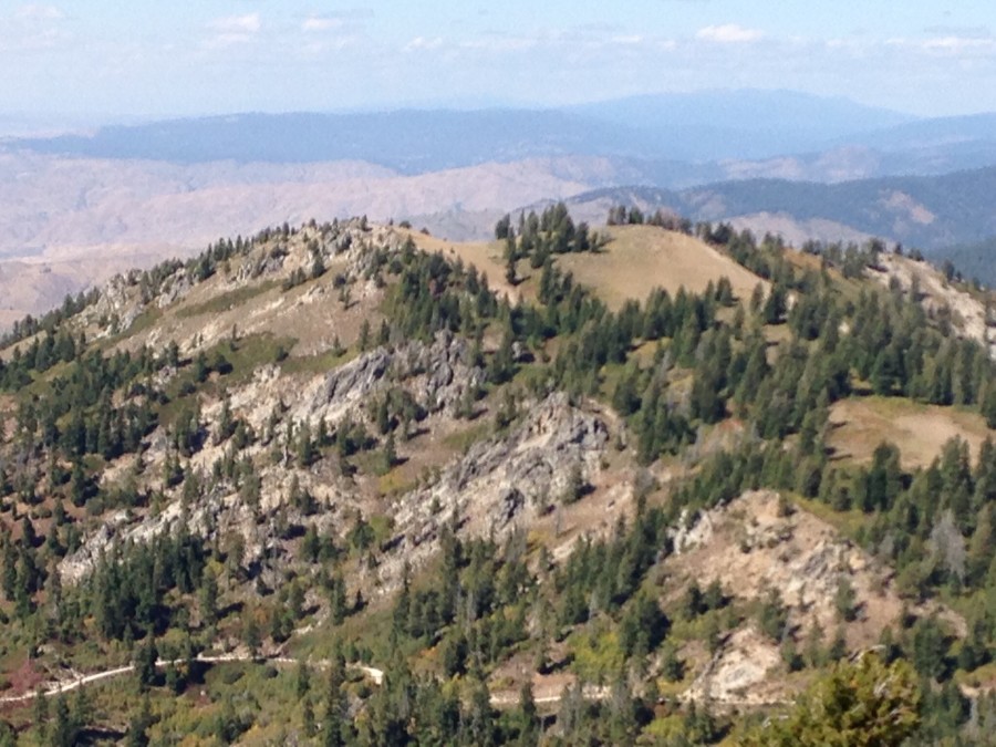
Mores Mountain as viewed from Shafer Butte.
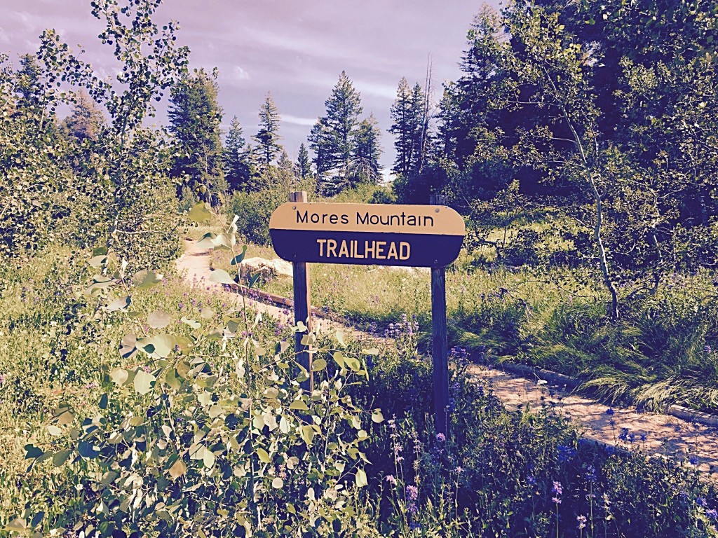
The trail begins here.
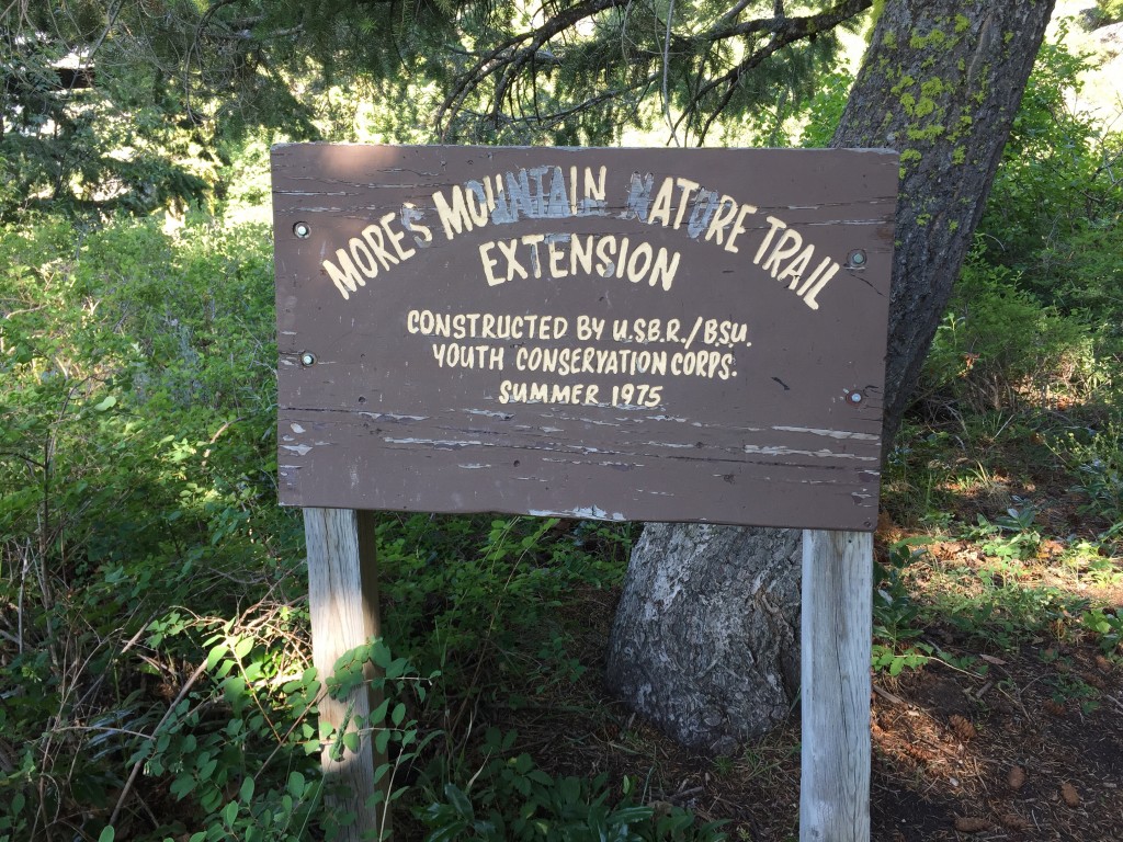
When you reach a junction by this sign, the nature trail runs off to the right and the Mores Mountain Round-the-Mountain Trail goes off to the left.
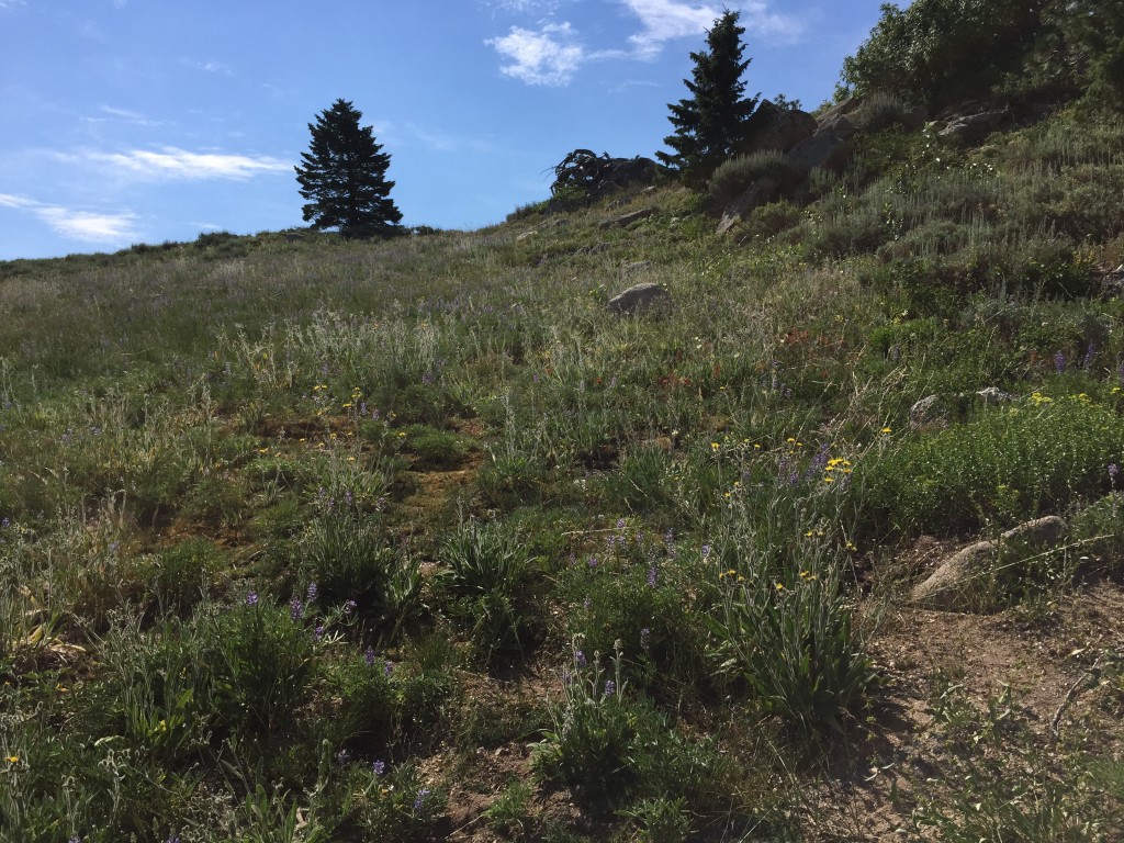
This shot is looking up towards the summit from the point where you leave the trail. It is an easy, off- trail hike of 0.08 miles to the top with minimal elevation gain.
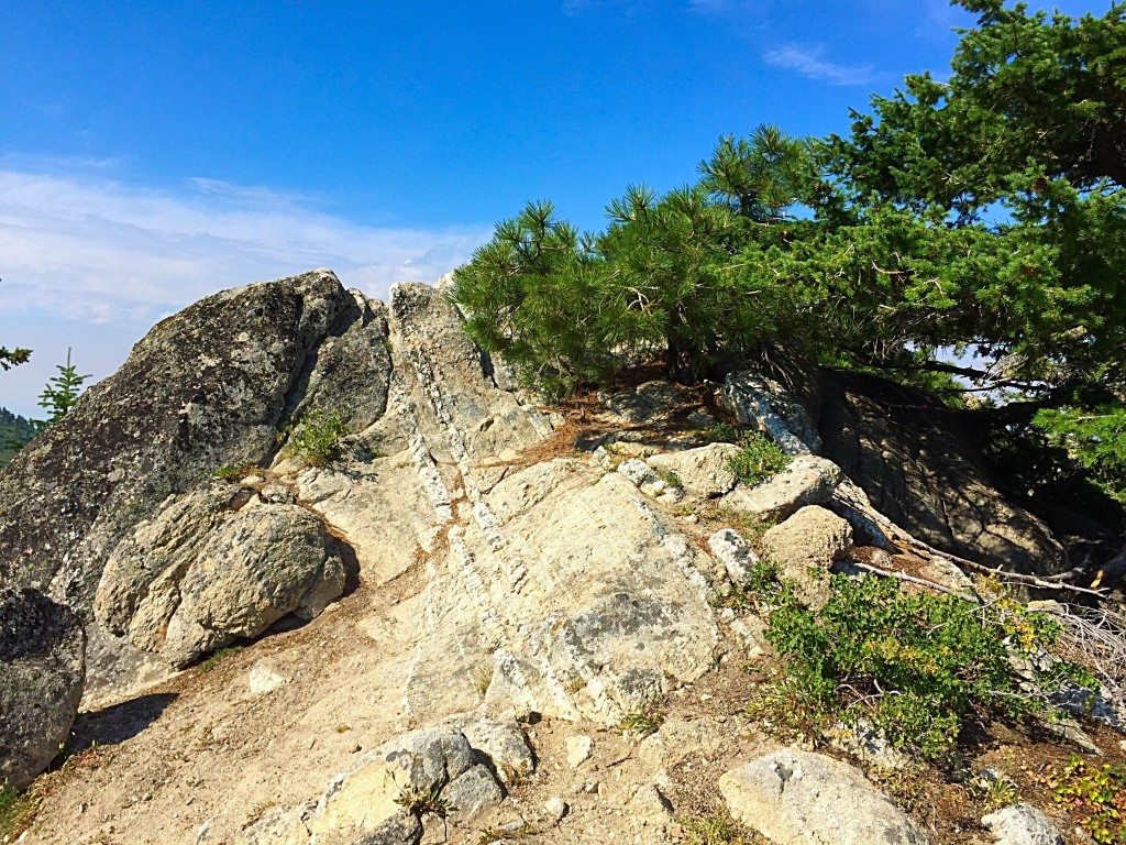
The highest point on Mores Mountain is a short uphill walk from the trail.
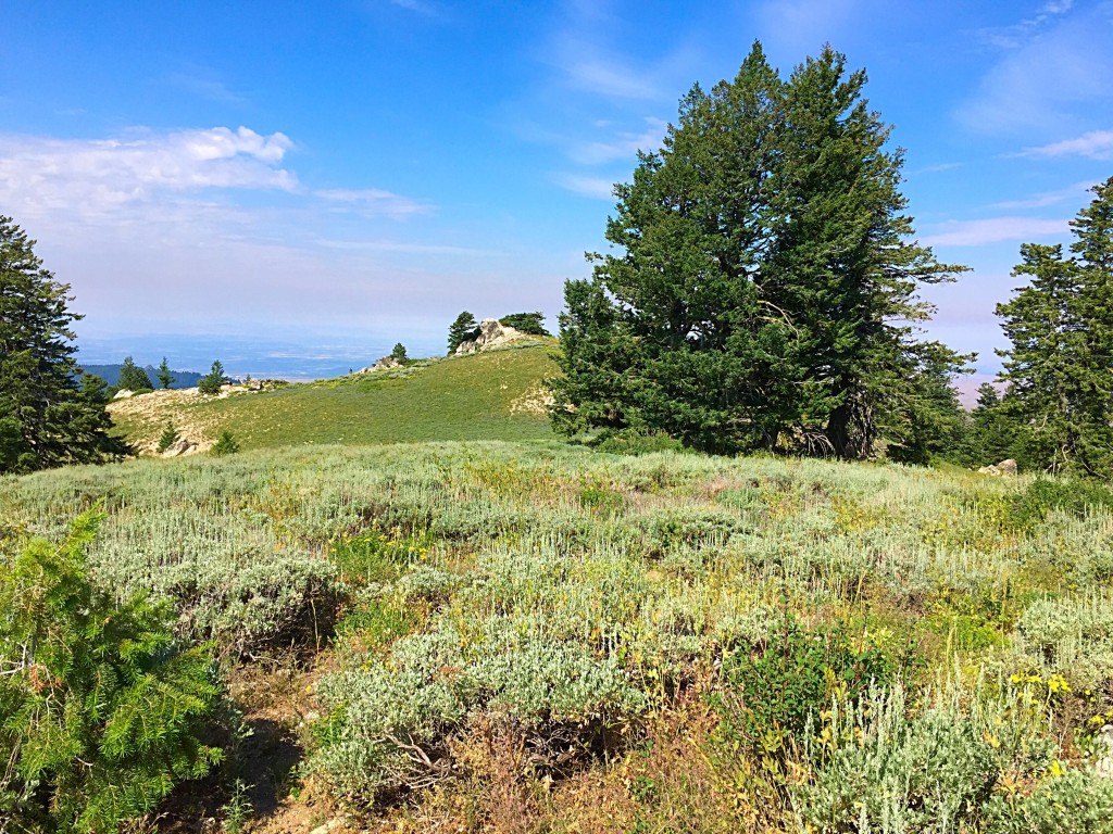
Looking across the saddle from the Point 7127 to the East Summit.
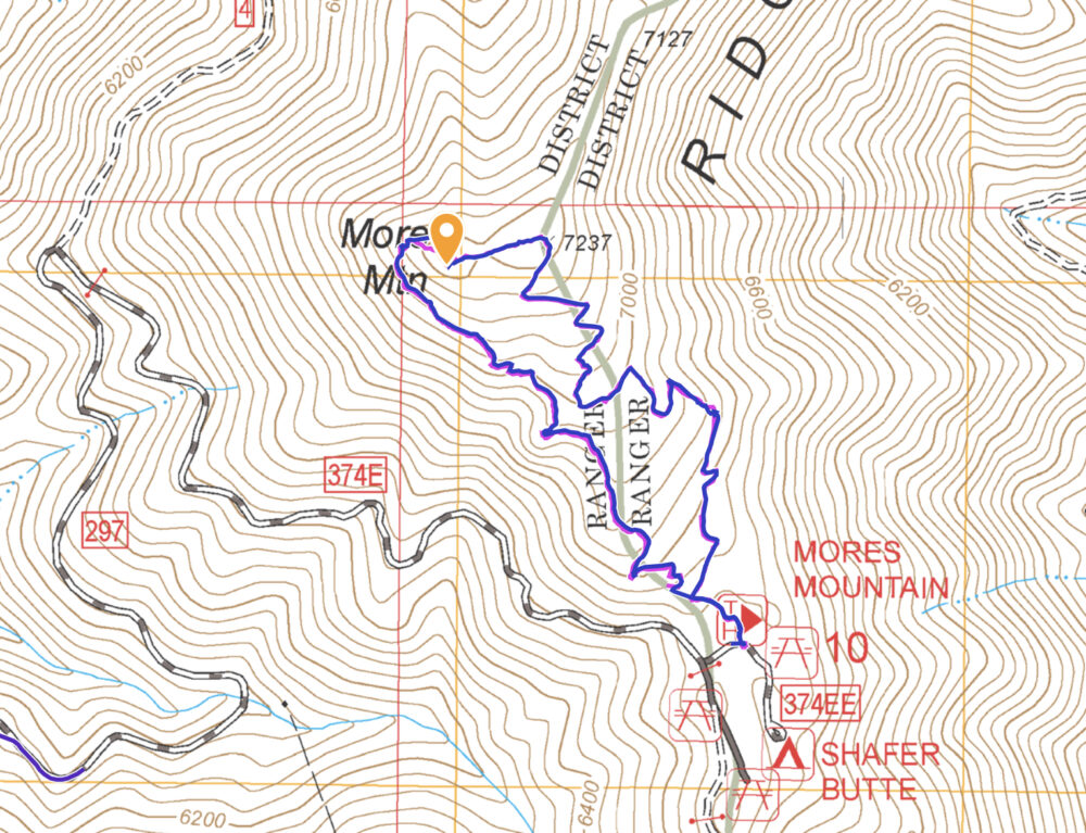
The loop is just over 2 miles long and gains 510 feet of elevation along the way.
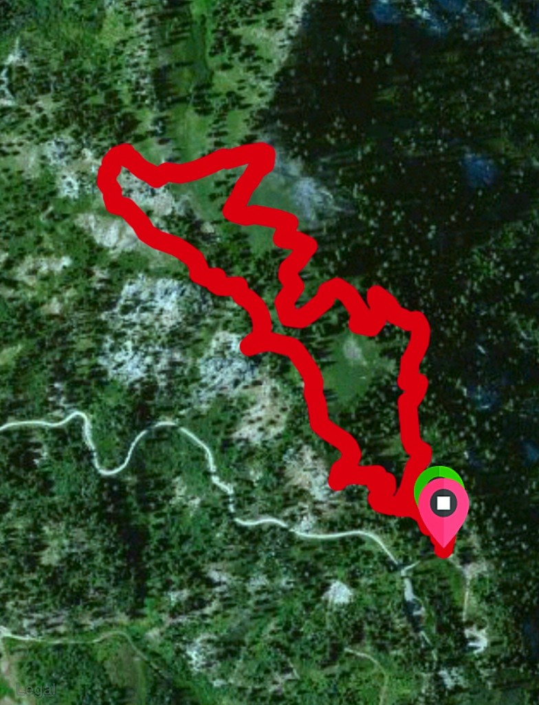
Mores Mountain GPS track (7/4/15).
Additional Resources
Regions: Boise Mountains->WESTERN IDAHO
Mountain Range: Boise Mountains
Year Climbed: 1986, 1995, 1995, 1996, 1999, 2000, 2001, 2001, 2008, 2009, 2015, 2017, 2020, 2021, 2022
Longitude: -116.093 Latitude: 43.79061