Elevation: 7,576 ft
Prominence: 356
This peak is not in the book. Published November 2023
Center Ridge is a gentle hump that is located east of Gilmore Summit along ID-28 south of Leadore. Its west ridge is an easy sagebrush scramble from the highway. USGS Gilmore Summit
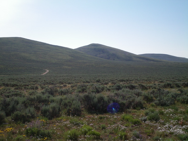
Center Ridge (hump in dead center) as viewed from Gilmore Summit to its northwest. Livingston Douglas Photo
Access
Gilmore Summit (signed) is located along ID-28 south of Leadore, ID. It is at virtual MM71.5 (Leadore is at MM90). Gilmore Summit has large, paved pullouts on both sides of the highway and a 2-track BLM road that heads east from it. Gilmore Summit is at 7,170 feet and 44⁰25’51”N, 113⁰13’54”W. While this area is a mix of private and public land, this climb is entirely on BLM land.
West Ridge, Class 2
The Climb
From the unsigned BLM road junction on Gilmore Summit, cross the cattle guard on the 2-track BLM road (to avoid scaling the cattle fence along the highway) and leave the road to head right/south-southeast parallel to ID-28. Follow one of a few wide lanes of cleared sagebrush and hike about ¼ mile south-southeast on the east side of the highway and the cattle fence. Bushwhack southeast and aim at a shoulder that sits on the west side of a prominent dry gully that separates Point 7484 from Center Ridge.
From Gilmore Summit, expect to drop 25 vertical feet before angling diagonally leftward/southeast up onto the shoulder. This area is a massive field of sagebrush with some areas rather thick and other areas not too bad. Bushwhack east up the easier sagebrush on the rounded shoulder then descend 25 vertical feet to cross the major [dry] gully on the west side of Center Ridge. Once across the thick sagebrush in the gully, climb east up onto the short scrub of the west ridge. Follow the easy west ridge to the cairned summit.
Center Ridge is clearly the highest hump but there are a few other high humps in this vicinity (Point 7558 to the east, Point7561 to the southeast, and Point 7484 to the north). Return via the ascent route. If you take a more direct line to Gilmore Summit (as I did on the descent), you will have thicker sagebrush to contend with and a more tedious return to the highway.
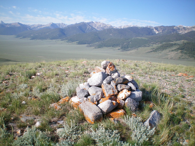
The large cairn atop Center Ridge with the Lemhi Range in the distance. Livingston Douglas Photo
Additional Resources
Regions: Beaverhead Range->EASTERN IDAHO
Mountain Range: Beaverhead Range
Longitude: -113.2094 Latitude: 44.4258