Elevation: 8,580 ft
Prominence: 480
This peak is not in the book. Published November 2022
Morgan Ridge is a high ridge in the foothills of the Pioneer Mountains, just above Sun Valley and on the south side of Corral Creek. It can be climbed directly from Trail Creek Road via its west ridge or from Corral Creek via its north ridge. USGS Sun Valley
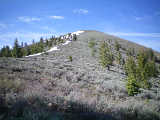
Morgan Ridge as viewed from the northwest. Livingston Douglas Photo
Access
Corral Creek Road is located 3.8 miles up Sun Valley Road/Trail Creek Road from its junction with Dollar Road in Sun Valley, Idaho. Drive 0.6 miles up Corral Creek Road to a wide gully on the right/side of the road. Park here. Morgan Ridge is due south from here and the upper ridge is visible from Corral Creek Road at this point. Climb either the forested north ridge (left side of the gully) or the north rib (right side of the gully) to reach the summit ridge and then continue on to the high point of Morgan Ridge.
North Ridge, Class 2
The Climb
Leave Corral Creek Road and bushwhack south through a short patch of sagebrush then enter the steep pine forest on the left/east side of the gully. Bushwhack south up the steep, but good, terrain in the pine forest without too much blowdown, scattered trees, and lateral/diagonal deer trails galore. Reach tree line where the ridge bends right-ish and climbs through gapped sagebrush to reach Point 8532. From Point 8532, continue south on the ridge and drop 35-40 feet to a minor saddle of sagebrush. Bushwhack south through more sagebrush then climb up a final ridge section to reach the summit of Morgan Ridge. The summit has no cairn but has two tall wooden posts laying on the ground next to the high point.
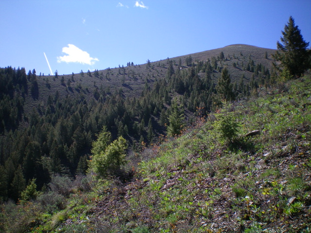
Profile view of the north ridge of Morgan Ridge (my ascent route). Livingston Douglas Photo
The final approach from tree line up the north ridge of Morgan Ridge. The summit hump is not yet in view. Livingston Douglas Photo
Northwest Ridge/North Rib, Class 2
The Descent
From the summit, return north to Point 8532. Descend west on the main ridge crest to about 8,150 feet then head right/north down the north rib. This rib is on the left/west side of the gully of the ascent route. Descend this [initially] open, narrow ridge in sagebrush then pines (with blowdown and some rocky outcrops) to reach a thicker pine forest farther down. Bushwhack north through the thick, blowdown-strewn pine forest where the ridge becomes a face. The combination of dense forest, blowdown, and brush is brutal. Upon reaching Corral Creek Road, return to your parked vehicle upstream to the right/north along the road. I did not enjoy this descent route. Stick with my ascent route (the north ridge) when tackling Morgan Ridge from Corral Creek Road.
Additional Resources
Regions: EASTERN IDAHO->Pioneer Mountains
Mountain Range: Pioneer Mountains
Longitude: -114.28719 Latitude: 43.71549